Turquoise Mountain Topo Map California
To zoom in, hover over the map of Turquoise Mountain
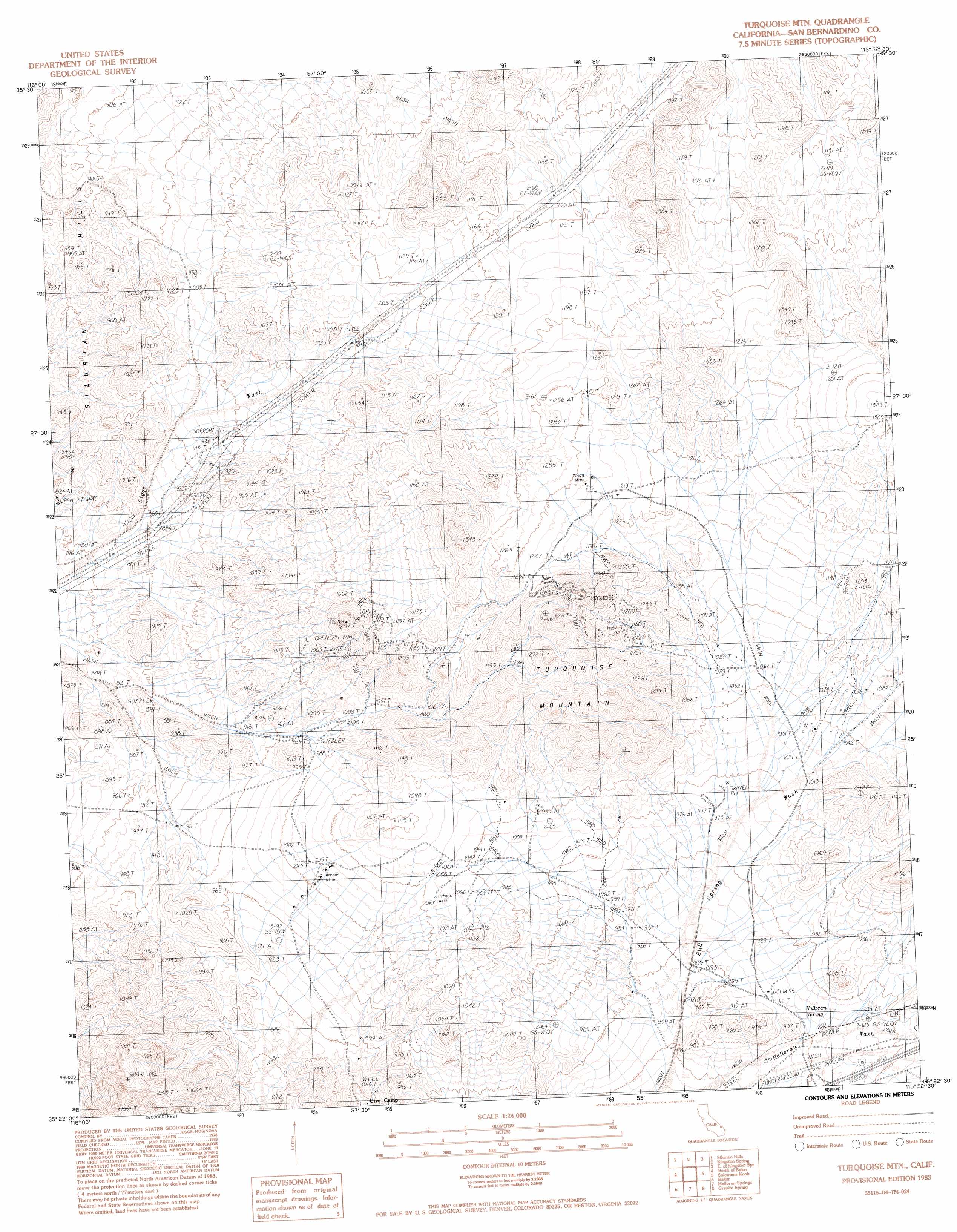
USGS Topo Quad 35115d8 - 1:24,000 scale
| Topo Map Name: | Turquoise Mountain |
| USGS Topo Quad ID: | 35115d8 |
| Print Size: | ca. 21 1/4" wide x 27" high |
| Southeast Coordinates: | 35.375° N latitude / 115.875° W longitude |
| Map Center Coordinates: | 35.4375° N latitude / 115.9375° W longitude |
| U.S. State: | CA |
| Filename: | o35115d8.jpg |
| Download Map JPG Image: | Turquoise Mountain topo map 1:24,000 scale |
| Map Type: | Topographic |
| Topo Series: | 7.5´ |
| Map Scale: | 1:24,000 |
| Source of Map Images: | United States Geological Survey (USGS) |
| Alternate Map Versions: |
Turquoise Mtn. CA 1983, updated 1983 Download PDF Buy paper map Turquoise Mtn CA 1983, updated 1984 Download PDF Buy paper map Turquoise Mountain CA 2012 Download PDF Buy paper map Turquoise Mountain CA 2015 Download PDF Buy paper map |
1:24,000 Topo Quads surrounding Turquoise Mountain
Dumont Dunes |
Valjean Hills |
Kingston Peak |
East Of Kingston Peak |
Mesquite Mountain |
Silurian Lake |
Silurian Hills |
Kingston Spring |
East Of Kingston Spring |
Pachalka Spring |
Silurian Valley |
North Of Baker |
Turquoise Mountain |
Solomons Knob |
Valley Wells |
West Of Baker |
Baker |
Halloran Spring |
Granite Spring |
Cow Cove |
West Of Soda Lake |
Soda Lake North |
Seventeenmile Point |
Indian Spring |
Marl Mountains |
> Back to 35115a1 at 1:100,000 scale
> Back to 35114a1 at 1:250,000 scale
> Back to U.S. Topo Maps home
Turquoise Mountain topo map: Gazetteer
Turquoise Mountain: Mines
Turquoise Mining Area elevation 1107m 3631′Wander Mine elevation 1005m 3297′
Yucca Mine elevation 1241m 4071′
Turquoise Mountain: Springs
Halloran Spring elevation 909m 2982′Turquoise Mountain: Summits
Turquoise Mountain elevation 1360m 4461′Turquoise Mountain: Wells
Hytens Well elevation 1062m 3484′Turquoise Mountain digital topo map on disk
Buy this Turquoise Mountain topo map showing relief, roads, GPS coordinates and other geographical features, as a high-resolution digital map file on DVD:
Southern Sierra Nevada, California & Southern Nevada
Buy digital topo maps: Southern Sierra Nevada, California & Southern Nevada