Roach Topo Map Nevada
To zoom in, hover over the map of Roach
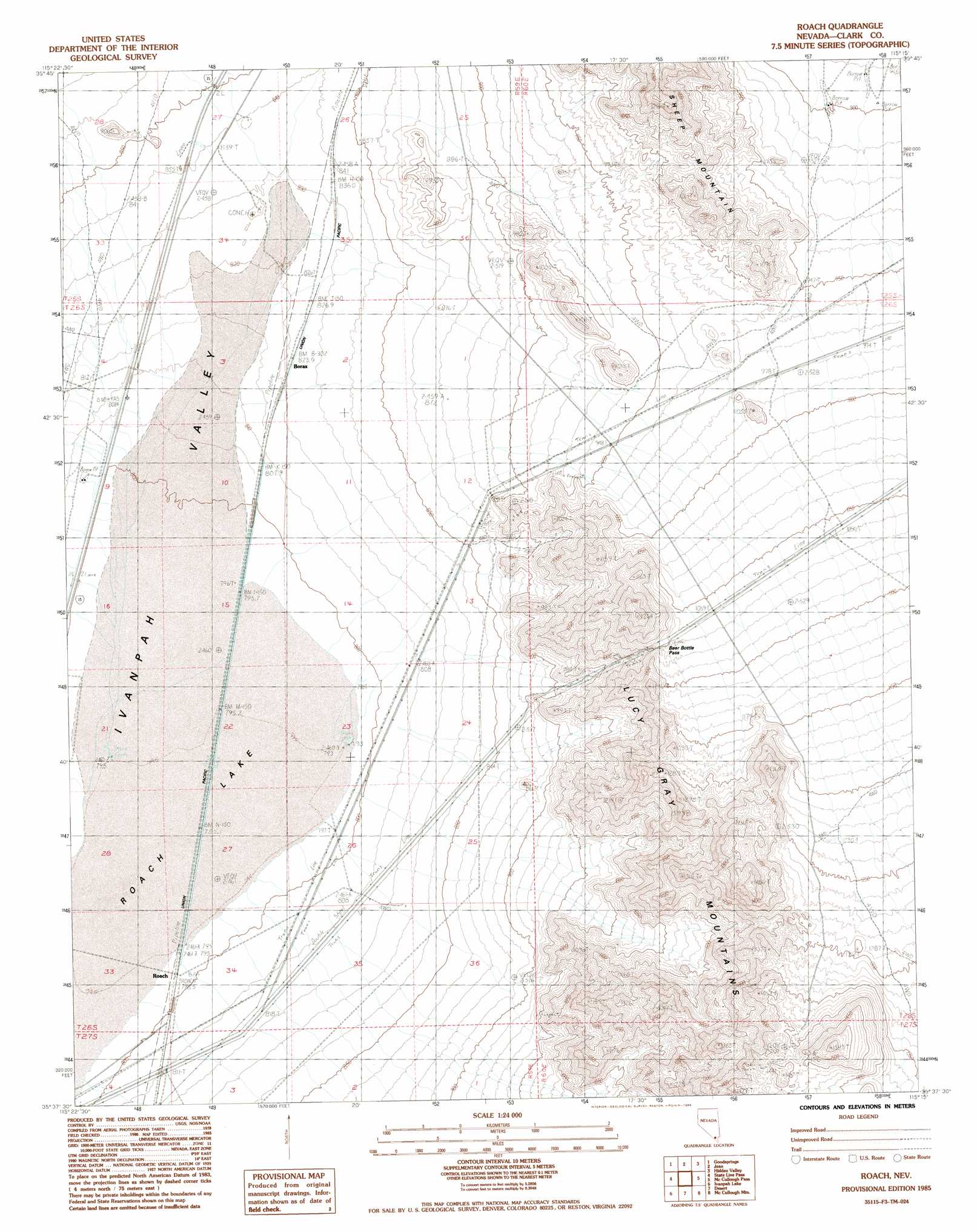
USGS Topo Quad 35115f3 - 1:24,000 scale
| Topo Map Name: | Roach |
| USGS Topo Quad ID: | 35115f3 |
| Print Size: | ca. 21 1/4" wide x 27" high |
| Southeast Coordinates: | 35.625° N latitude / 115.25° W longitude |
| Map Center Coordinates: | 35.6875° N latitude / 115.3125° W longitude |
| U.S. State: | NV |
| Filename: | o35115f3.jpg |
| Download Map JPG Image: | Roach topo map 1:24,000 scale |
| Map Type: | Topographic |
| Topo Series: | 7.5´ |
| Map Scale: | 1:24,000 |
| Source of Map Images: | United States Geological Survey (USGS) |
| Alternate Map Versions: |
Roach NV 1985, updated 1985 Download PDF Buy paper map Roach NV 2012 Download PDF Buy paper map Roach NV 2014 Download PDF Buy paper map |
1:24,000 Topo Quads surrounding Roach
Potosi |
Cottonwood Pass |
Bird Spring |
Sloan |
Sloan Ne |
Shenandoah Peak |
Goodsprings |
Jean |
Hidden Valley |
Sloan Se |
Mesquite Lake |
State Line Pass |
Roach |
Mccullough Pass |
Mccullough Mountain Ne |
Clark Mountain |
Ivanpah Lake |
Desert |
Mccullough Mountain |
Highland Spring |
Mescal Range |
Mineral Hill |
Nipton |
Crescent Peak |
Hopps Well |
> Back to 35115e1 at 1:100,000 scale
> Back to 35114a1 at 1:250,000 scale
> Back to U.S. Topo Maps home
Roach topo map: Gazetteer
Roach: Flats
Roach Lake elevation 795m 2608′Roach: Gaps
Beer Bottle Pass elevation 1070m 3510′Roach: Populated Places
Borax elevation 825m 2706′Roach elevation 798m 2618′
Roach digital topo map on disk
Buy this Roach topo map showing relief, roads, GPS coordinates and other geographical features, as a high-resolution digital map file on DVD:
Southern Sierra Nevada, California & Southern Nevada
Buy digital topo maps: Southern Sierra Nevada, California & Southern Nevada