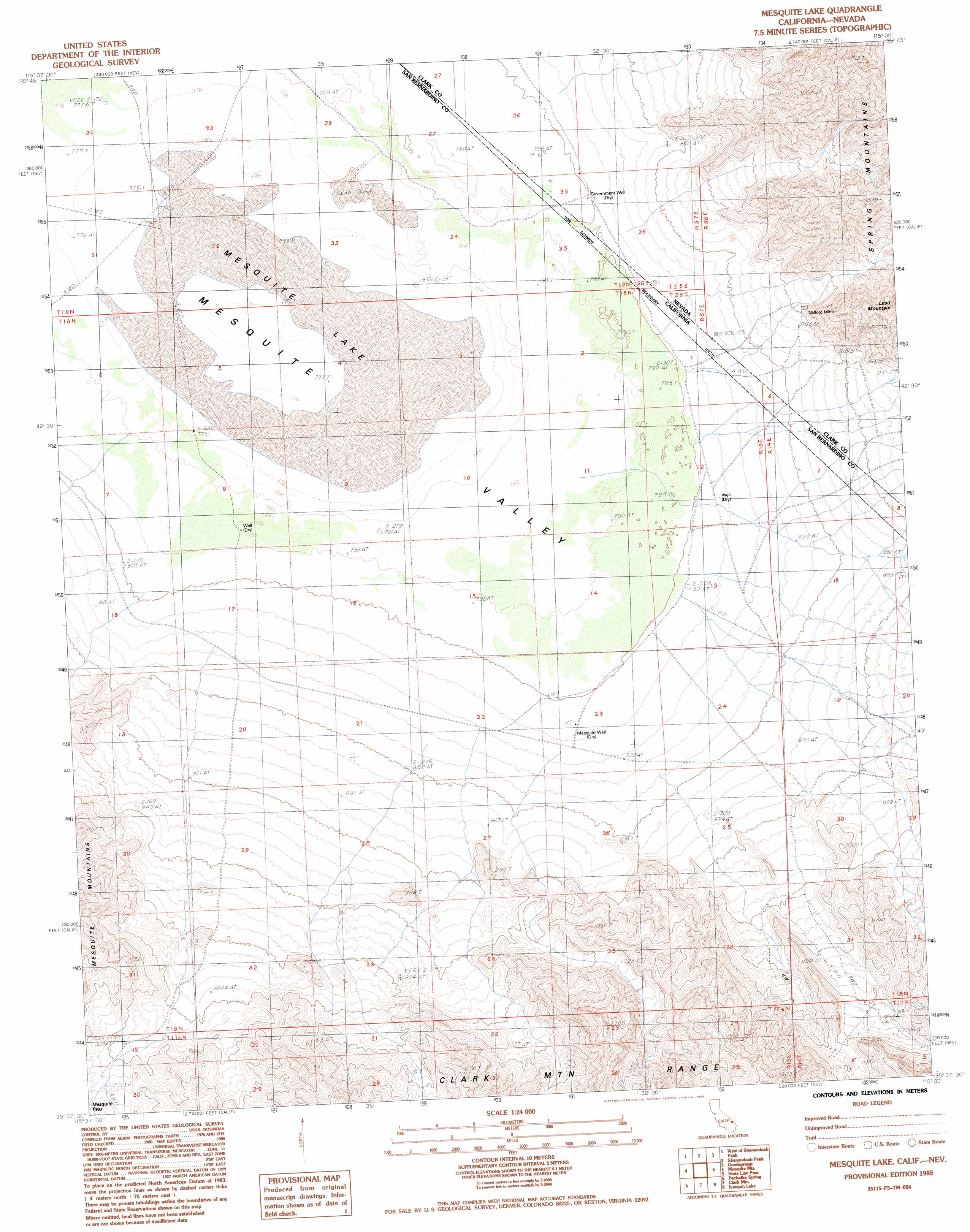
Mesquite Lake Topo Map California
To zoom in, hover over the map of Mesquite Lake
USGS Topo Quad 35115f5 - 1:24,000 scale
| Topo Map Name: | Mesquite Lake |
| USGS Topo Quad ID: | 35115f5 |
| Print Size: | ca. 21 1/4" wide x 27" high |
| Southeast Coordinates: | 35.625° N latitude / 115.5° W longitude |
| Map Center Coordinates: | 35.6875° N latitude / 115.5625° W longitude |
| U.S. States: | CA, NV |
| Filename: | o35115f5.jpg |
| Download Map JPG Image: | Mesquite Lake topo map 1:24,000 scale |
| Map Type: | Topographic |
| Topo Series: | 7.5´ |
| Map Scale: | 1:24,000 |
| Source of Map Images: | United States Geological Survey (USGS) |
| Alternate Map Versions: |
Mesquite Lake CA 1985, updated 1985 Download PDF Buy paper map Mesquite Lake CA 2012 Download PDF Buy paper map Mesquite Lake CA 2015 Download PDF Buy paper map |
1:24,000 Topo Quads surrounding Mesquite Lake
Stump Spring |
Green Monster Mine |
Potosi |
Cottonwood Pass |
Bird Spring |
Blackwater Mine |
West Of Shenandoah Peak |
Shenandoah Peak |
Goodsprings |
Jean |
East Of Kingston Peak |
Mesquite Mountain |
Mesquite Lake |
State Line Pass |
Roach |
East Of Kingston Spring |
Pachalka Spring |
Clark Mountain |
Ivanpah Lake |
Desert |
Solomons Knob |
Valley Wells |
Mescal Range |
Mineral Hill |
Nipton |
> Back to 35115e1 at 1:100,000 scale
> Back to 35114a1 at 1:250,000 scale
> Back to U.S. Topo Maps home
Mesquite Lake topo map: Gazetteer
Mesquite Lake: Flats
Mesquite Lake elevation 773m 2536′Mesquite Lake: Mines
Milford Mine elevation 973m 3192′Mesquite Lake: Wells
Government Well elevation 800m 2624′Mesquite Well elevation 810m 2657′
Mesquite Lake digital topo map on disk
Buy this Mesquite Lake topo map showing relief, roads, GPS coordinates and other geographical features, as a high-resolution digital map file on DVD:
Southern Sierra Nevada, California & Southern Nevada
Buy digital topo maps: Southern Sierra Nevada, California & Southern Nevada