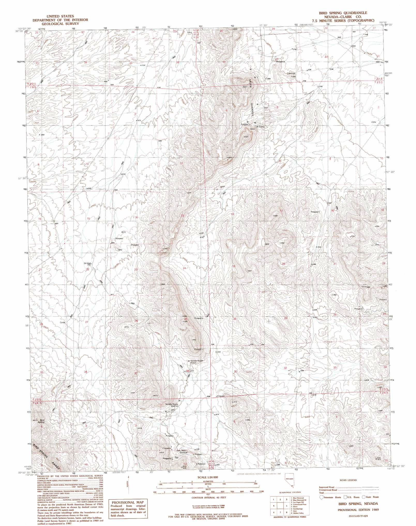
Bird Spring Topo Map Nevada
To zoom in, hover over the map of Bird Spring
USGS Topo Quad 35115h3 - 1:24,000 scale
| Topo Map Name: | Bird Spring |
| USGS Topo Quad ID: | 35115h3 |
| Print Size: | ca. 21 1/4" wide x 27" high |
| Southeast Coordinates: | 35.875° N latitude / 115.25° W longitude |
| Map Center Coordinates: | 35.9375° N latitude / 115.3125° W longitude |
| U.S. State: | NV |
| Filename: | o35115h3.jpg |
| Download Map JPG Image: | Bird Spring topo map 1:24,000 scale |
| Map Type: | Topographic |
| Topo Series: | 7.5´ |
| Map Scale: | 1:24,000 |
| Source of Map Images: | United States Geological Survey (USGS) |
| Alternate Map Versions: |
Bird Spring NV 1989, updated 1990 Download PDF Buy paper map Bird Spring NV 2012 Download PDF Buy paper map Bird Spring NV 2014 Download PDF Buy paper map |
1:24,000 Topo Quads surrounding Bird Spring
La Madre Spring |
La Madre Mountain |
Blue Diamond Ne |
Las Vegas Nw |
Las Vegas Ne |
Mountain Springs |
Blue Diamond |
Blue Diamond Se |
Las Vegas Sw |
Las Vegas Se |
Potosi |
Cottonwood Pass |
Bird Spring |
Sloan |
Sloan Ne |
Shenandoah Peak |
Goodsprings |
Jean |
Hidden Valley |
Sloan Se |
Mesquite Lake |
State Line Pass |
Roach |
Mccullough Pass |
Mccullough Mountain Ne |
> Back to 35115e1 at 1:100,000 scale
> Back to 35114a1 at 1:250,000 scale
> Back to U.S. Topo Maps home
Bird Spring topo map: Gazetteer
Bird Spring: Mines
Arden Quarries elevation 903m 2962′Gary Allen Quarry elevation 1189m 3900′
Nevada Royale Quarries elevation 1149m 3769′
Nevada Royale Quarry elevation 1176m 3858′
Bird Spring: Springs
Bird Spring elevation 1334m 4376′Bird Spring digital topo map on disk
Buy this Bird Spring topo map showing relief, roads, GPS coordinates and other geographical features, as a high-resolution digital map file on DVD:
Southern Sierra Nevada, California & Southern Nevada
Buy digital topo maps: Southern Sierra Nevada, California & Southern Nevada