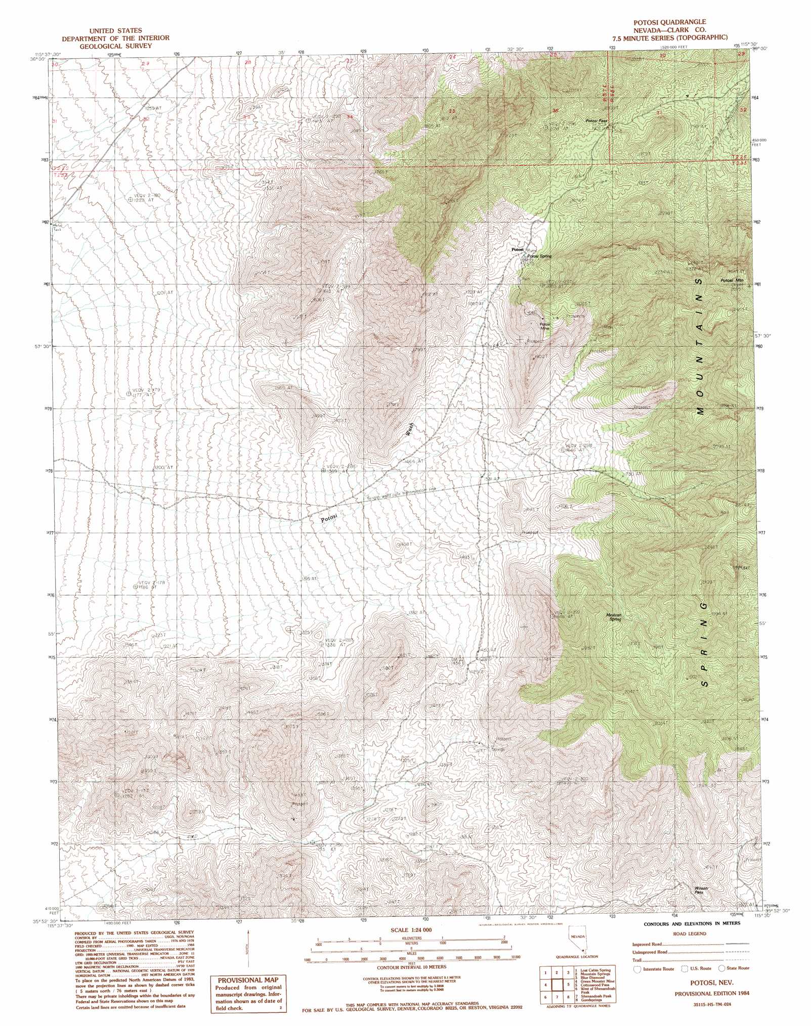
Potosi Topo Map Nevada
To zoom in, hover over the map of Potosi
USGS Topo Quad 35115h5 - 1:24,000 scale
| Topo Map Name: | Potosi |
| USGS Topo Quad ID: | 35115h5 |
| Print Size: | ca. 21 1/4" wide x 27" high |
| Southeast Coordinates: | 35.875° N latitude / 115.5° W longitude |
| Map Center Coordinates: | 35.9375° N latitude / 115.5625° W longitude |
| U.S. State: | NV |
| Filename: | o35115h5.jpg |
| Download Map JPG Image: | Potosi topo map 1:24,000 scale |
| Map Type: | Topographic |
| Topo Series: | 7.5´ |
| Map Scale: | 1:24,000 |
| Source of Map Images: | United States Geological Survey (USGS) |
| Alternate Map Versions: |
Potosi NV 1984, updated 1985 Download PDF Buy paper map Potosi NV 2012 Download PDF Buy paper map Potosi NV 2014 Download PDF Buy paper map |
| FStopo: | US Forest Service topo Potosi is available: Download FStopo PDF Download FStopo TIF |
1:24,000 Topo Quads surrounding Potosi
Pahrump Ne |
Griffith Peak |
La Madre Spring |
La Madre Mountain |
Blue Diamond Ne |
Hidden Hills Ranch |
Lost Cabin Spring |
Mountain Springs |
Blue Diamond |
Blue Diamond Se |
Stump Spring |
Green Monster Mine |
Potosi |
Cottonwood Pass |
Bird Spring |
Blackwater Mine |
West Of Shenandoah Peak |
Shenandoah Peak |
Goodsprings |
Jean |
East Of Kingston Peak |
Mesquite Mountain |
Mesquite Lake |
State Line Pass |
Roach |
> Back to 35115e1 at 1:100,000 scale
> Back to 35114a1 at 1:250,000 scale
> Back to U.S. Topo Maps home
Potosi topo map: Gazetteer
Potosi: Gaps
Potosi Pass elevation 1903m 6243′Wilson Pass elevation 1534m 5032′
Potosi: Mines
Potosi Mine elevation 2005m 6578′Potosi: Springs
Cave Spring elevation 1565m 5134′Keystone Spring elevation 1569m 5147′
Mexican Spring elevation 1693m 5554′
Potosi Spring elevation 1749m 5738′
Potosi: Summits
Potosi Mountain elevation 2562m 8405′Potosi digital topo map on disk
Buy this Potosi topo map showing relief, roads, GPS coordinates and other geographical features, as a high-resolution digital map file on DVD:
Southern Sierra Nevada, California & Southern Nevada
Buy digital topo maps: Southern Sierra Nevada, California & Southern Nevada