Green Monster Mine Topo Map Nevada
To zoom in, hover over the map of Green Monster Mine
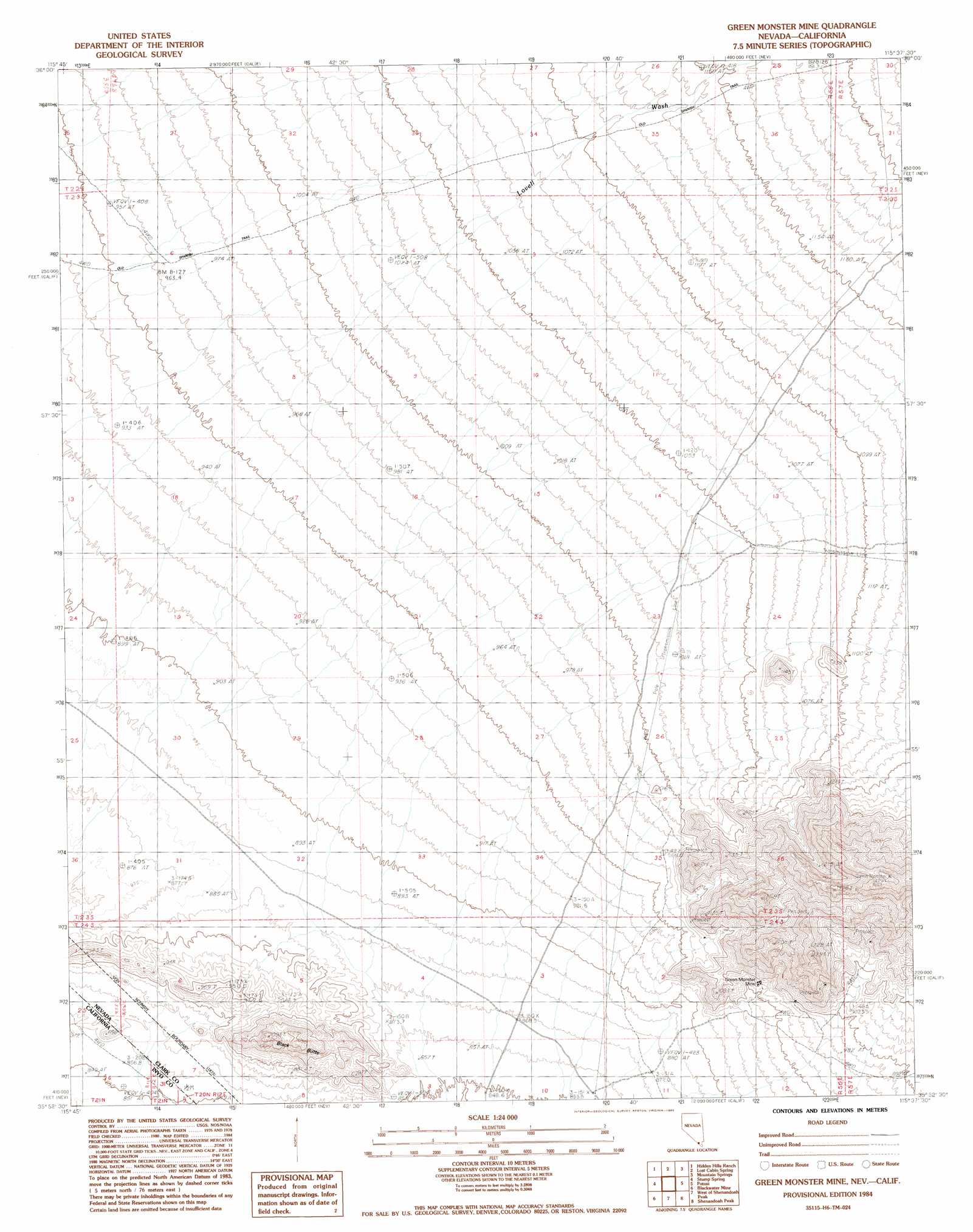
USGS Topo Quad 35115h6 - 1:24,000 scale
| Topo Map Name: | Green Monster Mine |
| USGS Topo Quad ID: | 35115h6 |
| Print Size: | ca. 21 1/4" wide x 27" high |
| Southeast Coordinates: | 35.875° N latitude / 115.625° W longitude |
| Map Center Coordinates: | 35.9375° N latitude / 115.6875° W longitude |
| U.S. States: | NV, CA |
| Filename: | o35115h6.jpg |
| Download Map JPG Image: | Green Monster Mine topo map 1:24,000 scale |
| Map Type: | Topographic |
| Topo Series: | 7.5´ |
| Map Scale: | 1:24,000 |
| Source of Map Images: | United States Geological Survey (USGS) |
| Alternate Map Versions: |
Green Monster Mine NV 1984, updated 1985 Download PDF Buy paper map Green Monster Mine NV 2012 Download PDF Buy paper map Green Monster Mine NV 2014 Download PDF Buy paper map |
1:24,000 Topo Quads surrounding Green Monster Mine
Pahrump |
Pahrump Ne |
Griffith Peak |
La Madre Spring |
La Madre Mountain |
Mound Spring |
Hidden Hills Ranch |
Lost Cabin Spring |
Mountain Springs |
Blue Diamond |
Calvada Springs |
Stump Spring |
Green Monster Mine |
Potosi |
Cottonwood Pass |
Horse Thief Springs |
Blackwater Mine |
West Of Shenandoah Peak |
Shenandoah Peak |
Goodsprings |
Kingston Peak |
East Of Kingston Peak |
Mesquite Mountain |
Mesquite Lake |
State Line Pass |
> Back to 35115e1 at 1:100,000 scale
> Back to 35114a1 at 1:250,000 scale
> Back to U.S. Topo Maps home
Green Monster Mine topo map: Gazetteer
Green Monster Mine: Mines
Green Monster Mine elevation 972m 3188′Green Monster Mine: Summits
Black Butte elevation 1012m 3320′Green Monster Mine digital topo map on disk
Buy this Green Monster Mine topo map showing relief, roads, GPS coordinates and other geographical features, as a high-resolution digital map file on DVD:
Southern Sierra Nevada, California & Southern Nevada
Buy digital topo maps: Southern Sierra Nevada, California & Southern Nevada