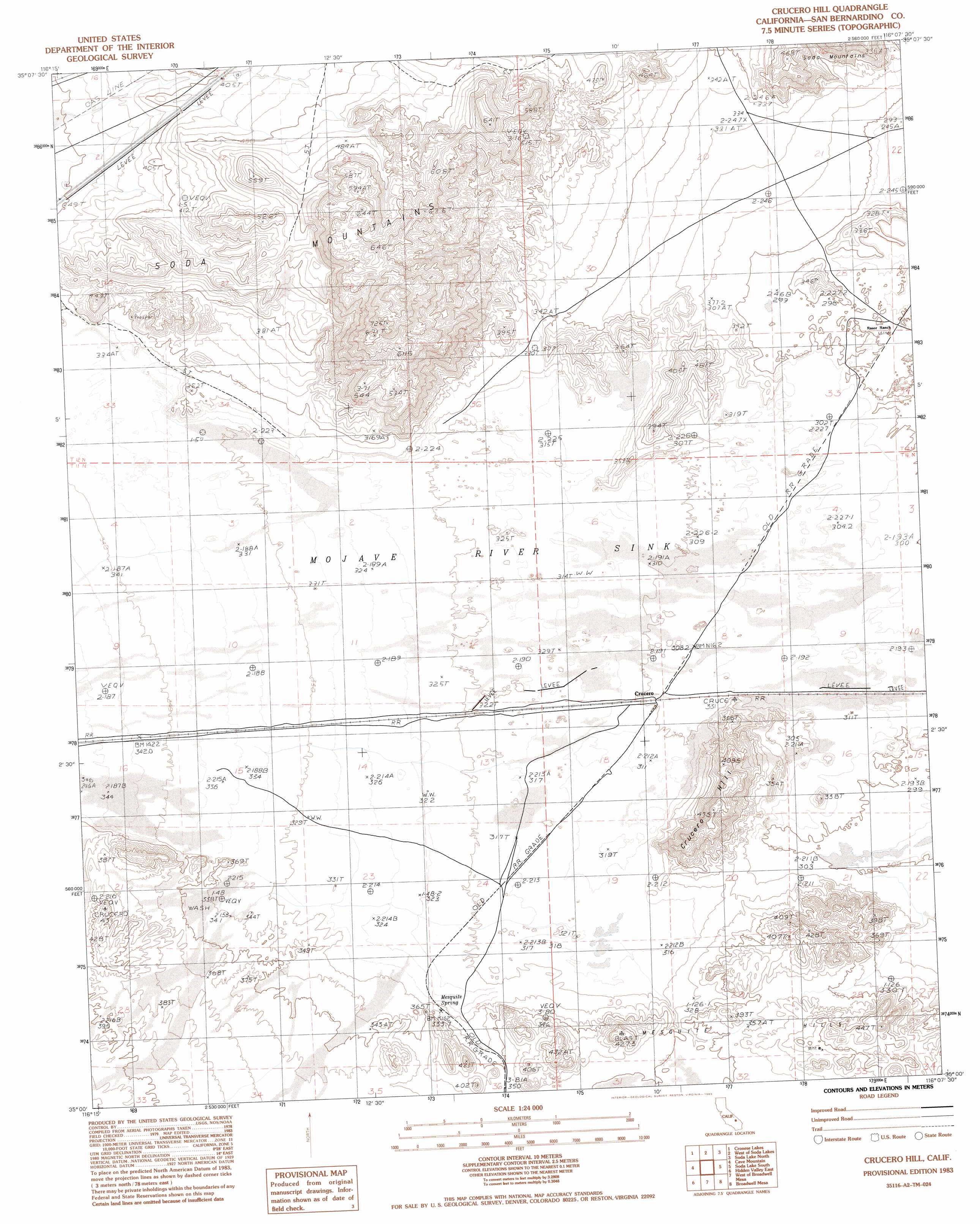
Crucero Hill Topo Map California
To zoom in, hover over the map of Crucero Hill
USGS Topo Quad 35116a2 - 1:24,000 scale
| Topo Map Name: | Crucero Hill |
| USGS Topo Quad ID: | 35116a2 |
| Print Size: | ca. 21 1/4" wide x 27" high |
| Southeast Coordinates: | 35° N latitude / 116.125° W longitude |
| Map Center Coordinates: | 35.0625° N latitude / 116.1875° W longitude |
| U.S. State: | CA |
| Filename: | o35116a2.jpg |
| Download Map JPG Image: | Crucero Hill topo map 1:24,000 scale |
| Map Type: | Topographic |
| Topo Series: | 7.5´ |
| Map Scale: | 1:24,000 |
| Source of Map Images: | United States Geological Survey (USGS) |
| Alternate Map Versions: |
Crucero Hill CA 1983, updated 1983 Download PDF Buy paper map Crucero Hill CA 1983, updated 1983 Download PDF Buy paper map Crucero Hill CA 1983, updated 1985 Download PDF Buy paper map Crucero Hill CA 2012 Download PDF Buy paper map Crucero Hill CA 2015 Download PDF Buy paper map |
1:24,000 Topo Quads surrounding Crucero Hill
West Of Red Pass Lake |
Red Pass Lake |
West Of Baker |
Baker |
Halloran Spring |
Bitter Spring |
Cronise Lakes |
West Of Soda Lake |
Soda Lake North |
Seventeenmile Point |
Dunn |
Cave Mountain |
Crucero Hill |
Soda Lake South |
Cowhole Mountain |
Hidden Valley West |
Hidden Valley East |
West Of Broadwell Mesa |
Broadwell Mesa |
West Of Glasgow |
Hector |
Sleeping Beauty |
Broadwell Lake |
East Of Broadwell Lake |
West Of Budweiser Wash |
> Back to 35116a1 at 1:100,000 scale
> Back to 35116a1 at 1:250,000 scale
> Back to U.S. Topo Maps home
Crucero Hill topo map: Gazetteer
Crucero Hill: Populated Places
Crucero elevation 311m 1020′King (historical) elevation 325m 1066′
Crucero Hill: Ranges
Mesquite Hills elevation 366m 1200′Crucero Hill: Springs
Mesquite Spring elevation 337m 1105′Crucero Hill: Summits
Crucero Hill elevation 445m 1459′Crucero Hill digital topo map on disk
Buy this Crucero Hill topo map showing relief, roads, GPS coordinates and other geographical features, as a high-resolution digital map file on DVD:
Southern Sierra Nevada, California & Southern Nevada
Buy digital topo maps: Southern Sierra Nevada, California & Southern Nevada