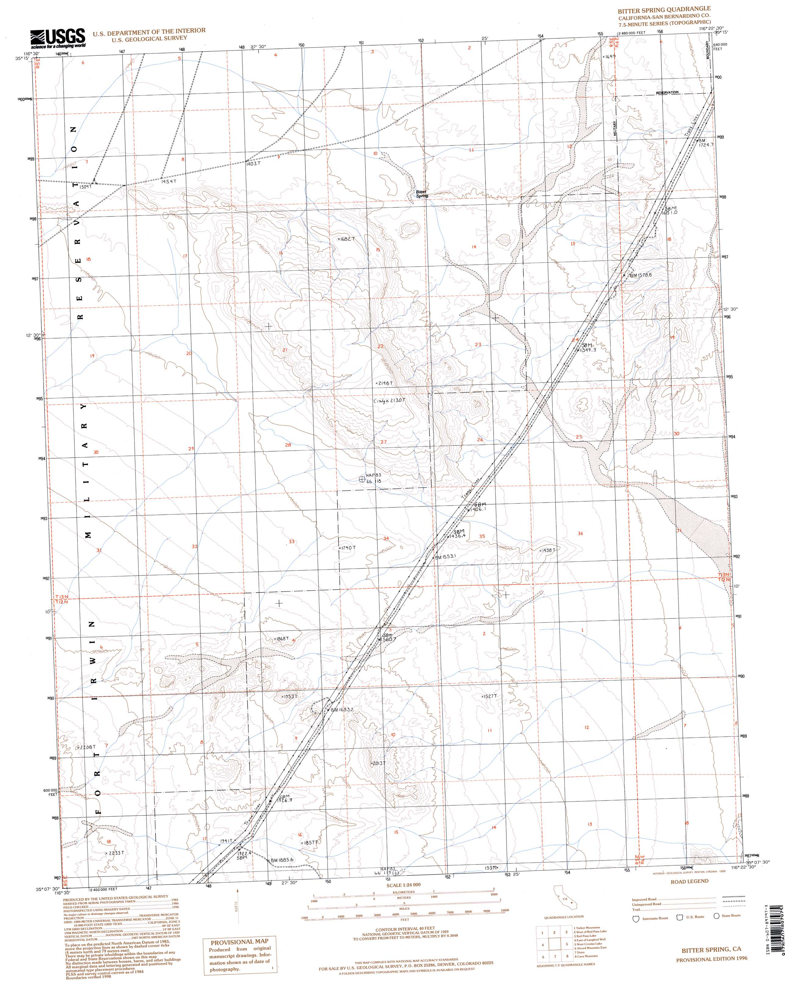
Bitter Spring Topo Map California
To zoom in, hover over the map of Bitter Spring
USGS Topo Quad 35116b4 - 1:24,000 scale
| Topo Map Name: | Bitter Spring |
| USGS Topo Quad ID: | 35116b4 |
| Print Size: | ca. 21 1/4" wide x 27" high |
| Southeast Coordinates: | 35.125° N latitude / 116.375° W longitude |
| Map Center Coordinates: | 35.1875° N latitude / 116.4375° W longitude |
| U.S. State: | CA |
| Filename: | o35116b4.jpg |
| Download Map JPG Image: | Bitter Spring topo map 1:24,000 scale |
| Map Type: | Topographic |
| Topo Series: | 7.5´ |
| Map Scale: | 1:24,000 |
| Source of Map Images: | United States Geological Survey (USGS) |
| Alternate Map Versions: |
Bitter Spring CA 1986, updated 1986 Download PDF Buy paper map Bitter Spring CA 1996, updated 1998 Download PDF Buy paper map Bitter Spring CA 2012 Download PDF Buy paper map Bitter Spring CA 2015 Download PDF Buy paper map |
1:24,000 Topo Quads surrounding Bitter Spring
West Of Drinkwater Lake |
Drinkwater Lake |
Red Pass Lake Nw |
Red Pass Lake Ne |
Silurian Valley |
Fort Irwin |
Tiefort Mountains |
West Of Red Pass Lake |
Red Pass Lake |
West Of Baker |
Langford Well |
East Of Langford Well |
Bitter Spring |
Cronise Lakes |
West Of Soda Lake |
Alvord Mountain West |
Alvord Mountain East |
Dunn |
Cave Mountain |
Crucero Hill |
Harvard Hill |
Manix |
Hidden Valley West |
Hidden Valley East |
West Of Broadwell Mesa |
> Back to 35116a1 at 1:100,000 scale
> Back to 35116a1 at 1:250,000 scale
> Back to U.S. Topo Maps home
Bitter Spring digital topo map on disk
Buy this Bitter Spring topo map showing relief, roads, GPS coordinates and other geographical features, as a high-resolution digital map file on DVD:
Southern Sierra Nevada, California & Southern Nevada
Buy digital topo maps: Southern Sierra Nevada, California & Southern Nevada