Fort Irwin Topo Map California
To zoom in, hover over the map of Fort Irwin
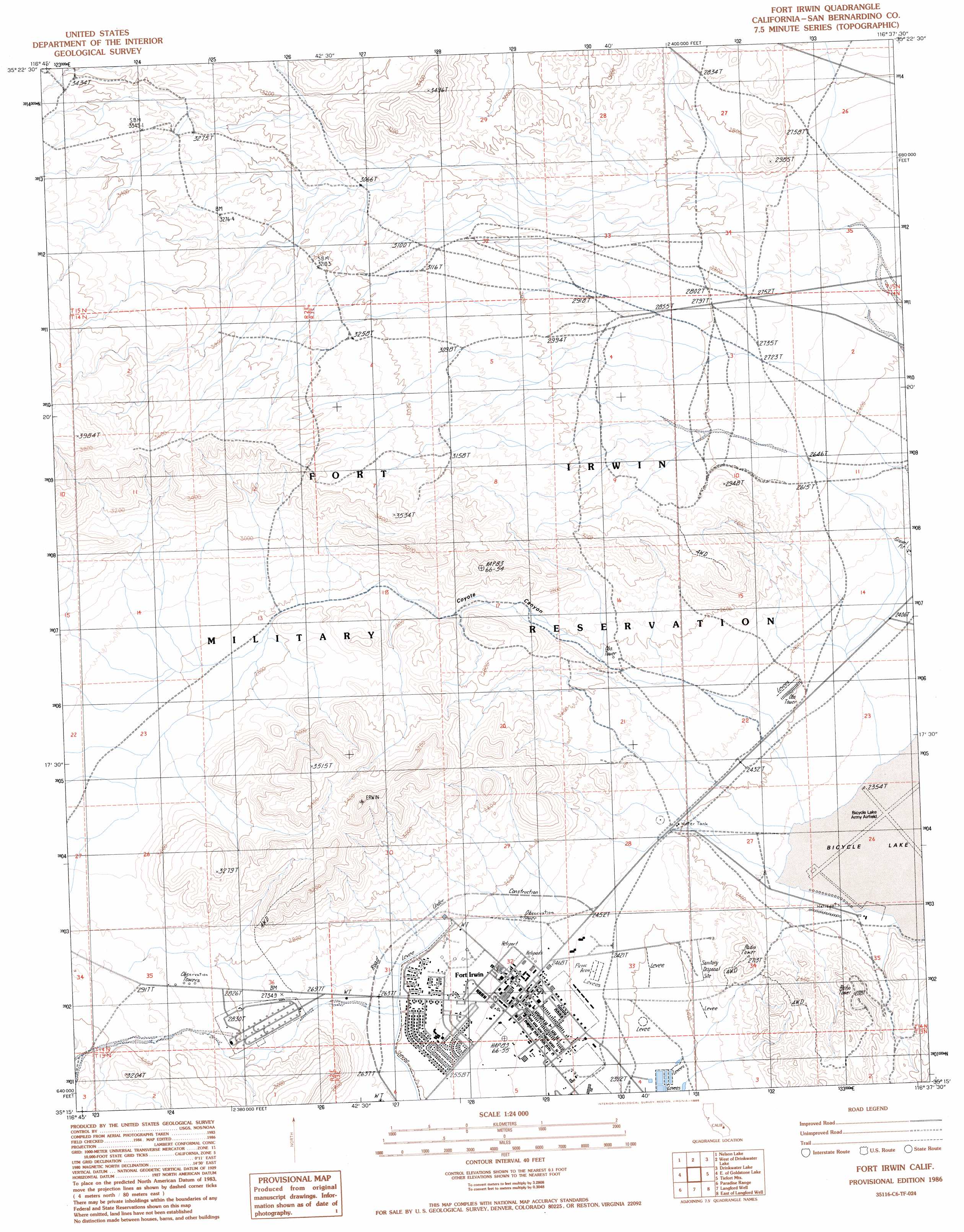
USGS Topo Quad 35116c6 - 1:24,000 scale
| Topo Map Name: | Fort Irwin |
| USGS Topo Quad ID: | 35116c6 |
| Print Size: | ca. 21 1/4" wide x 27" high |
| Southeast Coordinates: | 35.25° N latitude / 116.625° W longitude |
| Map Center Coordinates: | 35.3125° N latitude / 116.6875° W longitude |
| U.S. State: | CA |
| Filename: | o35116c6.jpg |
| Download Map JPG Image: | Fort Irwin topo map 1:24,000 scale |
| Map Type: | Topographic |
| Topo Series: | 7.5´ |
| Map Scale: | 1:24,000 |
| Source of Map Images: | United States Geological Survey (USGS) |
| Alternate Map Versions: |
Fort Irwin CA 1986, updated 1986 Download PDF Buy paper map Fort Irwin CA 1986, updated 1986 Download PDF Buy paper map Fort Irwin CA 2012 Download PDF Buy paper map Fort Irwin CA 2015 Download PDF Buy paper map |
1:24,000 Topo Quads surrounding Fort Irwin
West Of Leach Spring |
Leach Spring |
Leach Lake |
East Of Leach Lake |
Avawatz Pass |
West Of Nelson Lake |
Nelson Lake |
West Of Drinkwater Lake |
Drinkwater Lake |
Red Pass Lake Nw |
Goldstone |
East Of Goldstone |
Fort Irwin |
Tiefort Mountains |
West Of Red Pass Lake |
Williams Well |
Paradise Range |
Langford Well |
East Of Langford Well |
Bitter Spring |
Lane Mountain |
Coyote Lake |
Alvord Mountain West |
Alvord Mountain East |
Dunn |
> Back to 35116a1 at 1:100,000 scale
> Back to 35116a1 at 1:250,000 scale
> Back to U.S. Topo Maps home
Fort Irwin topo map: Gazetteer
Fort Irwin: Airports
Bicycle Lake Army Airfield elevation 711m 2332′Fort Irwin: Flats
Bicycle Lake elevation 711m 2332′Fort Irwin: Parks
Jackass Park elevation 767m 2516′Fort Irwin: Populated Places
Fort Irwin elevation 758m 2486′Fort Irwin: Valleys
Coyote Canyon elevation 766m 2513′Fort Irwin digital topo map on disk
Buy this Fort Irwin topo map showing relief, roads, GPS coordinates and other geographical features, as a high-resolution digital map file on DVD:
Southern Sierra Nevada, California & Southern Nevada
Buy digital topo maps: Southern Sierra Nevada, California & Southern Nevada