Silurian Valley Topo Map California
To zoom in, hover over the map of Silurian Valley
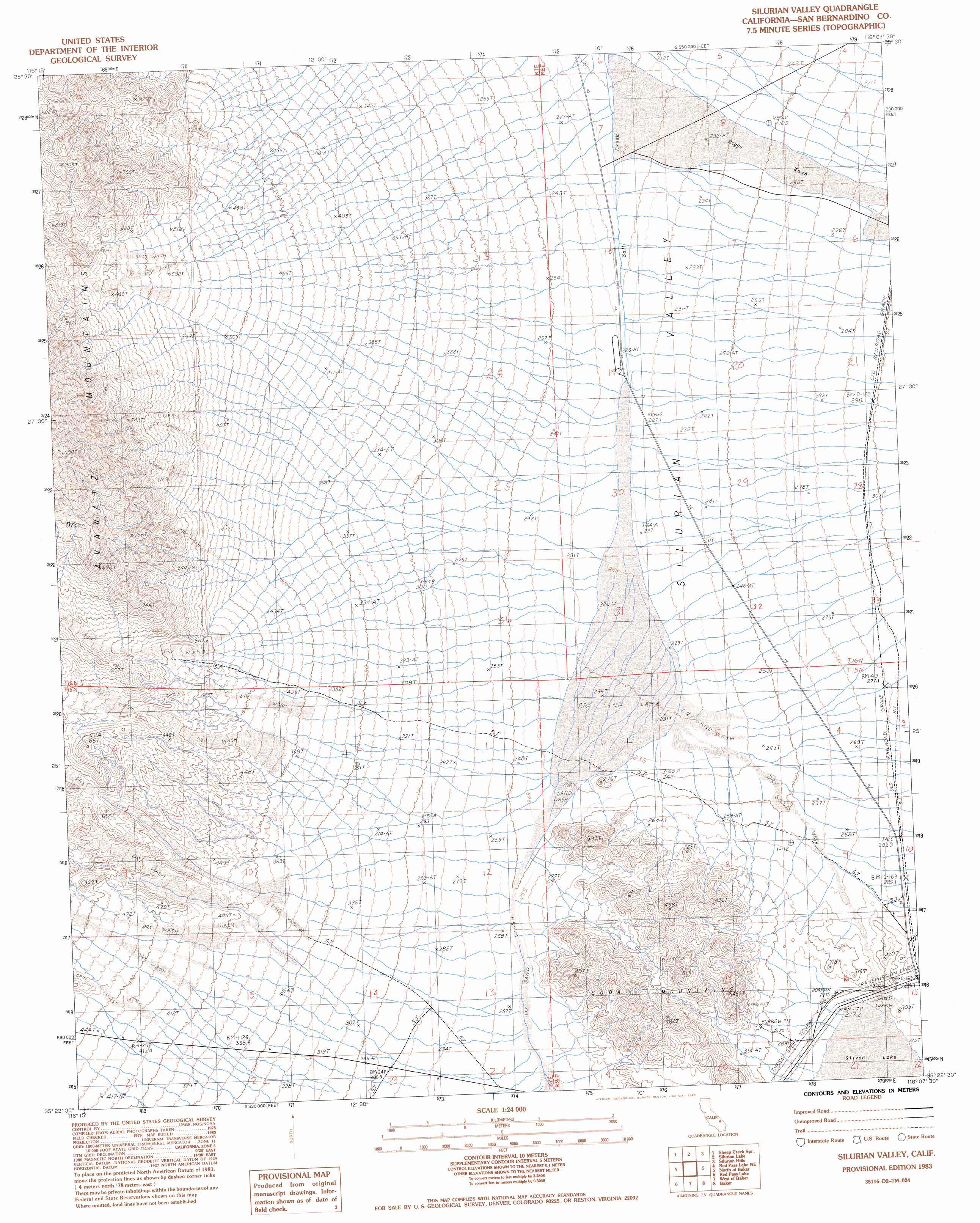
USGS Topo Quad 35116d2 - 1:24,000 scale
| Topo Map Name: | Silurian Valley |
| USGS Topo Quad ID: | 35116d2 |
| Print Size: | ca. 21 1/4" wide x 27" high |
| Southeast Coordinates: | 35.375° N latitude / 116.125° W longitude |
| Map Center Coordinates: | 35.4375° N latitude / 116.1875° W longitude |
| U.S. State: | CA |
| Filename: | o35116d2.jpg |
| Download Map JPG Image: | Silurian Valley topo map 1:24,000 scale |
| Map Type: | Topographic |
| Topo Series: | 7.5´ |
| Map Scale: | 1:24,000 |
| Source of Map Images: | United States Geological Survey (USGS) |
| Alternate Map Versions: |
Silurian Valley CA 1983, updated 1983 Download PDF Buy paper map Silurian Valley CA 2012 Download PDF Buy paper map Silurian Valley CA 2015 Download PDF Buy paper map |
1:24,000 Topo Quads surrounding Silurian Valley
Old Ibex Pass |
Saddle Peak Hills |
Dumont Dunes |
Valjean Hills |
Kingston Peak |
Avawatz Pass |
Sheep Creek Spring |
Silurian Lake |
Silurian Hills |
Kingston Spring |
Red Pass Lake Nw |
Red Pass Lake Ne |
Silurian Valley |
North Of Baker |
Turquoise Mountain |
West Of Red Pass Lake |
Red Pass Lake |
West Of Baker |
Baker |
Halloran Spring |
Bitter Spring |
Cronise Lakes |
West Of Soda Lake |
Soda Lake North |
Seventeenmile Point |
> Back to 35116a1 at 1:100,000 scale
> Back to 35116a1 at 1:250,000 scale
> Back to U.S. Topo Maps home
Silurian Valley topo map: Gazetteer
Silurian Valley: Flats
Dry Lake elevation 229m 751′Silurian Valley: Valleys
Silurian Valley elevation 235m 770′Silurian Valley digital topo map on disk
Buy this Silurian Valley topo map showing relief, roads, GPS coordinates and other geographical features, as a high-resolution digital map file on DVD:
Southern Sierra Nevada, California & Southern Nevada
Buy digital topo maps: Southern Sierra Nevada, California & Southern Nevada