Dumont Dunes Topo Map California
To zoom in, hover over the map of Dumont Dunes
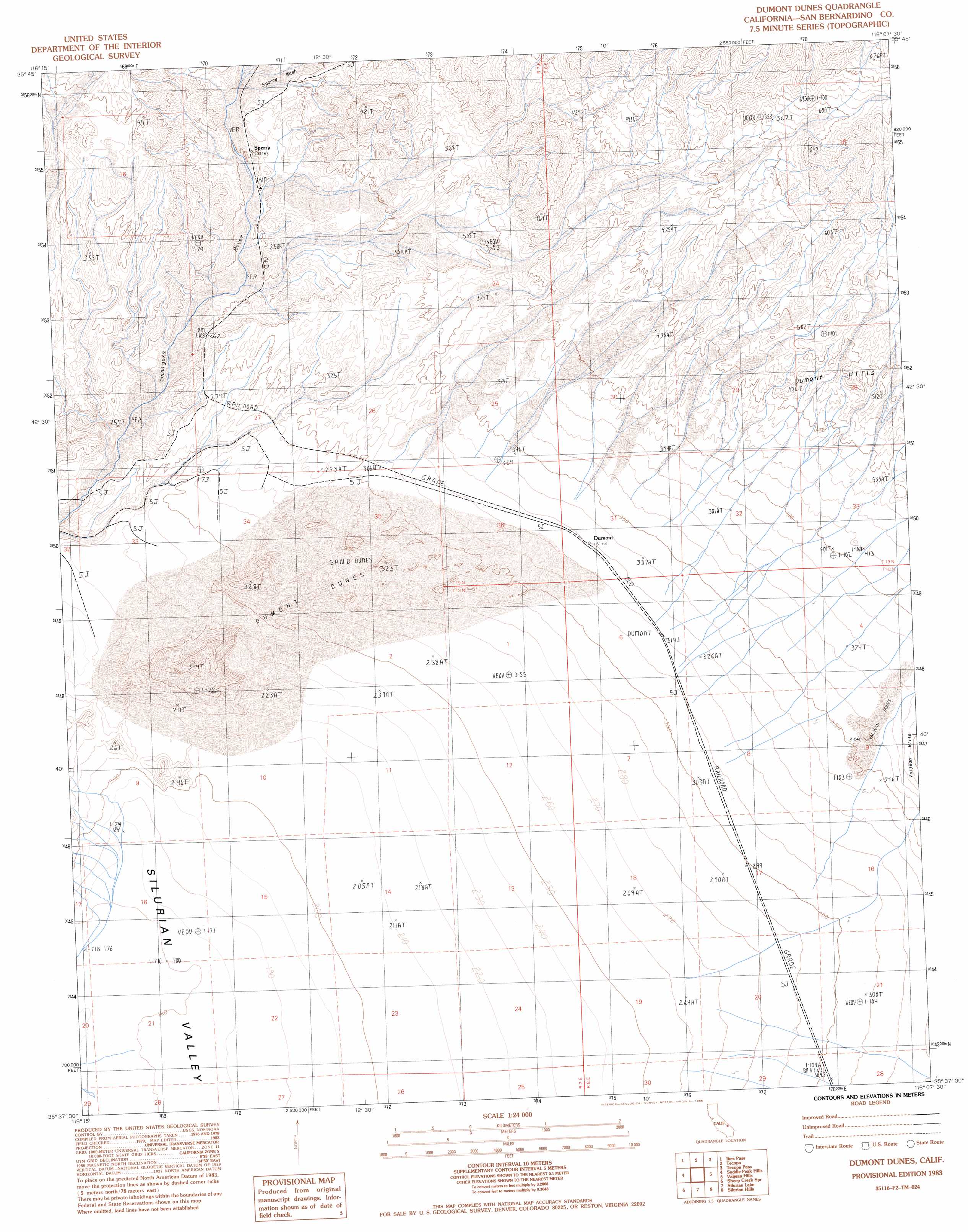
USGS Topo Quad 35116f2 - 1:24,000 scale
| Topo Map Name: | Dumont Dunes |
| USGS Topo Quad ID: | 35116f2 |
| Print Size: | ca. 21 1/4" wide x 27" high |
| Southeast Coordinates: | 35.625° N latitude / 116.125° W longitude |
| Map Center Coordinates: | 35.6875° N latitude / 116.1875° W longitude |
| U.S. State: | CA |
| Filename: | o35116f2.jpg |
| Download Map JPG Image: | Dumont Dunes topo map 1:24,000 scale |
| Map Type: | Topographic |
| Topo Series: | 7.5´ |
| Map Scale: | 1:24,000 |
| Source of Map Images: | United States Geological Survey (USGS) |
| Alternate Map Versions: |
Dumont Dunes CA 1983, updated 1983 Download PDF Buy paper map Dumont Dunes CA 1983, updated 1985 Download PDF Buy paper map Dumont Dunes CA 2012 Download PDF Buy paper map Dumont Dunes CA 2015 Download PDF Buy paper map |
1:24,000 Topo Quads surrounding Dumont Dunes
Salsberry Peak |
Shoshone |
Resting Spring |
North Of Tecopa Pass |
Calvada Springs |
Ibex Spring |
Ibex Pass |
Tecopa |
Tecopa Pass |
Horse Thief Springs |
Old Ibex Pass |
Saddle Peak Hills |
Dumont Dunes |
Valjean Hills |
Kingston Peak |
Avawatz Pass |
Sheep Creek Spring |
Silurian Lake |
Silurian Hills |
Kingston Spring |
Red Pass Lake Nw |
Red Pass Lake Ne |
Silurian Valley |
North Of Baker |
Turquoise Mountain |
> Back to 35116e1 at 1:100,000 scale
> Back to 35116a1 at 1:250,000 scale
> Back to U.S. Topo Maps home
Dumont Dunes topo map: Gazetteer
Dumont Dunes: Populated Places
Dumont (historical) elevation 330m 1082′Sperry elevation 254m 833′
Dumont Dunes: Streams
Sperry Wash elevation 260m 853′Dumont Dunes: Summits
Dumont Dunes elevation 262m 859′Valjean Dunes elevation 358m 1174′
Dumont Dunes: Valleys
Amargosa Canyon elevation 224m 734′Dumont Dunes digital topo map on disk
Buy this Dumont Dunes topo map showing relief, roads, GPS coordinates and other geographical features, as a high-resolution digital map file on DVD:
Southern Sierra Nevada, California & Southern Nevada
Buy digital topo maps: Southern Sierra Nevada, California & Southern Nevada