Confidence Hills East Topo Map California
To zoom in, hover over the map of Confidence Hills East
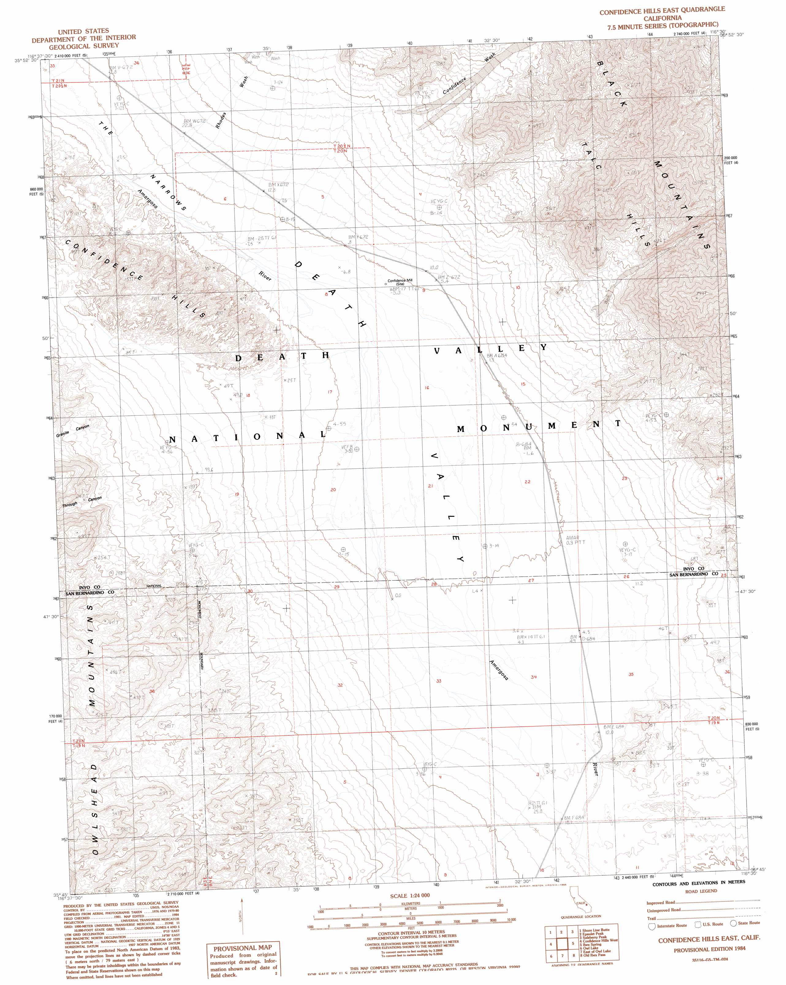
USGS Topo Quad 35116g5 - 1:24,000 scale
| Topo Map Name: | Confidence Hills East |
| USGS Topo Quad ID: | 35116g5 |
| Print Size: | ca. 21 1/4" wide x 27" high |
| Southeast Coordinates: | 35.75° N latitude / 116.5° W longitude |
| Map Center Coordinates: | 35.8125° N latitude / 116.5625° W longitude |
| U.S. State: | CA |
| Filename: | o35116g5.jpg |
| Download Map JPG Image: | Confidence Hills East topo map 1:24,000 scale |
| Map Type: | Topographic |
| Topo Series: | 7.5´ |
| Map Scale: | 1:24,000 |
| Source of Map Images: | United States Geological Survey (USGS) |
| Alternate Map Versions: |
Confidence Hills East CA 1984, updated 1985 Download PDF Buy paper map Confidence Hills East CA 1984, updated 1985 Download PDF Buy paper map Confidence Hills East CA 2012 Download PDF Buy paper map Confidence Hills East CA 2015 Download PDF Buy paper map |
1:24,000 Topo Quads surrounding Confidence Hills East
Mormon Point |
Gold Valley |
Funeral Peak |
Deadman Pass |
East Of Deadman Pass |
Anvil Spring Canyon East |
Shore Line Butte |
Epaulet Peak |
Salsberry Peak |
Shoshone |
Wingate Wash East |
Confidence Hills West |
Confidence Hills East |
Ibex Spring |
Ibex Pass |
Quail Spring |
Owl Lake |
East Of Owl Lake |
Old Ibex Pass |
Saddle Peak Hills |
Leach Spring |
Leach Lake |
East Of Leach Lake |
Avawatz Pass |
Sheep Creek Spring |
> Back to 35116e1 at 1:100,000 scale
> Back to 35116a1 at 1:250,000 scale
> Back to U.S. Topo Maps home
Confidence Hills East topo map: Gazetteer
Confidence Hills East: Streams
Confidence Wash elevation -8m -27′Rhodes Wash elevation 11m 36′
Confidence Hills East: Valleys
Granite Canyon elevation 169m 554′Through Canyon elevation 192m 629′
Confidence Hills East digital topo map on disk
Buy this Confidence Hills East topo map showing relief, roads, GPS coordinates and other geographical features, as a high-resolution digital map file on DVD:
Southern Sierra Nevada, California & Southern Nevada
Buy digital topo maps: Southern Sierra Nevada, California & Southern Nevada