Christmas Canyon Topo Map California
To zoom in, hover over the map of Christmas Canyon
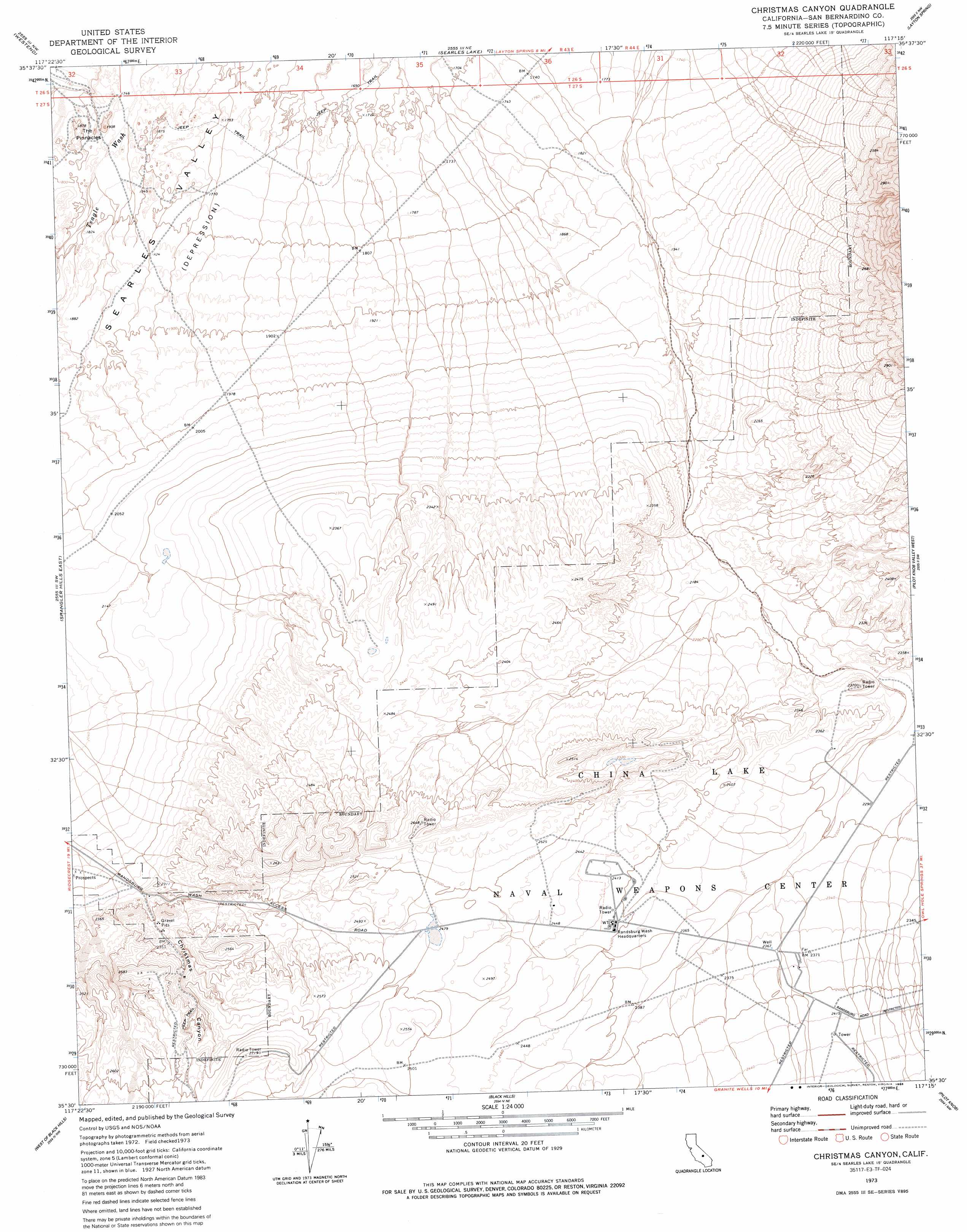
USGS Topo Quad 35117e3 - 1:24,000 scale
| Topo Map Name: | Christmas Canyon |
| USGS Topo Quad ID: | 35117e3 |
| Print Size: | ca. 21 1/4" wide x 27" high |
| Southeast Coordinates: | 35.5° N latitude / 117.25° W longitude |
| Map Center Coordinates: | 35.5625° N latitude / 117.3125° W longitude |
| U.S. State: | CA |
| Filename: | o35117e3.jpg |
| Download Map JPG Image: | Christmas Canyon topo map 1:24,000 scale |
| Map Type: | Topographic |
| Topo Series: | 7.5´ |
| Map Scale: | 1:24,000 |
| Source of Map Images: | United States Geological Survey (USGS) |
| Alternate Map Versions: |
Christmas Canyon CA 1973, updated 1975 Download PDF Buy paper map Christmas Canyon CA 1973, updated 1975 Download PDF Buy paper map Christmas Canyon CA 1973, updated 1986 Download PDF Buy paper map Christmas Canyon CA 2012 Download PDF Buy paper map Christmas Canyon CA 2015 Download PDF Buy paper map |
1:24,000 Topo Quads surrounding Christmas Canyon
Burro Canyon |
Trona West |
Trona East |
Copper Queen Canyon |
Sourdough Spring |
Lone Butte |
Westend |
Searles Lake |
Layton Spring |
Wingate Pass |
Spangler Hills West |
Spangler Hills East |
Christmas Canyon |
Pilot Knob Valley West |
Pilot Knob Valley East |
Klinker Mountain |
West Of Black Hills |
Black Hills |
Pilot Knob |
Eagle Crags |
Red Mountain |
Cuddeback Lake |
Blackwater Well |
Slocum Mountain |
Superior Valley |
> Back to 35117e1 at 1:100,000 scale
> Back to 35116a1 at 1:250,000 scale
> Back to U.S. Topo Maps home
Christmas Canyon topo map: Gazetteer
Christmas Canyon: Basins
Searles Valley elevation 531m 1742′Christmas Canyon: Pillars
The Pinnacles elevation 582m 1909′Christmas Canyon: Valleys
Christmas Canyon elevation 682m 2237′Christmas Canyon digital topo map on disk
Buy this Christmas Canyon topo map showing relief, roads, GPS coordinates and other geographical features, as a high-resolution digital map file on DVD:
Southern Sierra Nevada, California & Southern Nevada
Buy digital topo maps: Southern Sierra Nevada, California & Southern Nevada