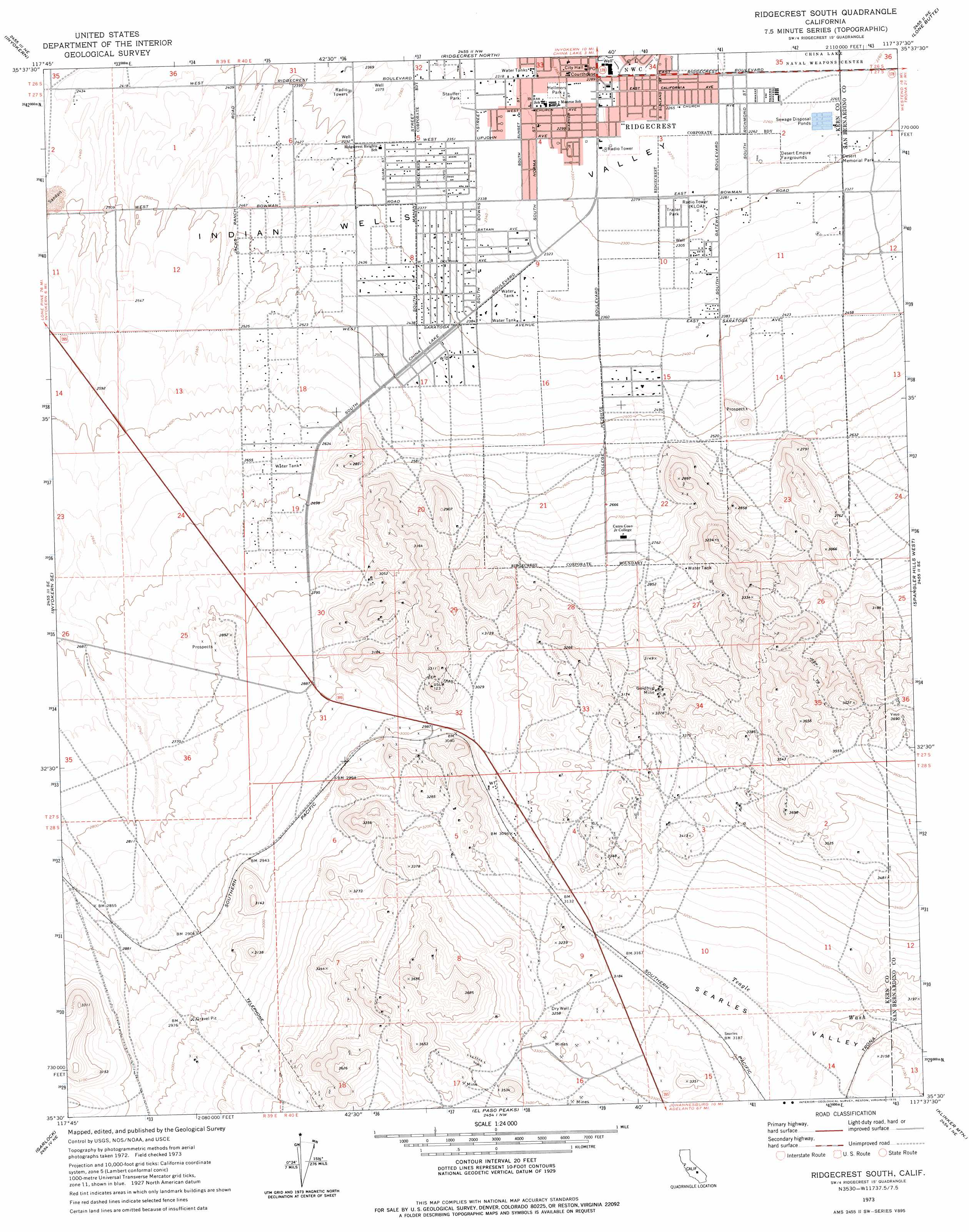
Ridgecrest South Topo Map California
To zoom in, hover over the map of Ridgecrest South
USGS Topo Quad 35117e6 - 1:24,000 scale
| Topo Map Name: | Ridgecrest South |
| USGS Topo Quad ID: | 35117e6 |
| Print Size: | ca. 21 1/4" wide x 27" high |
| Southeast Coordinates: | 35.5° N latitude / 117.625° W longitude |
| Map Center Coordinates: | 35.5625° N latitude / 117.6875° W longitude |
| U.S. State: | CA |
| Filename: | o35117e6.jpg |
| Download Map JPG Image: | Ridgecrest South topo map 1:24,000 scale |
| Map Type: | Topographic |
| Topo Series: | 7.5´ |
| Map Scale: | 1:24,000 |
| Source of Map Images: | United States Geological Survey (USGS) |
| Alternate Map Versions: |
Ridgecrest South CA 1973, updated 1975 Download PDF Buy paper map Ridgecrest South CA 2012 Download PDF Buy paper map Ridgecrest South CA 2015 Download PDF Buy paper map |
1:24,000 Topo Quads surrounding Ridgecrest South
Ninemile Canyon |
Pearsonville |
White Hills |
Burro Canyon |
Trona West |
Owens Peak |
Inyokern |
Ridgecrest North |
Lone Butte |
Westend |
Freeman Junction |
Inyokern Se |
Ridgecrest South |
Spangler Hills West |
Spangler Hills East |
Saltdale Nw |
Garlock |
El Paso Peaks |
Klinker Mountain |
West Of Black Hills |
Cantil |
Saltdale Se |
Johannesburg |
Red Mountain |
Cuddeback Lake |
> Back to 35117e1 at 1:100,000 scale
> Back to 35116a1 at 1:250,000 scale
> Back to U.S. Topo Maps home
Ridgecrest South topo map: Gazetteer
Ridgecrest South: Airports
Davis Airport (historical) elevation 701m 2299′SCE Ridgecrest Service Center Heliport elevation 696m 2283′
Tera Skypark elevation 758m 2486′
Ridgecrest South: Areas
Rademacher Mining District elevation 994m 3261′Ridgecrest South: Mines
Goldbug Mine elevation 978m 3208′Lonely Camp Mine elevation 927m 3041′
Ridgecrest South: Parks
Desert Memorial Park elevation 701m 2299′Hellmers Park elevation 704m 2309′
Stauffer Park elevation 713m 2339′
Upjohn Park elevation 692m 2270′
Ridgecrest South: Populated Places
Ridgecrest elevation 698m 2290′Ridgecrest South digital topo map on disk
Buy this Ridgecrest South topo map showing relief, roads, GPS coordinates and other geographical features, as a high-resolution digital map file on DVD:
Southern Sierra Nevada, California & Southern Nevada
Buy digital topo maps: Southern Sierra Nevada, California & Southern Nevada