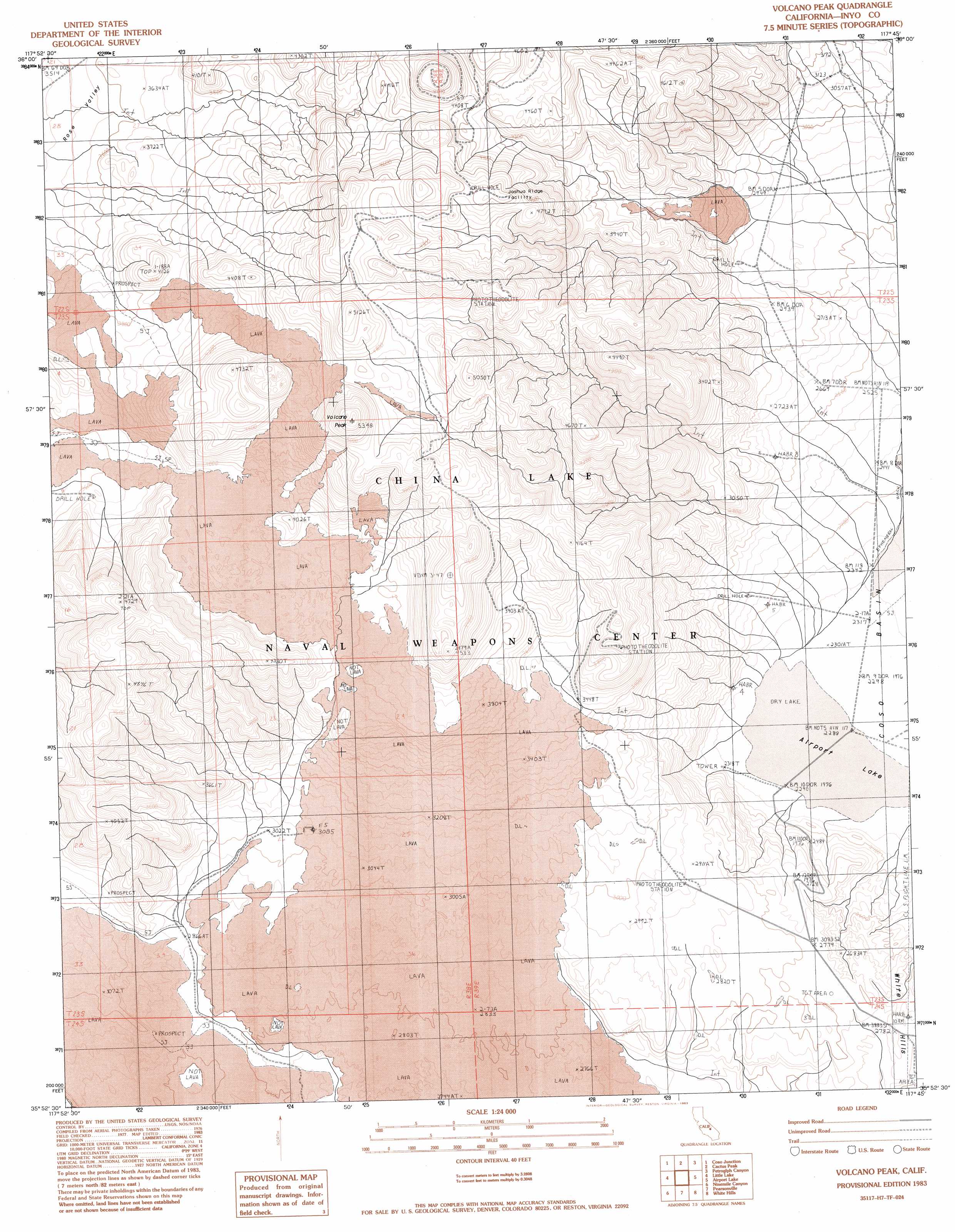
Volcano Peak Topo Map California
To zoom in, hover over the map of Volcano Peak
USGS Topo Quad 35117h7 - 1:24,000 scale
| Topo Map Name: | Volcano Peak |
| USGS Topo Quad ID: | 35117h7 |
| Print Size: | ca. 21 1/4" wide x 27" high |
| Southeast Coordinates: | 35.875° N latitude / 117.75° W longitude |
| Map Center Coordinates: | 35.9375° N latitude / 117.8125° W longitude |
| U.S. State: | CA |
| Filename: | o35117h7.jpg |
| Download Map JPG Image: | Volcano Peak topo map 1:24,000 scale |
| Map Type: | Topographic |
| Topo Series: | 7.5´ |
| Map Scale: | 1:24,000 |
| Source of Map Images: | United States Geological Survey (USGS) |
| Alternate Map Versions: |
Volcano Peak CA 1983, updated 1983 Download PDF Buy paper map Volcano Peak CA 2012 Download PDF Buy paper map Volcano Peak CA 2015 Download PDF Buy paper map |
1:24,000 Topo Quads surrounding Volcano Peak
Haiwee Pass |
Haiwee Reservoirs |
Upper Centennial Flat |
Coso Peak |
China Gardens |
Long Canyon |
Coso Junction |
Cactus Peak |
Petroglyph Canyon |
Louisiana Butte |
Sacatar Canyon |
Little Lake |
Volcano Peak |
Airport Lake |
Mountain Springs Canyon |
Lamont Peak |
Ninemile Canyon |
Pearsonville |
White Hills |
Burro Canyon |
Walker Pass |
Owens Peak |
Inyokern |
Ridgecrest North |
Lone Butte |
> Back to 35117e1 at 1:100,000 scale
> Back to 35116a1 at 1:250,000 scale
> Back to U.S. Topo Maps home
Volcano Peak topo map: Gazetteer
Volcano Peak: Streams
Coso Wash elevation 718m 2355′Volcano Peak: Summits
Volcano Peak elevation 1625m 5331′Volcano Peak digital topo map on disk
Buy this Volcano Peak topo map showing relief, roads, GPS coordinates and other geographical features, as a high-resolution digital map file on DVD:
Southern Sierra Nevada, California & Southern Nevada
Buy digital topo maps: Southern Sierra Nevada, California & Southern Nevada