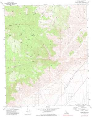
Cache Peak Topo Map California
To zoom in, hover over the map of Cache Peak
USGS Topo Quad 35118b2 - 1:24,000 scale
| Topo Map Name: | Cache Peak |
| USGS Topo Quad ID: | 35118b2 |
| Print Size: | ca. 21 1/4" wide x 27" high |
| Southeast Coordinates: | 35.125° N latitude / 118.125° W longitude |
| Map Center Coordinates: | 35.1875° N latitude / 118.1875° W longitude |
| U.S. State: | CA |
| Filename: | o35118b2.jpg |
| Download Map JPG Image: | Cache Peak topo map 1:24,000 scale |
| Map Type: | Topographic |
| Topo Series: | 7.5´ |
| Map Scale: | 1:24,000 |
| Source of Map Images: | United States Geological Survey (USGS) |
| Alternate Map Versions: |
Cache Peak CA 1973, updated 1977 Download PDF Buy paper map Cache Peak CA 1973, updated 1977 Download PDF Buy paper map Cache Peak CA 1973, updated 1983 Download PDF Buy paper map Cache Peak CA 1973, updated 1994 Download PDF Buy paper map Cache Peak CA 2012 Download PDF Buy paper map Cache Peak CA 2015 Download PDF Buy paper map |
1:24,000 Topo Quads surrounding Cache Peak
> Back to 35118a1 at 1:100,000 scale
> Back to 35118a1 at 1:250,000 scale
> Back to U.S. Topo Maps home
Cache Peak topo map: Gazetteer
Cache Peak: Flats
Airplane Flat elevation 1426m 4678′Cache Peak: Reservoirs
Weldon Pond elevation 1609m 5278′Cache Peak: Ridges
Barren Ridge elevation 1351m 4432′Sweet Ridge elevation 1853m 6079′
Cache Peak: Springs
Champagne Spring elevation 1747m 5731′Corral Spring elevation 1766m 5793′
Eagle Spring elevation 1342m 4402′
Golden Oaks Spring elevation 1683m 5521′
Hungry Spring elevation 1602m 5255′
Megs Mud Spring elevation 1552m 5091′
Peeping Tom Spring elevation 1233m 4045′
Quail Spring elevation 1336m 4383′
Ruth Camp Spring elevation 1427m 4681′
Springfield Spring elevation 1465m 4806′
Tolly Spring elevation 1169m 3835′
Trail Spring elevation 1289m 4229′
Cache Peak: Summits
Middle Knob elevation 1891m 6204′Cache Peak: Valleys
North Fork Pine Tree Canyon elevation 1131m 3710′Cache Peak digital topo map on disk
Buy this Cache Peak topo map showing relief, roads, GPS coordinates and other geographical features, as a high-resolution digital map file on DVD:
Southern Sierra Nevada, California & Southern Nevada
Buy digital topo maps: Southern Sierra Nevada, California & Southern Nevada


