Weed Patch Topo Map California
To zoom in, hover over the map of Weed Patch
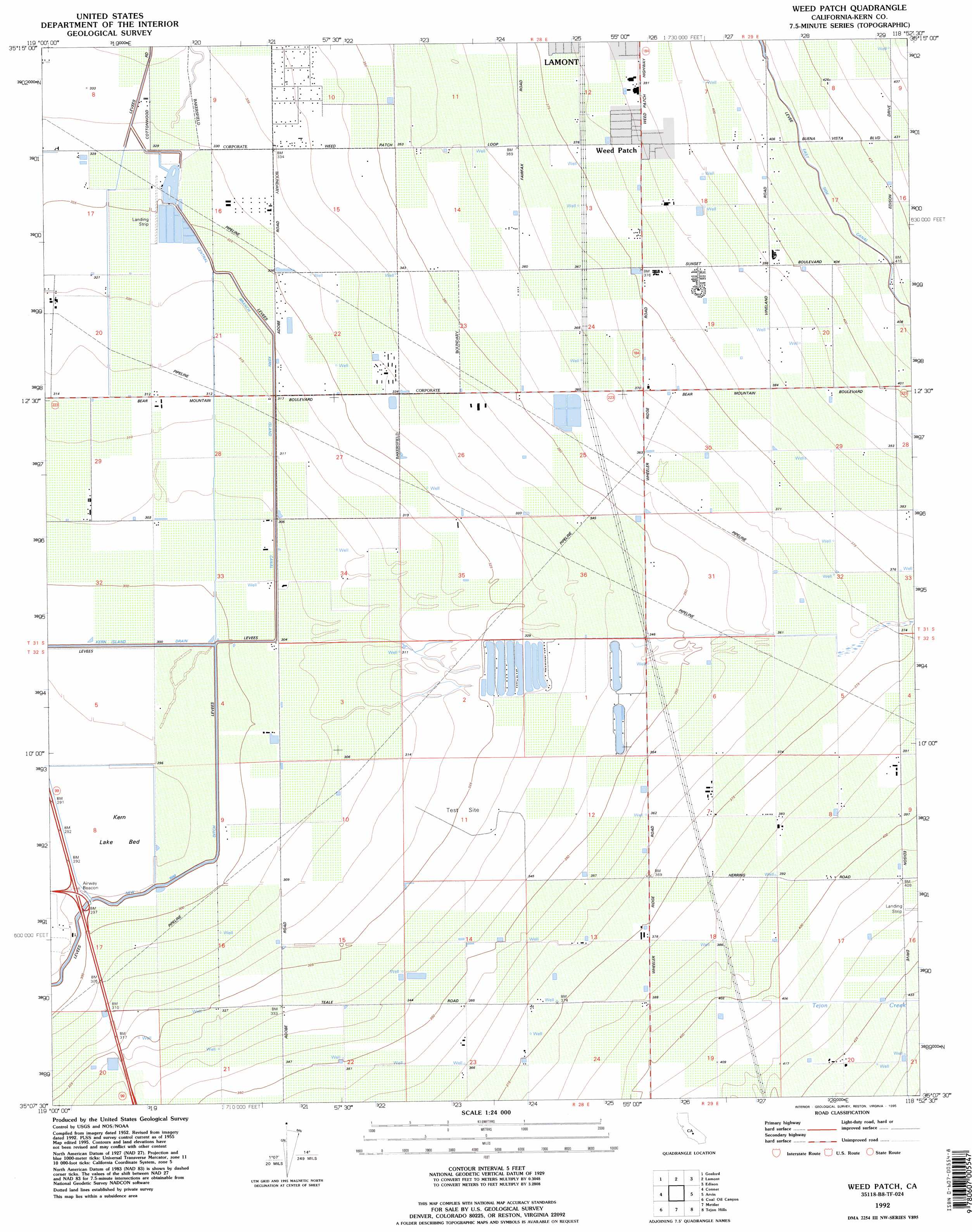
USGS Topo Quad 35118b8 - 1:24,000 scale
| Topo Map Name: | Weed Patch |
| USGS Topo Quad ID: | 35118b8 |
| Print Size: | ca. 21 1/4" wide x 27" high |
| Southeast Coordinates: | 35.125° N latitude / 118.875° W longitude |
| Map Center Coordinates: | 35.1875° N latitude / 118.9375° W longitude |
| U.S. State: | CA |
| Filename: | o35118b8.jpg |
| Download Map JPG Image: | Weed Patch topo map 1:24,000 scale |
| Map Type: | Topographic |
| Topo Series: | 7.5´ |
| Map Scale: | 1:24,000 |
| Source of Map Images: | United States Geological Survey (USGS) |
| Alternate Map Versions: |
Weed Patch CA 1955, updated 1956 Download PDF Buy paper map Weed Patch CA 1955, updated 1970 Download PDF Buy paper map Weed Patch CA 1955, updated 1976 Download PDF Buy paper map Weed Patch CA 1992, updated 1995 Download PDF Buy paper map Weed Patch CA 1992, updated 1995 Download PDF Buy paper map Weed Patch CA 2012 Download PDF Buy paper map Weed Patch CA 2015 Download PDF Buy paper map |
1:24,000 Topo Quads surrounding Weed Patch
Rosedale |
Oildale |
Oil Center |
Rio Bravo Ranch |
Mount Adelaide |
Stevens |
Gosford |
Lamont |
Edison |
Bena |
Millux |
Conner |
Weed Patch |
Arvin |
Bear Mountain |
Conner Sw |
Coal Oil Canyon |
Mettler |
Tejon Hills |
Tejon Ranch |
Eagle Rest Peak |
Pleito Hills |
Grapevine |
Pastoria Creek |
Winters Ridge |
> Back to 35118a1 at 1:100,000 scale
> Back to 35118a1 at 1:250,000 scale
> Back to U.S. Topo Maps home
Weed Patch topo map: Gazetteer
Weed Patch: Canals
Kern Island Drain elevation 91m 298′Weed Patch: Populated Places
Weedpatch elevation 118m 387′Weed Patch: Reservoirs
Lake Paulina elevation 95m 311′Weed Patch: Streams
Tejon Creek elevation 125m 410′Weed Patch digital topo map on disk
Buy this Weed Patch topo map showing relief, roads, GPS coordinates and other geographical features, as a high-resolution digital map file on DVD:
Southern Sierra Nevada, California & Southern Nevada
Buy digital topo maps: Southern Sierra Nevada, California & Southern Nevada