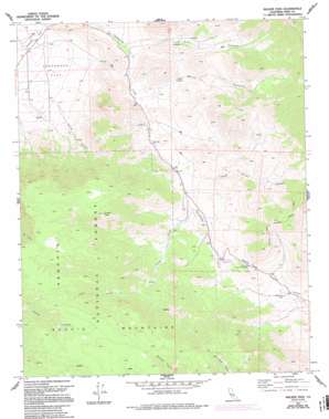
Walker Pass Topo Map California
To zoom in, hover over the map of Walker Pass
USGS Topo Quad 35118f1 - 1:24,000 scale
| Topo Map Name: | Walker Pass |
| USGS Topo Quad ID: | 35118f1 |
| Print Size: | ca. 21 1/4" wide x 27" high |
| Southeast Coordinates: | 35.625° N latitude / 118° W longitude |
| Map Center Coordinates: | 35.6875° N latitude / 118.0625° W longitude |
| U.S. State: | CA |
| Filename: | o35118f1.jpg |
| Download Map JPG Image: | Walker Pass topo map 1:24,000 scale |
| Map Type: | Topographic |
| Topo Series: | 7.5´ |
| Map Scale: | 1:24,000 |
| Source of Map Images: | United States Geological Survey (USGS) |
| Alternate Map Versions: |
Walker Pass CA 1972, updated 1975 Download PDF Buy paper map Walker Pass CA 1972, updated 1986 Download PDF Buy paper map Walker Pass CA 1972, updated 1992 Download PDF Buy paper map Walker Pass CA 1972, updated 1994 Download PDF Buy paper map Walker Pass CA 2012 Download PDF Buy paper map Walker Pass CA 2015 Download PDF Buy paper map |
| FStopo: | US Forest Service topo Walker Pass is available: Download FStopo PDF Download FStopo TIF |
1:24,000 Topo Quads surrounding Walker Pass
> Back to 35118e1 at 1:100,000 scale
> Back to 35118a1 at 1:250,000 scale
> Back to U.S. Topo Maps home
Walker Pass topo map: Gazetteer
Walker Pass: Flats
Canebrake Flat elevation 1004m 3293′Walker Pass: Gaps
Walker Pass elevation 1610m 5282′Walker Pass: Populated Places
Canebrake (historical) elevation 1198m 3930′Walker Pass: Ranges
Scodie Mountains elevation 2158m 7080′Walker Pass: Springs
Coyote Spring elevation 1329m 4360′Walker Pass: Streams
Jacks Creek elevation 1384m 4540′Walker Pass: Summits
Pinyon Peak elevation 2063m 6768′Walker Pass: Valleys
Berts Canyon elevation 1235m 4051′Cow Canyon elevation 1171m 3841′
Spring Canyon elevation 1055m 3461′
Three Pines Canyon elevation 1341m 4399′
Walker Pass: Wells
Freeman Well elevation 1488m 4881′Pilot Well elevation 1291m 4235′
Walker Pass digital topo map on disk
Buy this Walker Pass topo map showing relief, roads, GPS coordinates and other geographical features, as a high-resolution digital map file on DVD:
Southern Sierra Nevada, California & Southern Nevada
Buy digital topo maps: Southern Sierra Nevada, California & Southern Nevada


