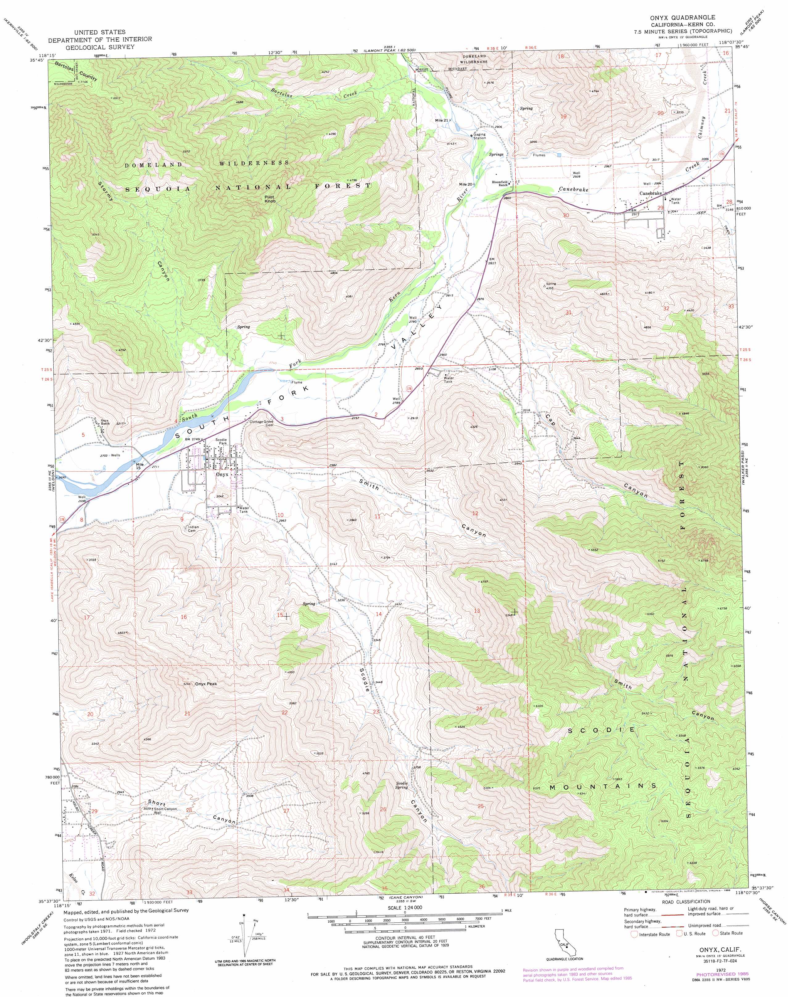
Onyx Topo Map California
To zoom in, hover over the map of Onyx
USGS Topo Quad 35118f2 - 1:24,000 scale
| Topo Map Name: | Onyx |
| USGS Topo Quad ID: | 35118f2 |
| Print Size: | ca. 21 1/4" wide x 27" high |
| Southeast Coordinates: | 35.625° N latitude / 118.125° W longitude |
| Map Center Coordinates: | 35.6875° N latitude / 118.1875° W longitude |
| U.S. State: | CA |
| Filename: | o35118f2.jpg |
| Download Map JPG Image: | Onyx topo map 1:24,000 scale |
| Map Type: | Topographic |
| Topo Series: | 7.5´ |
| Map Scale: | 1:24,000 |
| Source of Map Images: | United States Geological Survey (USGS) |
| Alternate Map Versions: |
Onyx CA 1972, updated 1976 Download PDF Buy paper map Onyx CA 1972, updated 1986 Download PDF Buy paper map Onyx CA 1972, updated 1994 Download PDF Buy paper map Onyx CA 2012 Download PDF Buy paper map Onyx CA 2015 Download PDF Buy paper map |
| FStopo: | US Forest Service topo Onyx is available: Download FStopo PDF Download FStopo TIF |
1:24,000 Topo Quads surrounding Onyx
Fairview |
Sirretta Peak |
Rockhouse Basin |
Sacatar Canyon |
Little Lake |
Kernville |
Cannell Peak |
White Dome |
Lamont Peak |
Ninemile Canyon |
Lake Isabella North |
Weldon |
Onyx |
Walker Pass |
Owens Peak |
Lake Isabella South |
Woolstalf Creek |
Cane Canyon |
Horse Canyon |
Freeman Junction |
Piute Peak |
Claraville |
Pinyon Mountain |
Dove Spring |
Saltdale Nw |
> Back to 35118e1 at 1:100,000 scale
> Back to 35118a1 at 1:250,000 scale
> Back to U.S. Topo Maps home
Onyx topo map: Gazetteer
Onyx: Parks
Scodie Park elevation 852m 2795′Onyx: Populated Places
Canebrake elevation 924m 3031′Onyx elevation 852m 2795′
Onyx: Springs
Scodie Spring elevation 1144m 3753′Onyx: Streams
Bartolas Creek elevation 903m 2962′Canebrake Creek elevation 859m 2818′
Chimney Creek elevation 919m 3015′
Onyx: Summits
Onyx Peak elevation 1594m 5229′Pilot Knob elevation 1877m 6158′
Onyx: Valleys
Cap Canyon elevation 920m 3018′Scodie Canyon elevation 968m 3175′
Short Canyon elevation 864m 2834′
Smith Canyon elevation 888m 2913′
Stormy Canyon elevation 830m 2723′
Onyx: Wells
Short Canyon Well elevation 931m 3054′Onyx digital topo map on disk
Buy this Onyx topo map showing relief, roads, GPS coordinates and other geographical features, as a high-resolution digital map file on DVD:
Southern Sierra Nevada, California & Southern Nevada
Buy digital topo maps: Southern Sierra Nevada, California & Southern Nevada