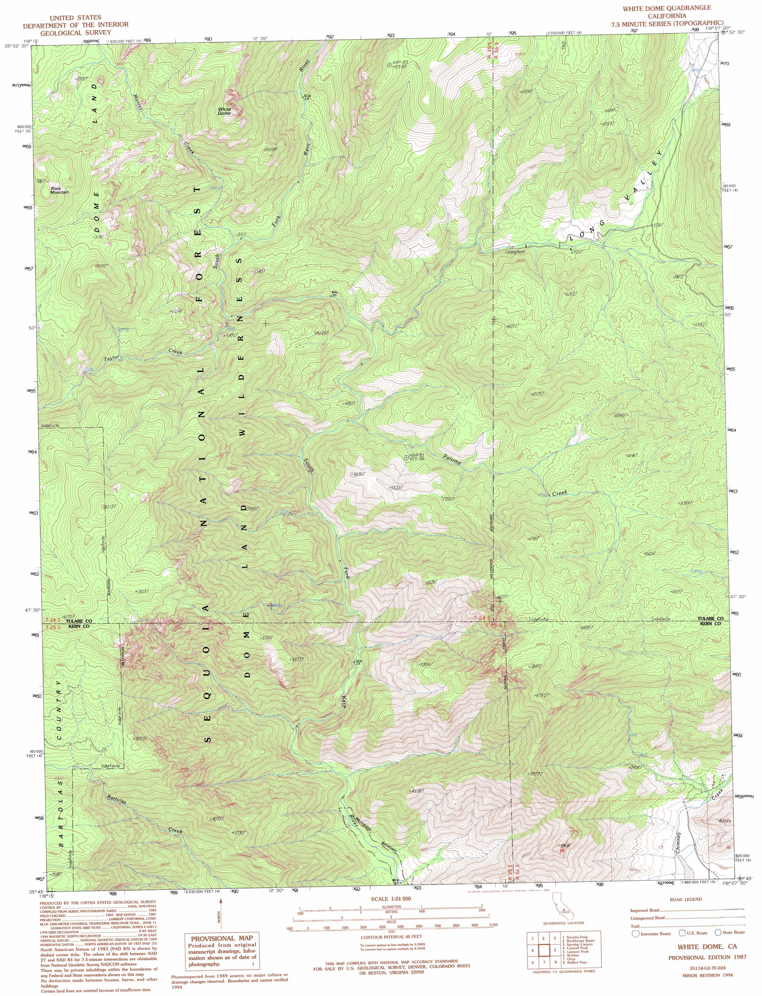
White Dome Topo Map California
To zoom in, hover over the map of White Dome
USGS Topo Quad 35118g2 - 1:24,000 scale
| Topo Map Name: | White Dome |
| USGS Topo Quad ID: | 35118g2 |
| Print Size: | ca. 21 1/4" wide x 27" high |
| Southeast Coordinates: | 35.75° N latitude / 118.125° W longitude |
| Map Center Coordinates: | 35.8125° N latitude / 118.1875° W longitude |
| U.S. State: | CA |
| Filename: | o35118g2.jpg |
| Download Map JPG Image: | White Dome topo map 1:24,000 scale |
| Map Type: | Topographic |
| Topo Series: | 7.5´ |
| Map Scale: | 1:24,000 |
| Source of Map Images: | United States Geological Survey (USGS) |
| Alternate Map Versions: |
White Dome CA 1987, updated 1987 Download PDF Buy paper map White Dome CA 1987, updated 1994 Download PDF Buy paper map White Dome CA 2012 Download PDF Buy paper map White Dome CA 2015 Download PDF Buy paper map |
| FStopo: | US Forest Service topo White Dome is available: Download FStopo PDF Download FStopo TIF |
1:24,000 Topo Quads surrounding White Dome
Durrwood Creek |
Bonita Meadows |
Crag Peak |
Long Canyon |
Coso Junction |
Fairview |
Sirretta Peak |
Rockhouse Basin |
Sacatar Canyon |
Little Lake |
Kernville |
Cannell Peak |
White Dome |
Lamont Peak |
Ninemile Canyon |
Lake Isabella North |
Weldon |
Onyx |
Walker Pass |
Owens Peak |
Lake Isabella South |
Woolstalf Creek |
Cane Canyon |
Horse Canyon |
Freeman Junction |
> Back to 35118e1 at 1:100,000 scale
> Back to 35118a1 at 1:250,000 scale
> Back to U.S. Topo Maps home
White Dome topo map: Gazetteer
White Dome: Streams
Manter Creek elevation 1542m 5059′Palome Creek elevation 1377m 4517′
Taylor Creek elevation 1499m 4917′
White Dome: Summits
Black Mountain elevation 2397m 7864′White Dome elevation 2281m 7483′
White Dome: Valleys
Long Valley elevation 1422m 4665′White Dome digital topo map on disk
Buy this White Dome topo map showing relief, roads, GPS coordinates and other geographical features, as a high-resolution digital map file on DVD:
Southern Sierra Nevada, California & Southern Nevada
Buy digital topo maps: Southern Sierra Nevada, California & Southern Nevada