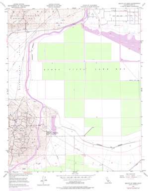
Buena Vista Lakebed Topo Map California
To zoom in, hover over the map of Buena Vista Lakebed
USGS Topo Quad 35119b3 - 1:24,000 scale
| Topo Map Name: | Buena Vista Lakebed |
| USGS Topo Quad ID: | 35119b3 |
| Print Size: | ca. 21 1/4" wide x 27" high |
| Southeast Coordinates: | 35.125° N latitude / 119.25° W longitude |
| Map Center Coordinates: | 35.1875° N latitude / 119.3125° W longitude |
| U.S. State: | CA |
| Filename: | o35119b3.jpg |
| Download Map JPG Image: | Buena Vista Lakebed topo map 1:24,000 scale |
| Map Type: | Topographic |
| Topo Series: | 7.5´ |
| Map Scale: | 1:24,000 |
| Source of Map Images: | United States Geological Survey (USGS) |
| Alternate Map Versions: |
Mouth of Kern CA 1950, updated 1962 Download PDF Buy paper map Mouth of Kern CA 1950, updated 1967 Download PDF Buy paper map Mouth of Kern CA 1950, updated 1970 Download PDF Buy paper map Mouth of Kern CA 1950, updated 1976 Download PDF Buy paper map Mouth of Kern CA 1951, updated 1951 Download PDF Buy paper map Buena Vista Lake Bed CA 2012 Download PDF Buy paper map Buena Vista Lake Bed CA 2015 Download PDF Buy paper map |
1:24,000 Topo Quads surrounding Buena Vista Lakebed
> Back to 35119a1 at 1:100,000 scale
> Back to 35118a1 at 1:250,000 scale
> Back to U.S. Topo Maps home
Buena Vista Lakebed topo map: Gazetteer
Buena Vista Lakebed: Dams
Buena Vista 732 Dam elevation 96m 314′Buena Vista 735-002 Dam elevation 92m 301′
Buena Vista Lakebed: Flats
Buena Vista Lake Bed elevation 89m 291′Buena Vista Lakebed: Islands
Pelican Island (historical) elevation 90m 295′Buena Vista Lakebed: Lakes
Buena Vista Lake (historical) elevation 88m 288′Lake Evans elevation 92m 301′
Lake Webb elevation 90m 295′
Buena Vista Lakebed: Parks
Buena Vista Aquatic Recreational Area elevation 89m 291′Buena Vista Park elevation 107m 351′
Buena Vista Lakebed: Populated Places
Kyan (historical) elevation 102m 334′Buena Vista Lakebed: Streams
Buena Vista Creek elevation 92m 301′Sandy Creek elevation 92m 301′
Buena Vista Lakebed: Valleys
Buena Vista Valley elevation 93m 305′Buena Vista Lakebed digital topo map on disk
Buy this Buena Vista Lakebed topo map showing relief, roads, GPS coordinates and other geographical features, as a high-resolution digital map file on DVD:
Southern Sierra Nevada, California & Southern Nevada
Buy digital topo maps: Southern Sierra Nevada, California & Southern Nevada


