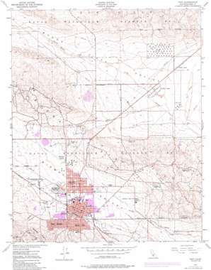
Taft Topo Map California
To zoom in, hover over the map of Taft
USGS Topo Quad 35119b4 - 1:24,000 scale
| Topo Map Name: | Taft |
| USGS Topo Quad ID: | 35119b4 |
| Print Size: | ca. 21 1/4" wide x 27" high |
| Southeast Coordinates: | 35.125° N latitude / 119.375° W longitude |
| Map Center Coordinates: | 35.1875° N latitude / 119.4375° W longitude |
| U.S. State: | CA |
| Filename: | o35119b4.jpg |
| Download Map JPG Image: | Taft topo map 1:24,000 scale |
| Map Type: | Topographic |
| Topo Series: | 7.5´ |
| Map Scale: | 1:24,000 |
| Source of Map Images: | United States Geological Survey (USGS) |
| Alternate Map Versions: |
Taft CA 1950, updated 1969 Download PDF Buy paper map Taft CA 1950, updated 1976 Download PDF Buy paper map Taft CA 1950, updated 1986 Download PDF Buy paper map Taft CA 1950, updated 1986 Download PDF Buy paper map Taft CA 1951, updated 1951 Download PDF Buy paper map Taft CA 2012 Download PDF Buy paper map Taft CA 2015 Download PDF Buy paper map |
1:24,000 Topo Quads surrounding Taft
> Back to 35119a1 at 1:100,000 scale
> Back to 35118a1 at 1:250,000 scale
> Back to U.S. Topo Maps home
Taft topo map: Gazetteer
Taft: Airports
Taft-Kern County Airport elevation 258m 846′West Side Hospital Heliport elevation 288m 944′
Taft: Oilfields
Standard Oil Tank Farm elevation 142m 465′United States Geological Survey Camp - Oil and Gas Division elevation 313m 1026′
Taft: Parks
A Street Park elevation 348m 1141′Civic Center Park elevation 277m 908′
Cougar Sports Center elevation 281m 921′
Ford City Park elevation 277m 908′
Franklin Field elevation 254m 833′
Taft: Populated Places
Buena Vista Mobile Home Park elevation 306m 1003′Dustin Acres elevation 117m 383′
Ford City elevation 272m 892′
South Taft elevation 310m 1017′
Taft elevation 291m 954′
Taft Heights elevation 359m 1177′
Valley Acres elevation 128m 419′
Wallace Center elevation 262m 859′
Taft: Post Offices
Taft Post Office elevation 298m 977′Taft: Ranges
Buena Vista Hills elevation 390m 1279′Taft: Ridges
Spellacy Hill elevation 478m 1568′Taft: Streams
Broad Creek elevation 121m 396′Taft digital topo map on disk
Buy this Taft topo map showing relief, roads, GPS coordinates and other geographical features, as a high-resolution digital map file on DVD:
Southern Sierra Nevada, California & Southern Nevada
Buy digital topo maps: Southern Sierra Nevada, California & Southern Nevada


