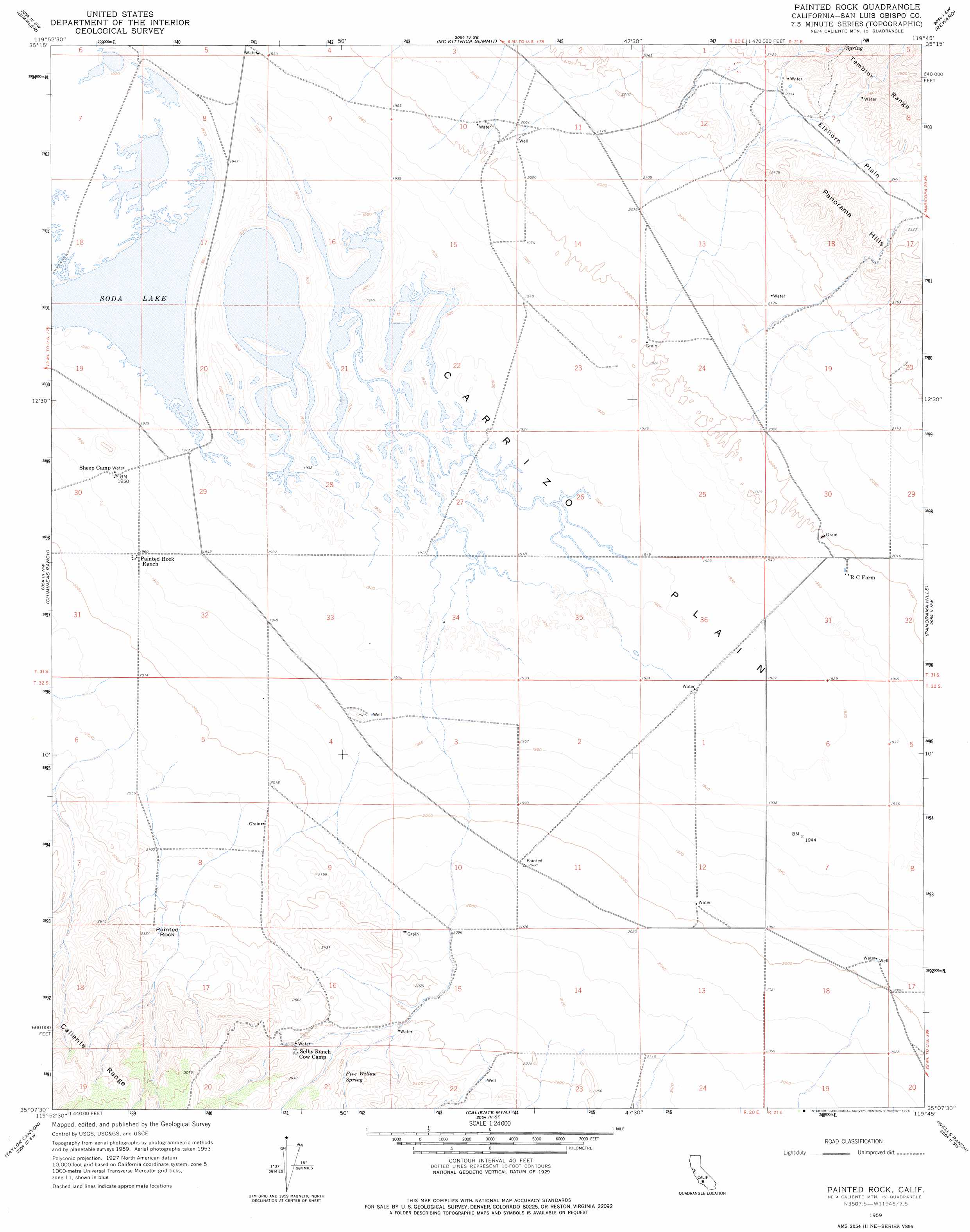
Painted Rock Topo Map California
To zoom in, hover over the map of Painted Rock
USGS Topo Quad 35119b7 - 1:24,000 scale
| Topo Map Name: | Painted Rock |
| USGS Topo Quad ID: | 35119b7 |
| Print Size: | ca. 21 1/4" wide x 27" high |
| Southeast Coordinates: | 35.125° N latitude / 119.75° W longitude |
| Map Center Coordinates: | 35.1875° N latitude / 119.8125° W longitude |
| U.S. State: | CA |
| Filename: | o35119b7.jpg |
| Download Map JPG Image: | Painted Rock topo map 1:24,000 scale |
| Map Type: | Topographic |
| Topo Series: | 7.5´ |
| Map Scale: | 1:24,000 |
| Source of Map Images: | United States Geological Survey (USGS) |
| Alternate Map Versions: |
Painted Rock CA 1959, updated 1961 Download PDF Buy paper map Painted Rock CA 1959, updated 1975 Download PDF Buy paper map Painted Rock CA 2012 Download PDF Buy paper map Painted Rock CA 2015 Download PDF Buy paper map |
1:24,000 Topo Quads surrounding Painted Rock
La Panza Ne |
Las Yeguas Ranch |
Carneros Rocks |
Belridge |
Lokern |
California Valley |
Simmler |
Mckittrick Summit |
Reward |
West Elk Hills |
Branch Mountain |
Chimineas Ranch |
Painted Rock |
Panorama Hills |
Fellows |
Miranda Pine Mountain |
Taylor Canyon |
Caliente Mountain |
Wells Ranch |
Elkhorn Hills |
Manzanita Mountain |
Bates Canyon |
Peak Mountain |
New Cuyama |
Cuyama |
> Back to 35119a1 at 1:100,000 scale
> Back to 35118a1 at 1:250,000 scale
> Back to U.S. Topo Maps home
Painted Rock topo map: Gazetteer
Painted Rock: Pillars
Painted Rock elevation 700m 2296′Painted Rock: Plains
Carrizo Plain elevation 586m 1922′Painted Rock digital topo map on disk
Buy this Painted Rock topo map showing relief, roads, GPS coordinates and other geographical features, as a high-resolution digital map file on DVD:
Southern Sierra Nevada, California & Southern Nevada
Buy digital topo maps: Southern Sierra Nevada, California & Southern Nevada