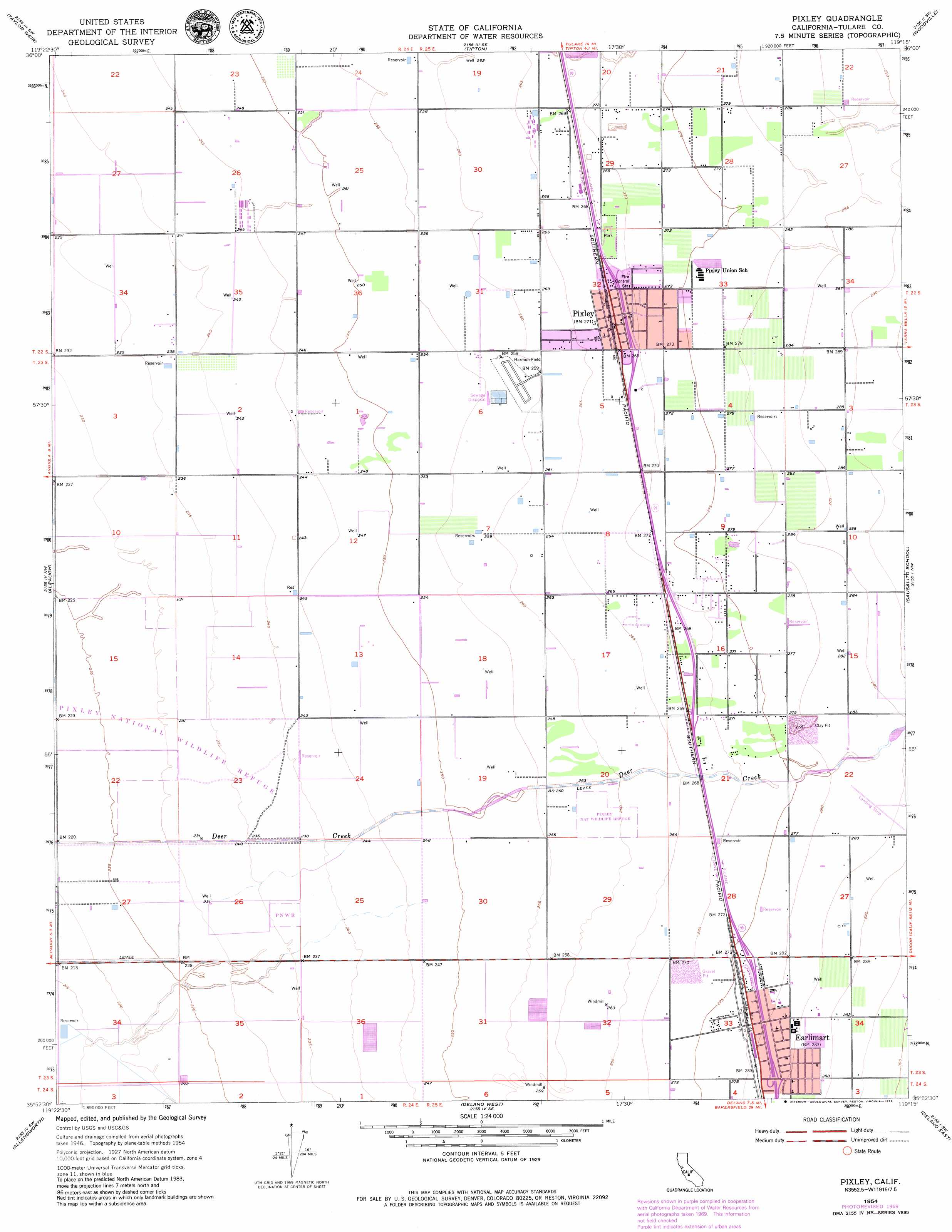
Pixley Topo Map California
To zoom in, hover over the map of Pixley
USGS Topo Quad 35119h3 - 1:24,000 scale
| Topo Map Name: | Pixley |
| USGS Topo Quad ID: | 35119h3 |
| Print Size: | ca. 21 1/4" wide x 27" high |
| Southeast Coordinates: | 35.875° N latitude / 119.25° W longitude |
| Map Center Coordinates: | 35.9375° N latitude / 119.3125° W longitude |
| U.S. State: | CA |
| Filename: | o35119h3.jpg |
| Download Map JPG Image: | Pixley topo map 1:24,000 scale |
| Map Type: | Topographic |
| Topo Series: | 7.5´ |
| Map Scale: | 1:24,000 |
| Source of Map Images: | United States Geological Survey (USGS) |
| Alternate Map Versions: |
Pixley CA 1950 Download PDF Buy paper map Pixley CA 1954, updated 1955 Download PDF Buy paper map Pixley CA 1954, updated 1971 Download PDF Buy paper map Pixley CA 1954, updated 1979 Download PDF Buy paper map Pixley CA 2012 Download PDF Buy paper map Pixley CA 2015 Download PDF Buy paper map |
1:24,000 Topo Quads surrounding Pixley
Waukena |
Paige |
Tulare |
Cairns Corner |
Lindsay |
Corcoran |
Taylor Weir |
Tipton |
Woodville |
Porterville |
Hacienda Ranch Ne |
Alpaugh |
Pixley |
Sausalito School |
Ducor |
Hacienda Ranch |
Allensworth |
Delano West |
Delano East |
Richgrove |
Lost Hills Ne |
Wasco Nw |
Pond |
Mcfarland |
Deepwell Ranch |
> Back to 35119e1 at 1:100,000 scale
> Back to 35118a1 at 1:250,000 scale
> Back to U.S. Topo Maps home
Pixley topo map: Gazetteer
Pixley: Airports
Pixley Airport elevation 79m 259′Pixley: Parks
Pixley National Wildlife Refuge elevation 70m 229′Pixley: Populated Places
Earlimart elevation 86m 282′Pixley elevation 83m 272′
Pixley: Post Offices
Earlimart Post Office elevation 86m 282′Pixley Post Office elevation 83m 272′
Pixley digital topo map on disk
Buy this Pixley topo map showing relief, roads, GPS coordinates and other geographical features, as a high-resolution digital map file on DVD:
Southern Sierra Nevada, California & Southern Nevada
Buy digital topo maps: Southern Sierra Nevada, California & Southern Nevada