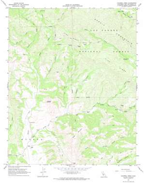
Caldwell Mesa Topo Map California
To zoom in, hover over the map of Caldwell Mesa
USGS Topo Quad 35120b3 - 1:24,000 scale
| Topo Map Name: | Caldwell Mesa |
| USGS Topo Quad ID: | 35120b3 |
| Print Size: | ca. 21 1/4" wide x 27" high |
| Southeast Coordinates: | 35.125° N latitude / 120.25° W longitude |
| Map Center Coordinates: | 35.1875° N latitude / 120.3125° W longitude |
| U.S. State: | CA |
| Filename: | o35120b3.jpg |
| Download Map JPG Image: | Caldwell Mesa topo map 1:24,000 scale |
| Map Type: | Topographic |
| Topo Series: | 7.5´ |
| Map Scale: | 1:24,000 |
| Source of Map Images: | United States Geological Survey (USGS) |
| Alternate Map Versions: |
Caldwell Mesa CA 1967, updated 1968 Download PDF Buy paper map Caldwell Mesa CA 1967, updated 1968 Download PDF Buy paper map Caldwell Mesa CA 1967, updated 1974 Download PDF Buy paper map Caldwell Mesa CA 1995, updated 1999 Download PDF Buy paper map Caldwell Mesa CA 2012 Download PDF Buy paper map Caldwell Mesa CA 2015 Download PDF Buy paper map |
| FStopo: | US Forest Service topo Caldwell Mesa is available: Download FStopo PDF Download FStopo TIF |
1:24,000 Topo Quads surrounding Caldwell Mesa
> Back to 35120a1 at 1:100,000 scale
> Back to 35120a1 at 1:250,000 scale
> Back to U.S. Topo Maps home
Caldwell Mesa topo map: Gazetteer
Caldwell Mesa: Pillars
Bonnet Rock elevation 720m 2362′Caldwell Mesa: Populated Places
Hathaway Place elevation 298m 977′Hubert Place elevation 373m 1223′
Reeves Place elevation 289m 948′
Renshaw Place elevation 490m 1607′
Caldwell Mesa: Ridges
Bald Mountain elevation 623m 2043′Garcia Mountain elevation 959m 3146′
Pine Ridge elevation 917m 3008′
Caldwell Mesa: Streams
Arroyo Seco elevation 231m 757′Oso Creek elevation 334m 1095′
Pine Creek elevation 271m 889′
Salt Creek elevation 320m 1049′
Stony Creek elevation 275m 902′
Trout Creek elevation 275m 902′
Caldwell Mesa: Summits
Caldwell Mesa elevation 760m 2493′Caldwell Mountain elevation 549m 1801′
Caldwell Mesa: Valleys
Drain One elevation 362m 1187′Joaquin Canyon elevation 270m 885′
Ranger Canyon elevation 280m 918′
Caldwell Mesa digital topo map on disk
Buy this Caldwell Mesa topo map showing relief, roads, GPS coordinates and other geographical features, as a high-resolution digital map file on DVD:


