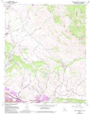
Arroyo Grande Ne Topo Map California
To zoom in, hover over the map of Arroyo Grande Ne
USGS Topo Quad 35120b5 - 1:24,000 scale
| Topo Map Name: | Arroyo Grande Ne |
| USGS Topo Quad ID: | 35120b5 |
| Print Size: | ca. 21 1/4" wide x 27" high |
| Southeast Coordinates: | 35.125° N latitude / 120.5° W longitude |
| Map Center Coordinates: | 35.1875° N latitude / 120.5625° W longitude |
| U.S. State: | CA |
| Filename: | o35120b5.jpg |
| Download Map JPG Image: | Arroyo Grande Ne topo map 1:24,000 scale |
| Map Type: | Topographic |
| Topo Series: | 7.5´ |
| Map Scale: | 1:24,000 |
| Source of Map Images: | United States Geological Survey (USGS) |
| Alternate Map Versions: |
Arroyo Grande NE CA 1965, updated 1967 Download PDF Buy paper map Arroyo Grande NE CA 1965, updated 1967 Download PDF Buy paper map Arroyo Grande NE CA 1965, updated 1977 Download PDF Buy paper map Arroyo Grande NE CA 1965, updated 1978 Download PDF Buy paper map Arroyo Grande NE CA 1965, updated 1978 Download PDF Buy paper map Arroyo Grande NE CA 1965, updated 1994 Download PDF Buy paper map Arroyo Grande NE CA 1995, updated 2000 Download PDF Buy paper map Arroyo Grande NE CA 2012 Download PDF Buy paper map Arroyo Grande NE CA 2015 Download PDF Buy paper map |
| FStopo: | US Forest Service topo Arroyo Grande NE is available: Download FStopo PDF Download FStopo TIF |
1:24,000 Topo Quads surrounding Arroyo Grande Ne
> Back to 35120a1 at 1:100,000 scale
> Back to 35120a1 at 1:250,000 scale
> Back to U.S. Topo Maps home
Arroyo Grande Ne topo map: Gazetteer
Arroyo Grande Ne: Airports
Weirs Airstrip elevation 75m 246′Arroyo Grande Ne: Dams
Righetti 743 Dam elevation 153m 501′Terminal 1055-002 Dam elevation 92m 301′
Arroyo Grande Ne: Oilfields
Arroyo Grande Oil Field elevation 35m 114′Arroyo Grande Ne: Parks
Grover Heights Park elevation 44m 144′Hoosgow Park elevation 67m 219′
La Barranca Park elevation 66m 216′
Rancho Grande Park elevation 91m 298′
Strother Park elevation 45m 147′
Terra de Oro Park elevation 67m 219′
Arroyo Grande Ne: Populated Places
Asphalt Mines (historical) elevation 58m 190′Edna elevation 74m 242′
Maxwellton (historical) elevation 73m 239′
Reeds (historical) elevation 62m 203′
Steele (historical) elevation 80m 262′
Tiber elevation 43m 141′
Verde elevation 106m 347′
Arroyo Grande Ne: Reservoirs
Lopez Reservoir elevation 92m 301′Arroyo Grande Ne: Streams
East Corral de Piedra Creek elevation 59m 193′Tar Spring Creek elevation 42m 137′
Villa Creek elevation 202m 662′
West Corral de Piedra Creek elevation 59m 193′
Arroyo Grande Ne: Summits
Bald Mountain elevation 855m 2805′Islay Hill elevation 230m 754′
Round Top elevation 624m 2047′
Slide Hill elevation 640m 2099′
Arroyo Grande Ne: Valleys
Bee Canyon elevation 88m 288′Cañada Verde elevation 45m 147′
Canyon de los Alisos elevation 93m 305′
Canyon Number 1 elevation 39m 127′
Canyon Number 2 elevation 30m 98′
Carpenter Canyon elevation 49m 160′
Corralitos Valley elevation 63m 206′
Deer Canyon elevation 89m 291′
Poorman Canyon elevation 44m 144′
Tiber Canyon elevation 40m 131′
Arroyo Grande Ne digital topo map on disk
Buy this Arroyo Grande Ne topo map showing relief, roads, GPS coordinates and other geographical features, as a high-resolution digital map file on DVD:


