Sawtooth Ridge Topo Map California
To zoom in, hover over the map of Sawtooth Ridge
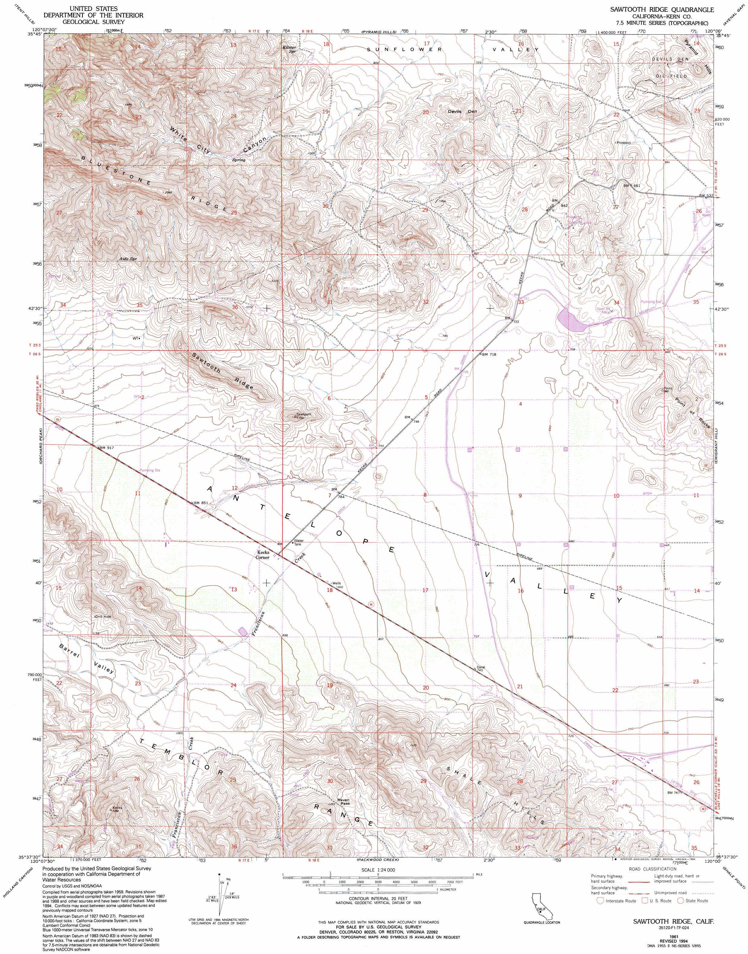
USGS Topo Quad 35120f1 - 1:24,000 scale
| Topo Map Name: | Sawtooth Ridge |
| USGS Topo Quad ID: | 35120f1 |
| Print Size: | ca. 21 1/4" wide x 27" high |
| Southeast Coordinates: | 35.625° N latitude / 120° W longitude |
| Map Center Coordinates: | 35.6875° N latitude / 120.0625° W longitude |
| U.S. State: | CA |
| Filename: | o35120f1.jpg |
| Download Map JPG Image: | Sawtooth Ridge topo map 1:24,000 scale |
| Map Type: | Topographic |
| Topo Series: | 7.5´ |
| Map Scale: | 1:24,000 |
| Source of Map Images: | United States Geological Survey (USGS) |
| Alternate Map Versions: |
Sawtooth Ridge CA 1953, updated 1956 Download PDF Buy paper map Sawtooth Ridge CA 1961, updated 1962 Download PDF Buy paper map Sawtooth Ridge CA 1961, updated 1976 Download PDF Buy paper map Sawtooth Ridge CA 1961, updated 1994 Download PDF Buy paper map Sawtooth Ridge CA 2012 Download PDF Buy paper map Sawtooth Ridge CA 2015 Download PDF Buy paper map |
1:24,000 Topo Quads surrounding Sawtooth Ridge
The Dark Hole |
Garza Peak |
Kettleman Plain |
Los Viejos |
Dudley Ridge |
Cholame Valley |
Tent Hills |
Pyramid Hills |
Avenal Gap |
West Camp |
Cholame |
Orchard Peak |
Sawtooth Ridge |
Emigrant Hill |
Antelope Plain |
Camatta Canyon |
Holland Canyon |
Packwood Creek |
Shale Point |
Blackwells Corner |
Camatta Ranch |
La Panza Ranch |
La Panza Ne |
Las Yeguas Ranch |
Carneros Rocks |
> Back to 35120e1 at 1:100,000 scale
> Back to 35120a1 at 1:250,000 scale
> Back to U.S. Topo Maps home
Sawtooth Ridge topo map: Gazetteer
Sawtooth Ridge: Airports
Blackwell Land Company Incorporated Airport elevation 227m 744′Sawtooth Ridge: Dams
Berrenda Mesa 1051 Dam elevation 223m 731′Sawtooth Ridge: Gaps
Raven Pass elevation 385m 1263′Sawtooth Ridge: Pillars
Devils Den elevation 258m 846′Sawtooth Ridge: Populated Places
Kecks Corner elevation 259m 849′Sawtooth Ridge: Ranges
Point of Rocks elevation 245m 803′Sawtooth Ridge: Ridges
Sawtooth Ridge elevation 406m 1332′Sawtooth Ridge: Slopes
Hilbrich Grade elevation 468m 1535′Sawtooth Ridge: Springs
Aido Spring elevation 410m 1345′Kilmer Spring elevation 258m 846′
Sawtooth Ridge: Streams
Franciscan Creek elevation 235m 770′Packwood Creek elevation 238m 780′
Sawtooth Ridge: Valleys
Barrel Valley elevation 288m 944′White City Canyon elevation 273m 895′
Sawtooth Ridge digital topo map on disk
Buy this Sawtooth Ridge topo map showing relief, roads, GPS coordinates and other geographical features, as a high-resolution digital map file on DVD: