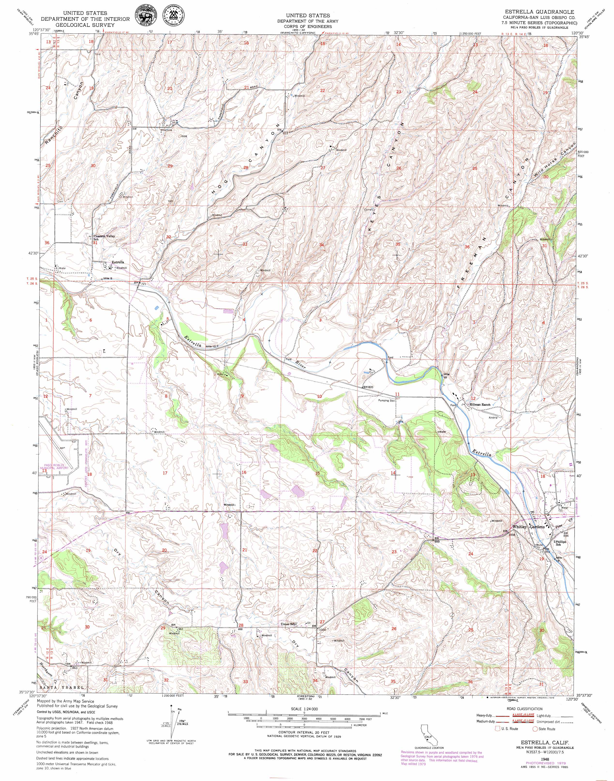
Estrella Topo Map California
To zoom in, hover over the map of Estrella
USGS Topo Quad 35120f5 - 1:24,000 scale
| Topo Map Name: | Estrella |
| USGS Topo Quad ID: | 35120f5 |
| Print Size: | ca. 21 1/4" wide x 27" high |
| Southeast Coordinates: | 35.625° N latitude / 120.5° W longitude |
| Map Center Coordinates: | 35.6875° N latitude / 120.5625° W longitude |
| U.S. State: | CA |
| Filename: | o35120f5.jpg |
| Download Map JPG Image: | Estrella topo map 1:24,000 scale |
| Map Type: | Topographic |
| Topo Series: | 7.5´ |
| Map Scale: | 1:24,000 |
| Source of Map Images: | United States Geological Survey (USGS) |
| Alternate Map Versions: |
Estrella CA 1948, updated 1952 Download PDF Buy paper map Estrella CA 1948, updated 1966 Download PDF Buy paper map Estrella CA 1948, updated 1966 Download PDF Buy paper map Estrella CA 1948, updated 1973 Download PDF Buy paper map Estrella CA 1948, updated 1979 Download PDF Buy paper map Estrella CA 1948, updated 1979 Download PDF Buy paper map Estrella CA 2012 Download PDF Buy paper map Estrella CA 2015 Download PDF Buy paper map |
1:24,000 Topo Quads surrounding Estrella
Wunpost |
Valleton |
Stockdale Mountain |
Parkfield |
The Dark Hole |
Bradley |
San Miguel |
Ranchito Canyon |
Cholame Hills |
Cholame Valley |
Adelaida |
Paso Robles |
Estrella |
Shandon |
Cholame |
York Mountain |
Templeton |
Creston |
Shedd Canyon |
Camatta Canyon |
Morro Bay North |
Atascadero |
Santa Margarita |
Wilson Corner |
Camatta Ranch |
> Back to 35120e1 at 1:100,000 scale
> Back to 35120a1 at 1:250,000 scale
> Back to U.S. Topo Maps home
Estrella topo map: Gazetteer
Estrella: Airports
Bonel Airport elevation 313m 1026′Estrella: Bridges
Fifteenmile Bridge elevation 255m 836′Estrella: Populated Places
Bern elevation 256m 839′Estrella elevation 235m 770′
Union elevation 314m 1030′
Whitley Gardens elevation 276m 905′
Estrella: Streams
Pine Creek elevation 254m 833′Estrella: Valleys
Clarke Canyon elevation 251m 823′Hog Canyon elevation 222m 728′
Keyes Canyon elevation 235m 770′
Mason Canyon elevation 244m 800′
Sheep Camp Canyon elevation 251m 823′
Wild Horse Canyon elevation 327m 1072′
Estrella digital topo map on disk
Buy this Estrella topo map showing relief, roads, GPS coordinates and other geographical features, as a high-resolution digital map file on DVD: