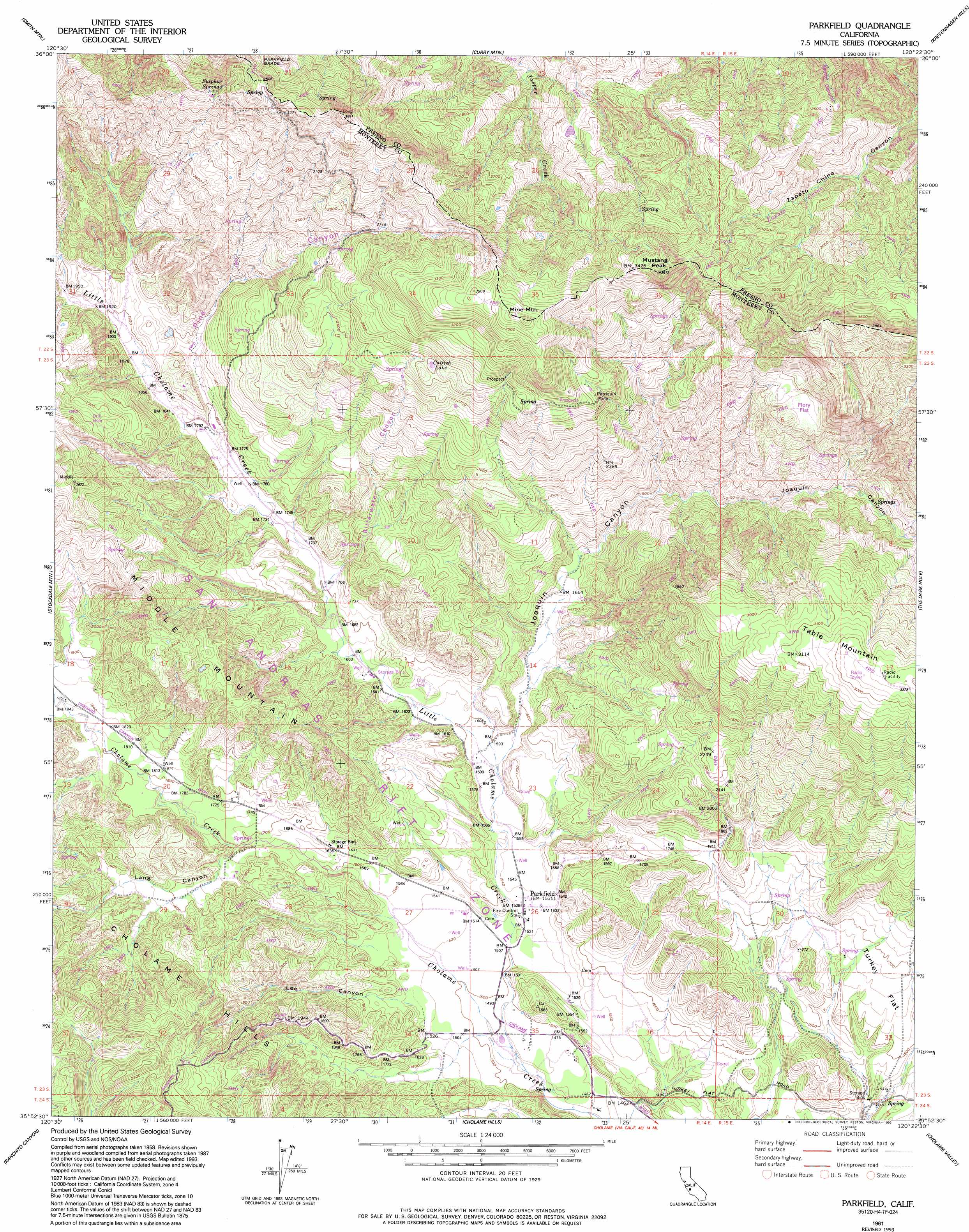
Parkfield Topo Map California
To zoom in, hover over the map of Parkfield
USGS Topo Quad 35120h4 - 1:24,000 scale
| Topo Map Name: | Parkfield |
| USGS Topo Quad ID: | 35120h4 |
| Print Size: | ca. 21 1/4" wide x 27" high |
| Southeast Coordinates: | 35.875° N latitude / 120.375° W longitude |
| Map Center Coordinates: | 35.9375° N latitude / 120.4375° W longitude |
| U.S. State: | CA |
| Filename: | o35120h4.jpg |
| Download Map JPG Image: | Parkfield topo map 1:24,000 scale |
| Map Type: | Topographic |
| Topo Series: | 7.5´ |
| Map Scale: | 1:24,000 |
| Source of Map Images: | United States Geological Survey (USGS) |
| Alternate Map Versions: |
Parkfield CA 1942, updated 1956 Download PDF Buy paper map Parkfield CA 1961, updated 1962 Download PDF Buy paper map Parkfield CA 1961, updated 1978 Download PDF Buy paper map Parkfield CA 1961, updated 1993 Download PDF Buy paper map Parkfield CA 2012 Download PDF Buy paper map Parkfield CA 2015 Download PDF Buy paper map |
1:24,000 Topo Quads surrounding Parkfield
Priest Valley |
Sherman Peak |
Alcalde Hills |
Coalinga |
Guijarral Hills |
Slack Canyon |
Smith Mountain |
Curry Mountain |
Kreyenhagen Hills |
Avenal |
Valleton |
Stockdale Mountain |
Parkfield |
The Dark Hole |
Garza Peak |
San Miguel |
Ranchito Canyon |
Cholame Hills |
Cholame Valley |
Tent Hills |
Paso Robles |
Estrella |
Shandon |
Cholame |
Orchard Peak |
> Back to 35120e1 at 1:100,000 scale
> Back to 35120a1 at 1:250,000 scale
> Back to U.S. Topo Maps home
Parkfield topo map: Gazetteer
Parkfield: Lakes
Catfish Lake elevation 850m 2788′Parkfield: Mines
Patriquin Mine elevation 874m 2867′Sommers Prospect elevation 901m 2956′
Parkfield: Populated Places
Parkfield elevation 466m 1528′Parkfield: Ridges
Middle Mountain elevation 783m 2568′Parkfield: Springs
Sulphur Springs elevation 965m 3166′Parkfield: Streams
Little Cholame Creek elevation 473m 1551′Parkfield: Summits
Mine Mountain elevation 1108m 3635′Mustang Peak elevation 1096m 3595′
Parkfield: Valleys
Joaquin Canyon elevation 484m 1587′Lang Canyon elevation 519m 1702′
Lee Canyon elevation 470m 1541′
Pine Canyon elevation 546m 1791′
Parkfield digital topo map on disk
Buy this Parkfield topo map showing relief, roads, GPS coordinates and other geographical features, as a high-resolution digital map file on DVD: