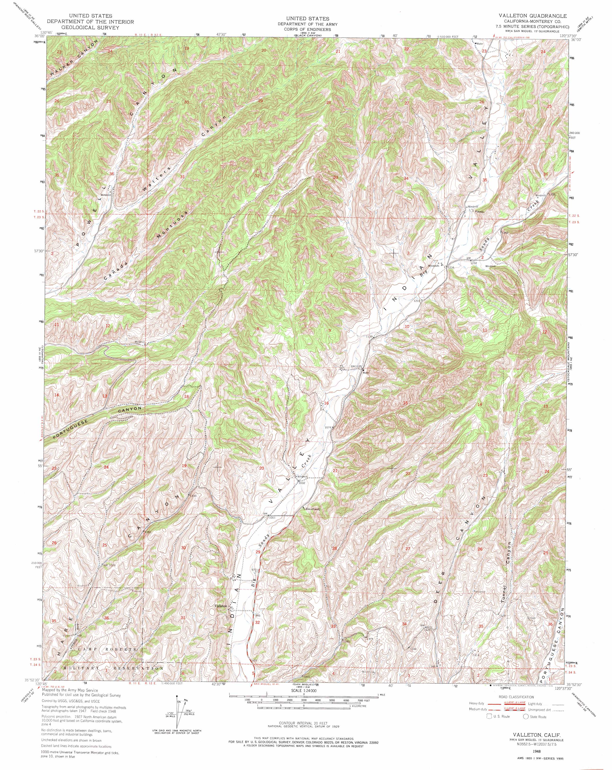
Valleton Topo Map California
To zoom in, hover over the map of Valleton
USGS Topo Quad 35120h6 - 1:24,000 scale
| Topo Map Name: | Valleton |
| USGS Topo Quad ID: | 35120h6 |
| Print Size: | ca. 21 1/4" wide x 27" high |
| Southeast Coordinates: | 35.875° N latitude / 120.625° W longitude |
| Map Center Coordinates: | 35.9375° N latitude / 120.6875° W longitude |
| U.S. State: | CA |
| Filename: | o35120h6.jpg |
| Download Map JPG Image: | Valleton topo map 1:24,000 scale |
| Map Type: | Topographic |
| Topo Series: | 7.5´ |
| Map Scale: | 1:24,000 |
| Source of Map Images: | United States Geological Survey (USGS) |
| Alternate Map Versions: |
Valleton CA 1948, updated 1952 Download PDF Buy paper map Valleton CA 1948, updated 1968 Download PDF Buy paper map Valleton CA 1948, updated 1976 Download PDF Buy paper map Valleton CA 2012 Download PDF Buy paper map Valleton CA 2015 Download PDF Buy paper map |
1:24,000 Topo Quads surrounding Valleton
Nattrass Valley |
Monarch Peak |
Priest Valley |
Sherman Peak |
Alcalde Hills |
San Ardo |
Pancho Rico Valley |
Slack Canyon |
Smith Mountain |
Curry Mountain |
Hames Valley |
Wunpost |
Valleton |
Stockdale Mountain |
Parkfield |
Tierra Redondo Mountain |
Bradley |
San Miguel |
Ranchito Canyon |
Cholame Hills |
Lime Mountain |
Adelaida |
Paso Robles |
Estrella |
Shandon |
> Back to 35120e1 at 1:100,000 scale
> Back to 35120a1 at 1:250,000 scale
> Back to U.S. Topo Maps home
Valleton topo map: Gazetteer
Valleton: Populated Places
Valleton elevation 293m 961′Valleton: Valleys
Cañada Montuosa elevation 335m 1099′Medford Valley elevation 440m 1443′
Walters Canyon elevation 354m 1161′
Valleton digital topo map on disk
Buy this Valleton topo map showing relief, roads, GPS coordinates and other geographical features, as a high-resolution digital map file on DVD: