Hames Valley Topo Map California
To zoom in, hover over the map of Hames Valley
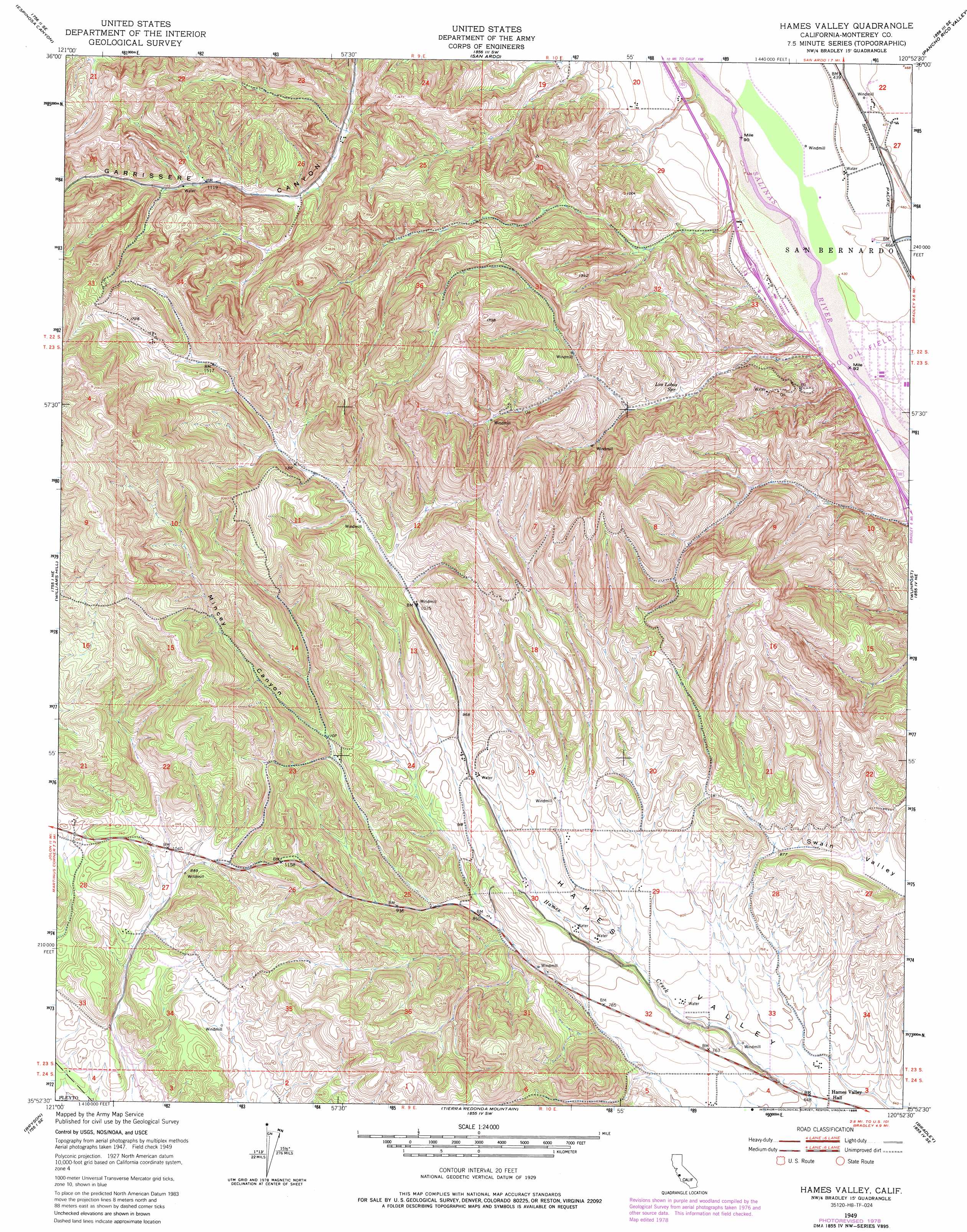
USGS Topo Quad 35120h8 - 1:24,000 scale
| Topo Map Name: | Hames Valley |
| USGS Topo Quad ID: | 35120h8 |
| Print Size: | ca. 21 1/4" wide x 27" high |
| Southeast Coordinates: | 35.875° N latitude / 120.875° W longitude |
| Map Center Coordinates: | 35.9375° N latitude / 120.9375° W longitude |
| U.S. State: | CA |
| Filename: | o35120h8.jpg |
| Download Map JPG Image: | Hames Valley topo map 1:24,000 scale |
| Map Type: | Topographic |
| Topo Series: | 7.5´ |
| Map Scale: | 1:24,000 |
| Source of Map Images: | United States Geological Survey (USGS) |
| Alternate Map Versions: |
Hames Valley CA 1949, updated 1963 Download PDF Buy paper map Hames Valley CA 1949, updated 1967 Download PDF Buy paper map Hames Valley CA 1949, updated 1974 Download PDF Buy paper map Hames Valley CA 1949, updated 1979 Download PDF Buy paper map Hames Valley CA 1949, updated 1986 Download PDF Buy paper map Hames Valley CA 2012 Download PDF Buy paper map Hames Valley CA 2015 Download PDF Buy paper map |
1:24,000 Topo Quads surrounding Hames Valley
Thompson Canyon |
San Lucas |
Nattrass Valley |
Monarch Peak |
Priest Valley |
Cosio Knob |
Espinosa Canyon |
San Ardo |
Pancho Rico Valley |
Slack Canyon |
Jolon |
Williams Hill |
Hames Valley |
Wunpost |
Valleton |
Burnett Peak |
Bryson |
Tierra Redondo Mountain |
Bradley |
San Miguel |
San Simeon |
Pebblestone Shut-In |
Lime Mountain |
Adelaida |
Paso Robles |
> Back to 35120e1 at 1:100,000 scale
> Back to 35120a1 at 1:250,000 scale
> Back to U.S. Topo Maps home
Hames Valley topo map: Gazetteer
Hames Valley: Oilfields
San Ardo Oil Field elevation 135m 442′Hames Valley: Springs
Los Lobos Spring elevation 220m 721′Hames Valley: Valleys
Mincey Canyon elevation 342m 1122′Hames Valley digital topo map on disk
Buy this Hames Valley topo map showing relief, roads, GPS coordinates and other geographical features, as a high-resolution digital map file on DVD: