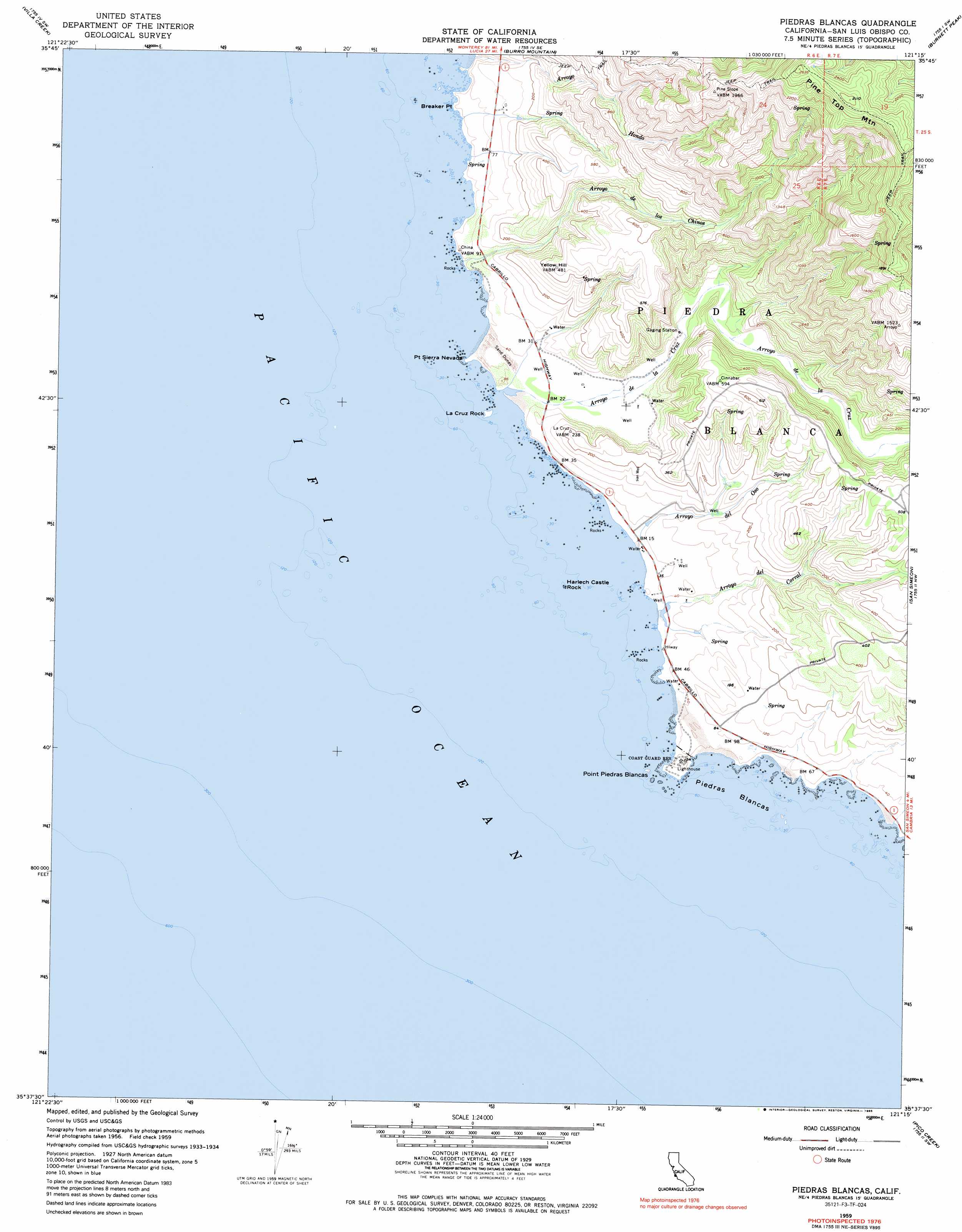
Piedras Blancas Topo Map California
To zoom in, hover over the map of Piedras Blancas
USGS Topo Quad 35121f3 - 1:24,000 scale
| Topo Map Name: | Piedras Blancas |
| USGS Topo Quad ID: | 35121f3 |
| Print Size: | ca. 21 1/4" wide x 27" high |
| Southeast Coordinates: | 35.625° N latitude / 121.25° W longitude |
| Map Center Coordinates: | 35.6875° N latitude / 121.3125° W longitude |
| U.S. State: | CA |
| Filename: | o35121f3.jpg |
| Download Map JPG Image: | Piedras Blancas topo map 1:24,000 scale |
| Map Type: | Topographic |
| Topo Series: | 7.5´ |
| Map Scale: | 1:24,000 |
| Source of Map Images: | United States Geological Survey (USGS) |
| Alternate Map Versions: |
Piedras Blancas CA 1959, updated 1960 Download PDF Buy paper map Piedras Blancas CA 1959, updated 1973 Download PDF Buy paper map Piedras Blancas CA 1959, updated 1985 Download PDF Buy paper map Piedras Blancas CA 2012 Download PDF Buy paper map Piedras Blancas CA 2015 Download PDF Buy paper map |
1:24,000 Topo Quads surrounding Piedras Blancas
Cape San Martin |
Alder Peak |
Jolon |
Williams Hill |
|
Villa Creek |
Burro Mountain |
Burnett Peak |
Bryson |
|
Piedras Blancas |
San Simeon |
Pebblestone Shut-In |
||
Pico Creek |
Cambria |
|||
> Back to 35121e1 at 1:100,000 scale
> Back to 35120a1 at 1:250,000 scale
> Back to U.S. Topo Maps home
Piedras Blancas topo map: Gazetteer
Piedras Blancas: Bars
Harlech Castle Rock elevation 0m 0′Piedras Blancas: Capes
Breaker Point elevation 14m 45′Point Piedras Blancas elevation 14m 45′
Point Sierra Nevada elevation 3m 9′
Piedras Blancas: Islands
La Cruz Rock elevation 1m 3′Piedras Blancas: Streams
Arroyo De La Laguna elevation 0m 0′Arroyo De Los Chinos elevation 4m 13′
Arroyo Del Corral elevation 2m 6′
Arroyo Del Oso elevation 2m 6′
Arroyo Hondo elevation 9m 29′
Piedras Blancas: Summits
Piedras Blancas elevation -2m -7′Pine Top Mountain elevation 798m 2618′
Yellow Hill elevation 149m 488′
Piedras Blancas digital topo map on disk
Buy this Piedras Blancas topo map showing relief, roads, GPS coordinates and other geographical features, as a high-resolution digital map file on DVD: