Alder Peak Topo Map California
To zoom in, hover over the map of Alder Peak
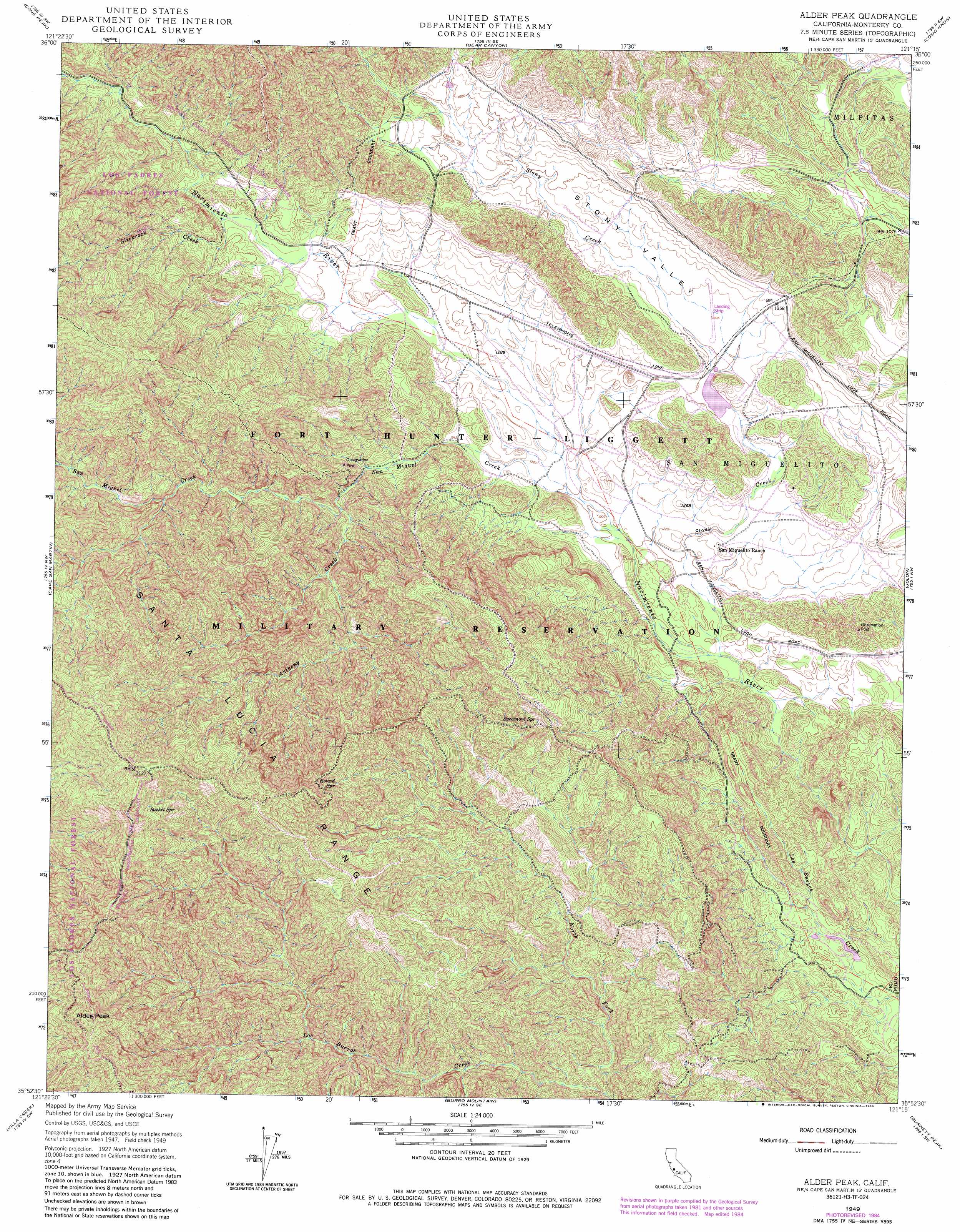
USGS Topo Quad 35121h3 - 1:24,000 scale
| Topo Map Name: | Alder Peak |
| USGS Topo Quad ID: | 35121h3 |
| Print Size: | ca. 21 1/4" wide x 27" high |
| Southeast Coordinates: | 35.875° N latitude / 121.25° W longitude |
| Map Center Coordinates: | 35.9375° N latitude / 121.3125° W longitude |
| U.S. State: | CA |
| Filename: | o35121h3.jpg |
| Download Map JPG Image: | Alder Peak topo map 1:24,000 scale |
| Map Type: | Topographic |
| Topo Series: | 7.5´ |
| Map Scale: | 1:24,000 |
| Source of Map Images: | United States Geological Survey (USGS) |
| Alternate Map Versions: |
Alder Peak CA 1949, updated 1953 Download PDF Buy paper map Alder Peak CA 1949, updated 1964 Download PDF Buy paper map Alder Peak CA 1949, updated 1969 Download PDF Buy paper map Alder Peak CA 1949, updated 1969 Download PDF Buy paper map Alder Peak CA 1949, updated 1980 Download PDF Buy paper map Alder Peak CA 1949, updated 1984 Download PDF Buy paper map Alder Peak CA 1949, updated 1986 Download PDF Buy paper map Alder Peak CA 1995, updated 2000 Download PDF Buy paper map Alder Peak CA 2012 Download PDF Buy paper map Alder Peak CA 2015 Download PDF Buy paper map |
| FStopo: | US Forest Service topo Alder Peak is available: Download FStopo PDF Download FStopo TIF |
1:24,000 Topo Quads surrounding Alder Peak
Tassajara Hot Springs |
Junipero Serra Peak |
Reliz Canyon |
Thompson Canyon |
San Lucas |
Lopez Point |
Cone Peak |
Bear Canyon |
Cosio Knob |
Espinosa Canyon |
Cape San Martin |
Alder Peak |
Jolon |
Williams Hill |
|
Villa Creek |
Burro Mountain |
Burnett Peak |
Bryson |
|
Piedras Blancas |
San Simeon |
Pebblestone Shut-In |
> Back to 35121e1 at 1:100,000 scale
> Back to 35120a1 at 1:250,000 scale
> Back to U.S. Topo Maps home
Alder Peak topo map: Gazetteer
Alder Peak: Dams
Lower Stoney Reservoir Dam elevation 389m 1276′Alder Peak: Populated Places
Sans (historical) elevation 401m 1315′Alder Peak: Reservoirs
Lower Stoney Creek Reservoir elevation 394m 1292′Lower Stoney Creek Reservoir elevation 393m 1289′
Alder Peak: Springs
Basket Spring elevation 909m 2982′Round Spring elevation 737m 2417′
Squirrel Spring elevation 356m 1167′
Sycamore Spring elevation 694m 2276′
Alder Peak: Streams
Anthony Creek elevation 397m 1302′North Fork Los Burros Creek elevation 493m 1617′
San Miguel Creek elevation 366m 1200′
Slickrock Creek elevation 408m 1338′
Stony Creek elevation 354m 1161′
Alder Peak: Summits
Alder Peak elevation 1137m 3730′Alder Peak: Valleys
Stony Valley elevation 395m 1295′Alder Peak digital topo map on disk
Buy this Alder Peak topo map showing relief, roads, GPS coordinates and other geographical features, as a high-resolution digital map file on DVD: