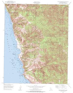
Cape San Martin Topo Map California
To zoom in, hover over the map of Cape San Martin
USGS Topo Quad 35121h4 - 1:24,000 scale
| Topo Map Name: | Cape San Martin |
| USGS Topo Quad ID: | 35121h4 |
| Print Size: | ca. 21 1/4" wide x 27" high |
| Southeast Coordinates: | 35.875° N latitude / 121.375° W longitude |
| Map Center Coordinates: | 35.9375° N latitude / 121.4375° W longitude |
| U.S. State: | CA |
| Filename: | o35121h4.jpg |
| Download Map JPG Image: | Cape San Martin topo map 1:24,000 scale |
| Map Type: | Topographic |
| Topo Series: | 7.5´ |
| Map Scale: | 1:24,000 |
| Source of Map Images: | United States Geological Survey (USGS) |
| Alternate Map Versions: |
Cape San Martin CA 1949, updated 1953 Download PDF Buy paper map Cape San Martin CA 1949, updated 1956 Download PDF Buy paper map Cape San Martin CA 1949, updated 1956 Download PDF Buy paper map Cape San Martin CA 1949, updated 1956 Download PDF Buy paper map Cape San Martin CA 1995, updated 2000 Download PDF Buy paper map Cape San Martin CA 2012 Download PDF Buy paper map Cape San Martin CA 2015 Download PDF Buy paper map |
| FStopo: | US Forest Service topo Cape San Martin is available: Download FStopo PDF Download FStopo TIF |
1:24,000 Topo Quads surrounding Cape San Martin
> Back to 35121e1 at 1:100,000 scale
> Back to 35120a1 at 1:250,000 scale
> Back to U.S. Topo Maps home
Cape San Martin topo map: Gazetteer
Cape San Martin: Bars
Tide Rock elevation 0m 0′Cape San Martin: Bays
Jade Cove elevation 4m 13′Cape San Martin: Beaches
Sand Dollar Beach elevation 1m 3′Cape San Martin: Capes
Cape San Martin elevation 44m 144′Cape San Martin: Islands
Bird Rock elevation 0m 0′Plaskett Rock elevation 6m 19′
San Martin Rock elevation 39m 127′
Cape San Martin: Mines
Buclimo Mine elevation 894m 2933′Gorda Mine elevation 480m 1574′
Melville Mine elevation 872m 2860′
Melville Mine elevation 905m 2969′
Cape San Martin: Populated Places
Gorda elevation 45m 147′Plaskett elevation 62m 203′
Cape San Martin: Streams
Kirk Creek elevation 7m 22′Mill Creek elevation 3m 9′
Negro Fork elevation 456m 1496′
Negro Fork Nacimiento River elevation 460m 1509′
North Fork Willow Creek elevation 221m 725′
Plaskett Creek elevation 4m 13′
Prewitt Creek elevation 10m 32′
South Fork Prewitt Creek elevation 136m 446′
South Fork Willow Creek elevation 61m 200′
Wild Cattle Creek elevation 2m 6′
Willow Creek elevation 8m 26′
Cape San Martin: Summits
Chalk Peak elevation 1070m 3510′San Martin Top elevation 938m 3077′
Willow Peak elevation 600m 1968′
Cape San Martin digital topo map on disk
Buy this Cape San Martin topo map showing relief, roads, GPS coordinates and other geographical features, as a high-resolution digital map file on DVD:


