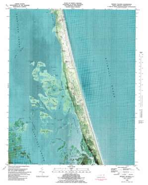
Mossey Islands Topo Map North Carolina
To zoom in, hover over the map of Mossey Islands
USGS Topo Quad 36075c7 - 1:24,000 scale
| Topo Map Name: | Mossey Islands |
| USGS Topo Quad ID: | 36075c7 |
| Print Size: | ca. 21 1/4" wide x 27" high |
| Southeast Coordinates: | 36.25° N latitude / 75.75° W longitude |
| Map Center Coordinates: | 36.3125° N latitude / 75.8125° W longitude |
| U.S. State: | NC |
| Filename: | p36075c7.jpg |
| Download Map JPG Image: | Mossey Islands topo map 1:24,000 scale |
| Map Type: | Orthophoto |
| Topo Series: | 7.5´ |
| Map Scale: | 1:24,000 |
| Source of Map Images: | United States Geological Survey (USGS) |
| Alternate Map Versions: |
Mossey Islands NC 1982, updated 1983 Download PDF Buy paper map Mossey Islands NC 2010 Download PDF Buy paper map Mossey Islands NC 2013 Download PDF Buy paper map Mossey Islands NC 2016 Download PDF Buy paper map |
1:24,000 Topo Quads surrounding Mossey Islands
Creeds |
Knotts Island |
|||
Currituck |
Barco |
Corolla |
||
Shiloh |
Coinjock |
Mossey Islands |
||
Wade Point |
Camden Point |
Jarvisburg |
Martin Point |
|
Point Harbor |
Kitty Hawk |
> Back to 36075a1 at 1:100,000 scale
> Back to 36074a1 at 1:250,000 scale
> Back to U.S. Topo Maps home
Mossey Islands topo map: Gazetteer
Mossey Islands: Airports
PI-19 Airport elevation 3m 9′Mossey Islands: Areas
Peters Quarter elevation 3m 9′Mossey Islands: Bays
Ballast Bay elevation 0m 0′Beasley Bay elevation 0m 0′
Brant Island Pond elevation 0m 0′
Burris Bay elevation 0m 0′
Currituck Sound elevation 0m 0′
Duck Hole elevation 0m 0′
Goat Island Bay elevation 0m 0′
Little Goat Island Bay elevation 0m 0′
Long Point Pond elevation 0m 0′
Long Pond elevation 0m 0′
Mallard Pond elevation 0m 0′
Mossy Pond elevation 0m 0′
Myrtle Bay elevation 0m 0′
Old House Pond elevation 0m 0′
Overhaul Pond elevation 0m 0′
Piney Cove elevation 0m 0′
Poplar Branch Bay elevation 0m 0′
Porpoise Pond elevation -1m -4′
Sand Cove elevation 0m 0′
Sanders Bay elevation 0m 0′
Stumpy Cove elevation 0m 0′
Wells Bay elevation 0m 0′
Wells Creek elevation 0m 0′
Whale Head Bay elevation 0m 0′
Whole Head Bay elevation 0m 0′
Mossey Islands: Capes
Canvasback Point elevation 0m 0′Cattle Pen Point elevation 0m 0′
Long Point elevation 0m 0′
Sheep Pen Point elevation 0m 0′
Mossey Islands: Channels
Strait Creek elevation 1m 3′The Hammock elevation 0m 0′
Mossey Islands: Guts
Baums Creek elevation 0m 0′Big Narrows elevation 0m 0′
Buzzard Lead elevation 0m 0′
Deep Neck elevation 0m 0′
Fosters Channel elevation 0m 0′
Indian Gap elevation 0m 0′
Jarvis Channel elevation 0m 0′
Little Narrows elevation 0m 0′
Lone Oak Channel elevation 0m 0′
Neals Creek elevation 0m 0′
Sanders Creek elevation 0m 0′
Straight Creek elevation 3m 9′
Taylor Creek elevation 0m 0′
Thorofare elevation 0m 0′
Turkells Gut elevation 1m 3′
Mossey Islands: Islands
Bay Tree elevation 1m 3′Bearhead elevation 0m 0′
Brant Island elevation 0m 0′
Bush Island elevation 0m 0′
Cat Island elevation 0m 0′
Currituck Banks elevation 2m 6′
Goat Island elevation 0m 0′
Greys Island elevation 0m 0′
Hog Islands elevation 0m 0′
Indian Gap Island elevation 0m 0′
Little Hog Island elevation 0m 0′
Long Island elevation 0m 0′
Marsh Island elevation 0m 0′
Mossey Islands elevation 0m 0′
Narrows Island elevation 0m 0′
North Burris Island elevation 0m 0′
Rattlesnake Island elevation 0m 0′
Sedge Island elevation 0m 0′
Sledge Island elevation 0m 0′
South Burris Island elevation 0m 0′
Steer Island elevation 0m 0′
Swan Island elevation 0m 0′
Thorofare Island elevation 2m 6′
Mossey Islands: Lakes
Big Pond elevation 0m 0′Canvasback Pond elevation 0m 0′
Dotty Pond elevation 0m 0′
Great Beach Pond elevation 0m 0′
House Pond elevation 0m 0′
Long Pond elevation 0m 0′
Northeast Pond elevation 0m 0′
Perch Pond elevation 0m 0′
The Hammock elevation 0m 0′
Mossey Islands: Parks
Outer Banks Center for Wildlife Education elevation 0m 0′Mossey Islands: Populated Places
Poyners Hill (historical) elevation 3m 9′Mossey Islands: Streams
Ware Creek elevation 0m 0′Mossey Islands: Summits
Poyners Hill elevation 2m 6′Three Dunes elevation 9m 29′
Whale Head Hill elevation 3m 9′
Mossey Islands: Swamps
Tar Cove Marsh elevation 1m 3′Mossey Islands digital topo map on disk
Buy this Mossey Islands topo map showing relief, roads, GPS coordinates and other geographical features, as a high-resolution digital map file on DVD:
Atlantic Coast (NY, NJ, PA, DE, MD, VA, NC)
Buy digital topo maps: Atlantic Coast (NY, NJ, PA, DE, MD, VA, NC)


