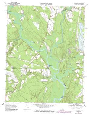
Riverdale Topo Map Virginia
To zoom in, hover over the map of Riverdale
USGS Topo Quad 36076e8 - 1:24,000 scale
| Topo Map Name: | Riverdale |
| USGS Topo Quad ID: | 36076e8 |
| Print Size: | ca. 21 1/4" wide x 27" high |
| Southeast Coordinates: | 36.5° N latitude / 76.875° W longitude |
| Map Center Coordinates: | 36.5625° N latitude / 76.9375° W longitude |
| U.S. States: | VA, NC |
| Filename: | o36076e8.jpg |
| Download Map JPG Image: | Riverdale topo map 1:24,000 scale |
| Map Type: | Topographic |
| Topo Series: | 7.5´ |
| Map Scale: | 1:24,000 |
| Source of Map Images: | United States Geological Survey (USGS) |
| Alternate Map Versions: |
Riverdale VA 1967, updated 1970 Download PDF Buy paper map Riverdale VA 1967, updated 1986 Download PDF Buy paper map Riverdale VA 1967, updated 1986 Download PDF Buy paper map Riverdale VA 2010 Download PDF Buy paper map Riverdale VA 2013 Download PDF Buy paper map Riverdale VA 2016 Download PDF Buy paper map |
1:24,000 Topo Quads surrounding Riverdale
> Back to 36076e1 at 1:100,000 scale
> Back to 36076a1 at 1:250,000 scale
> Back to U.S. Topo Maps home
Riverdale topo map: Gazetteer
Riverdale: Bends
Georges Bend elevation 1m 3′Smiths Bend elevation 1m 3′
Riverdale: Bridges
General Vaughan Bridge elevation 0m 0′Monroe Bridge elevation 1m 3′
Riverdale: Cliffs
Point Beach elevation 1m 3′Riverdale: Crossings
Smiths Ferry (historical) elevation 1m 3′Riverdale: Dams
C-Pond Dam elevation 11m 36′D-Pond Dam elevation 4m 13′
Riverdale: Guts
Round Gut elevation 1m 3′Simms Gut elevation 1m 3′
Riverdale: Populated Places
Cherry Grove elevation 2m 6′Mill Neck elevation 12m 39′
Riddicks Landing elevation 1m 3′
Riddicksville elevation 10m 32′
Riverdale elevation 11m 36′
South Quay elevation 8m 26′
Sweepstakes (historical) elevation 1m 3′
Wyanoke elevation 4m 13′
Riverdale: Reservoirs
C-Pond elevation 11m 36′D-Pond elevation 4m 13′
Riverdale: Streams
Beaman Branch elevation 10m 32′Blackwater River elevation 1m 3′
Buckhorn Creek elevation 0m 0′
Jernigan Branch elevation 1m 3′
Mill Creek elevation 1m 3′
Nottoway River elevation 1m 3′
Nottoway River elevation 1m 3′
Somerton Creek elevation 0m 0′
Riverdale digital topo map on disk
Buy this Riverdale topo map showing relief, roads, GPS coordinates and other geographical features, as a high-resolution digital map file on DVD:
Atlantic Coast (NY, NJ, PA, DE, MD, VA, NC)
Buy digital topo maps: Atlantic Coast (NY, NJ, PA, DE, MD, VA, NC)


