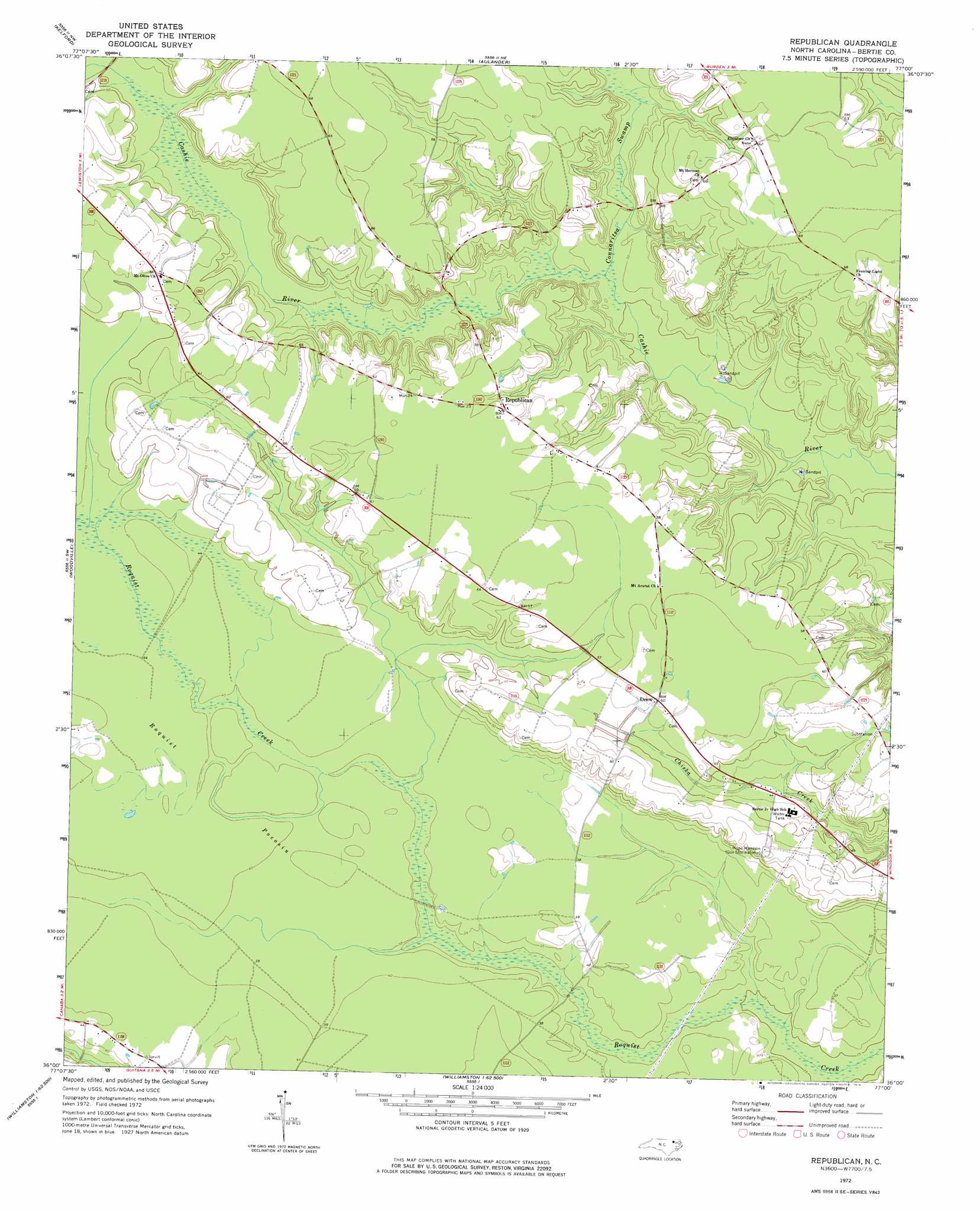
Republican Topo Map North Carolina
To zoom in, hover over the map of Republican
USGS Topo Quad 36077a1 - 1:24,000 scale
| Topo Map Name: | Republican |
| USGS Topo Quad ID: | 36077a1 |
| Print Size: | ca. 21 1/4" wide x 27" high |
| Southeast Coordinates: | 36° N latitude / 77° W longitude |
| Map Center Coordinates: | 36.0625° N latitude / 77.0625° W longitude |
| U.S. State: | NC |
| Filename: | o36077a1.jpg |
| Download Map JPG Image: | Republican topo map 1:24,000 scale |
| Map Type: | Topographic |
| Topo Series: | 7.5´ |
| Map Scale: | 1:24,000 |
| Source of Map Images: | United States Geological Survey (USGS) |
| Alternate Map Versions: |
Republican NC 1972, updated 1976 Download PDF Buy paper map Republican NC 2010 Download PDF Buy paper map Republican NC 2013 Download PDF Buy paper map Republican NC 2016 Download PDF Buy paper map |
1:24,000 Topo Quads surrounding Republican
Rich Square |
Woodland |
Union |
Ahoskie |
Harrellsville |
Norfleet |
Kelford |
Aulander |
Powellsville |
Colerain |
Palmyra |
Woodville |
Republican |
Windsor North |
Merry Hill |
Oak City |
Hamilton |
Quitsna |
Windsor South |
Woodard |
Robersonville West |
Robersonville East |
Williamston |
Jamesville |
Plymouth West |
> Back to 36077a1 at 1:100,000 scale
> Back to 36076a1 at 1:250,000 scale
> Back to U.S. Topo Maps home
Republican topo map: Gazetteer
Republican: Populated Places
Bertie Mobile Homes elevation 17m 55′Drew elevation 18m 59′
Republican elevation 18m 59′
Republican: Streams
Connaritsa Swamp elevation 8m 26′Republican: Swamps
Roquist Pocosin elevation 12m 39′Republican digital topo map on disk
Buy this Republican topo map showing relief, roads, GPS coordinates and other geographical features, as a high-resolution digital map file on DVD:
Atlantic Coast (NY, NJ, PA, DE, MD, VA, NC)
Buy digital topo maps: Atlantic Coast (NY, NJ, PA, DE, MD, VA, NC)
 map DVD")