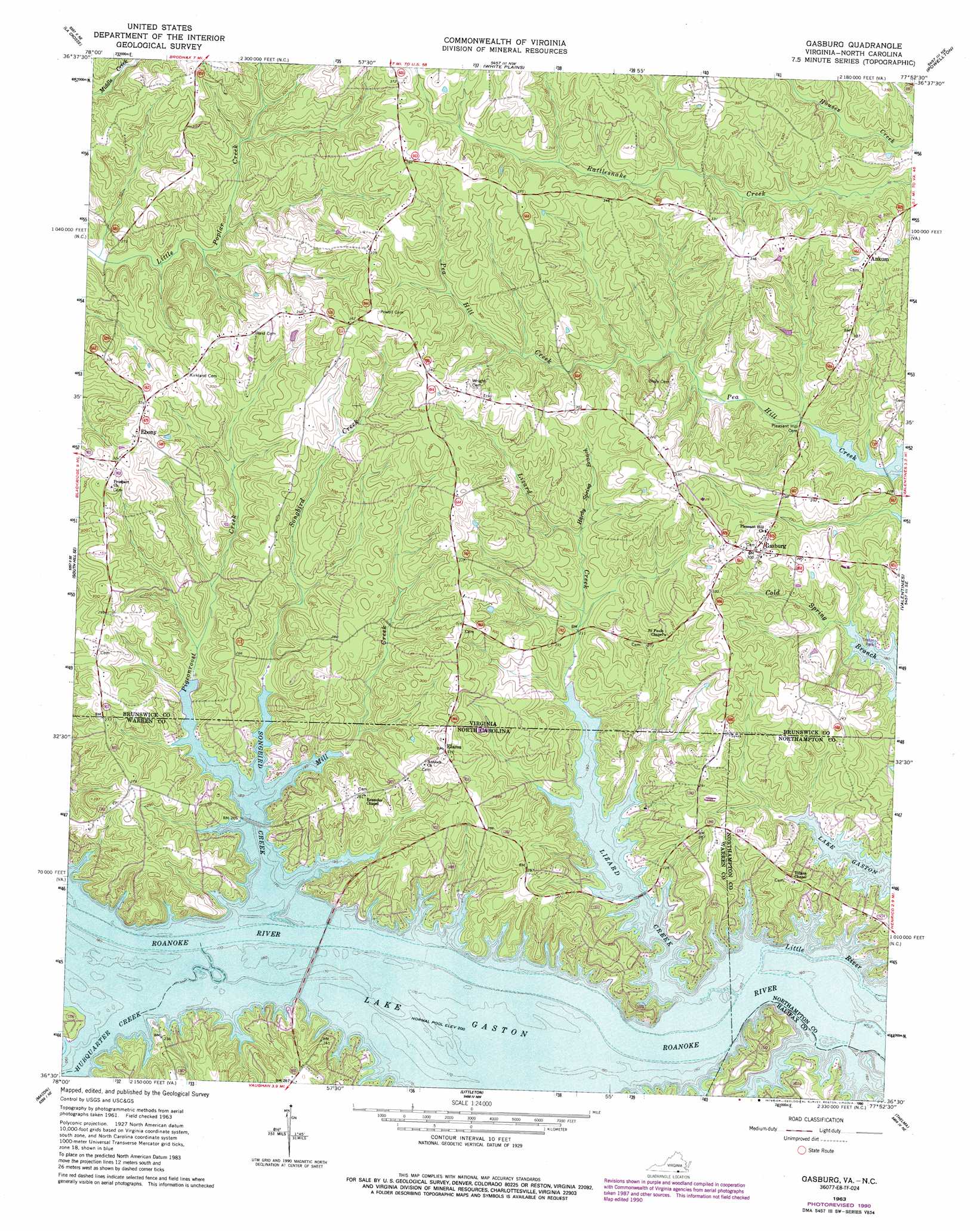
Gasburg Topo Map Virginia
To zoom in, hover over the map of Gasburg
USGS Topo Quad 36077e8 - 1:24,000 scale
| Topo Map Name: | Gasburg |
| USGS Topo Quad ID: | 36077e8 |
| Print Size: | ca. 21 1/4" wide x 27" high |
| Southeast Coordinates: | 36.5° N latitude / 77.875° W longitude |
| Map Center Coordinates: | 36.5625° N latitude / 77.9375° W longitude |
| U.S. States: | VA, NC |
| Filename: | o36077e8.jpg |
| Download Map JPG Image: | Gasburg topo map 1:24,000 scale |
| Map Type: | Topographic |
| Topo Series: | 7.5´ |
| Map Scale: | 1:24,000 |
| Source of Map Images: | United States Geological Survey (USGS) |
| Alternate Map Versions: |
Gasburg VA 1963, updated 1964 Download PDF Buy paper map Gasburg VA 1963, updated 1980 Download PDF Buy paper map Gasburg VA 1963, updated 1985 Download PDF Buy paper map Gasburg VA 1963, updated 1990 Download PDF Buy paper map Gasburg VA 1977, updated 1979 Download PDF Buy paper map Gasburg VA 2010 Download PDF Buy paper map Gasburg VA 2013 Download PDF Buy paper map Gasburg VA 2016 Download PDF Buy paper map |
1:24,000 Topo Quads surrounding Gasburg
North View |
Forksville |
Alberta |
Lawrenceville |
Smoky Ordinary |
South Hill |
La Crosse |
White Plains |
Powellton |
Ante |
Bracey |
South Hill Se |
Gasburg |
Valentines |
Barley |
Warrenton |
Macon |
Littleton |
Thelma |
Roanoke Rapids |
Afton |
Inez |
Hollister |
Aurelian Springs |
Darlington |
> Back to 36077e1 at 1:100,000 scale
> Back to 36076a1 at 1:250,000 scale
> Back to U.S. Topo Maps home
Gasburg topo map: Gazetteer
Gasburg: Populated Places
Ankum elevation 101m 331′Ebony elevation 105m 344′
Elams elevation 93m 305′
Gasburg elevation 94m 308′
Gasburg: Streams
Hardy Spring Branch elevation 69m 226′Hubquarter Creek elevation 60m 196′
Lizard Creek elevation 59m 193′
Lizard Creek elevation 59m 193′
Mill Creek elevation 60m 196′
Mill Creek elevation 60m 196′
Pigeonroost Creek elevation 60m 196′
Pigeonroost Creek elevation 60m 196′
Songbird Creek elevation 60m 196′
Songbird Creek elevation 60m 196′
Gasburg digital topo map on disk
Buy this Gasburg topo map showing relief, roads, GPS coordinates and other geographical features, as a high-resolution digital map file on DVD:
Atlantic Coast (NY, NJ, PA, DE, MD, VA, NC)
Buy digital topo maps: Atlantic Coast (NY, NJ, PA, DE, MD, VA, NC)
 map DVD")