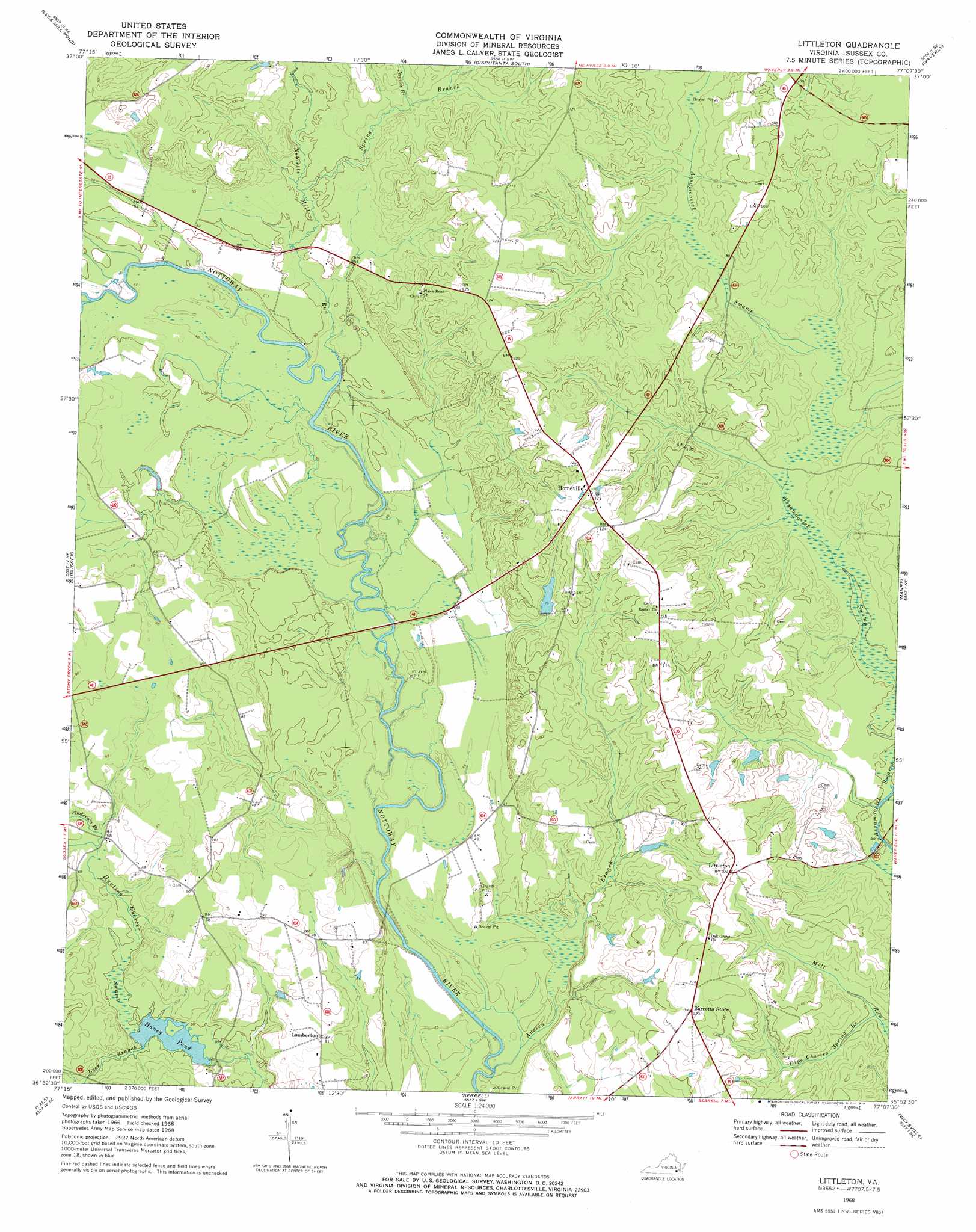
Littleton Topo Map Virginia
To zoom in, hover over the map of Littleton
USGS Topo Quad 36077h2 - 1:24,000 scale
| Topo Map Name: | Littleton |
| USGS Topo Quad ID: | 36077h2 |
| Print Size: | ca. 21 1/4" wide x 27" high |
| Southeast Coordinates: | 36.875° N latitude / 77.125° W longitude |
| Map Center Coordinates: | 36.9375° N latitude / 77.1875° W longitude |
| U.S. State: | VA |
| Filename: | o36077h2.jpg |
| Download Map JPG Image: | Littleton topo map 1:24,000 scale |
| Map Type: | Topographic |
| Topo Series: | 7.5´ |
| Map Scale: | 1:24,000 |
| Source of Map Images: | United States Geological Survey (USGS) |
| Alternate Map Versions: |
Littleton VA 1956, updated 1958 Download PDF Buy paper map Littleton VA 1968, updated 1970 Download PDF Buy paper map Littleton VA 1968, updated 1970 Download PDF Buy paper map Littleton VA 2010 Download PDF Buy paper map Littleton VA 2013 Download PDF Buy paper map Littleton VA 2016 Download PDF Buy paper map |
1:24,000 Topo Quads surrounding Littleton
Petersburg |
Prince George |
Disputanta North |
Savedge |
Claremont |
Carson |
Templeton |
Disputanta South |
Waverly |
Dendron |
Stony Creek |
Sussex |
Littleton |
Manry |
Ivor |
Jarratt |
Yale |
Sebrell |
Vicksville |
Sedley |
Adams Grove |
Drewryville |
Capron |
Courtland |
Franklin |
> Back to 36077e1 at 1:100,000 scale
> Back to 36076a1 at 1:250,000 scale
> Back to U.S. Topo Maps home
Littleton topo map: Gazetteer
Littleton: Bridges
Allens Bridge (historical) elevation 9m 29′Littleton: Dams
Honey Dam elevation 12m 39′Renney Dam elevation 21m 68′
Littleton: Populated Places
Burt (historical) elevation 14m 45′Church (historical) elevation 22m 72′
Homeville elevation 34m 111′
Littleton elevation 30m 98′
Lumberton elevation 24m 78′
Littleton: Reservoirs
Honey Pond elevation 12m 39′Renney Pond elevation 21m 68′
Littleton: Streams
Anderson Branch elevation 16m 52′Austin Branch elevation 7m 22′
Cape Charles Spring Branch elevation 14m 45′
Jennies Branch elevation 18m 59′
Lees Branch elevation 14m 45′
Nebletts Mill Run elevation 15m 49′
Spring Branch elevation 15m 49′
Underhill Branch elevation 20m 65′
Littleton: Swamps
Mussel Swamp elevation 20m 65′Littleton digital topo map on disk
Buy this Littleton topo map showing relief, roads, GPS coordinates and other geographical features, as a high-resolution digital map file on DVD:
Atlantic Coast (NY, NJ, PA, DE, MD, VA, NC)
Buy digital topo maps: Atlantic Coast (NY, NJ, PA, DE, MD, VA, NC)
 map DVD")