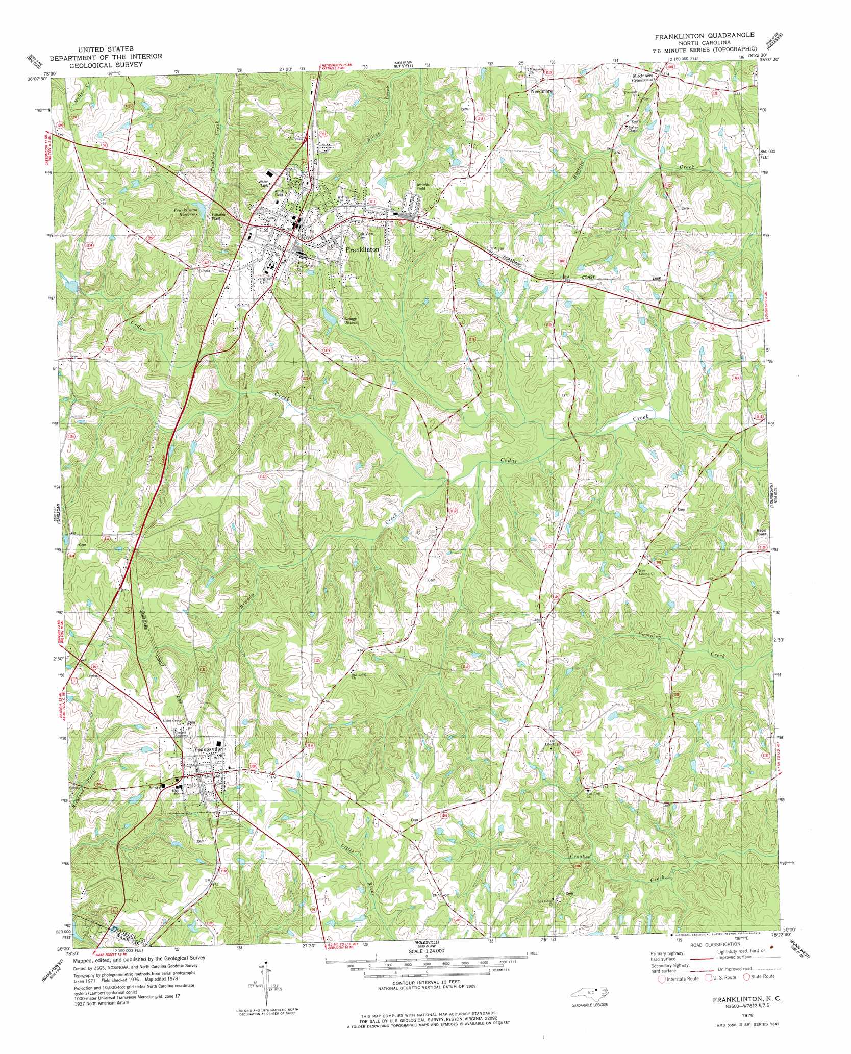
Franklinton Topo Map North Carolina
To zoom in, hover over the map of Franklinton
USGS Topo Quad 36078a4 - 1:24,000 scale
| Topo Map Name: | Franklinton |
| USGS Topo Quad ID: | 36078a4 |
| Print Size: | ca. 21 1/4" wide x 27" high |
| Southeast Coordinates: | 36° N latitude / 78.375° W longitude |
| Map Center Coordinates: | 36.0625° N latitude / 78.4375° W longitude |
| U.S. State: | NC |
| Filename: | o36078a4.jpg |
| Download Map JPG Image: | Franklinton topo map 1:24,000 scale |
| Map Type: | Topographic |
| Topo Series: | 7.5´ |
| Map Scale: | 1:24,000 |
| Source of Map Images: | United States Geological Survey (USGS) |
| Alternate Map Versions: |
Franklinton NC 1978, updated 1978 Download PDF Buy paper map Franklinton NC 1978, updated 1978 Download PDF Buy paper map Franklinton NC 2010 Download PDF Buy paper map Franklinton NC 2013 Download PDF Buy paper map Franklinton NC 2016 Download PDF Buy paper map |
1:24,000 Topo Quads surrounding Franklinton
Berea |
Oxford |
Henderson |
Vicksboro |
Afton |
Stem |
Wilton |
Kittrell |
Ingleside |
Gold Sand |
Creedmoor |
Grissom |
Franklinton |
Louisburg |
Justice |
Bayleaf |
Wake Forest |
Rolesville |
Bunn West |
Bunn East |
Raleigh West |
Raleigh East |
Knightdale |
Zebulon |
Middlesex |
> Back to 36078a1 at 1:100,000 scale
> Back to 36078a1 at 1:250,000 scale
> Back to U.S. Topo Maps home
Franklinton topo map: Gazetteer
Franklinton: Bridges
Greens Bridge elevation 74m 242′Winston Bridge elevation 76m 249′
Franklinton: Dams
Calvin Ray Pond Dam elevation 109m 357′Franklinton Reservoir Dam elevation 95m 311′
Kearneys Creek Dam elevation 91m 298′
Thomas Lake Dam elevation 87m 285′
Franklinton: Populated Places
Franklinton elevation 125m 410′Mays Crossroads elevation 135m 442′
Mitchiners Crossroads elevation 113m 370′
Needmore elevation 119m 390′
Popes Crossroads elevation 135m 442′
Youngsville elevation 142m 465′
Franklinton: Reservoirs
Calvin Ray Pond elevation 109m 357′Franklinton Reservoir elevation 95m 311′
Franklinton Reservoir Number Two elevation 91m 298′
Thomas Lake elevation 87m 285′
Franklinton: Streams
Brandy Creek elevation 82m 269′Franklinton digital topo map on disk
Buy this Franklinton topo map showing relief, roads, GPS coordinates and other geographical features, as a high-resolution digital map file on DVD:
Western Virginia & Southern West Virginia
Buy digital topo maps: Western Virginia & Southern West Virginia