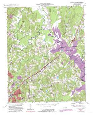
Northeast Durham Topo Map North Carolina
To zoom in, hover over the map of Northeast Durham
USGS Topo Quad 36078a7 - 1:24,000 scale
| Topo Map Name: | Northeast Durham |
| USGS Topo Quad ID: | 36078a7 |
| Print Size: | ca. 21 1/4" wide x 27" high |
| Southeast Coordinates: | 36° N latitude / 78.75° W longitude |
| Map Center Coordinates: | 36.0625° N latitude / 78.8125° W longitude |
| U.S. State: | NC |
| Filename: | o36078a7.jpg |
| Download Map JPG Image: | Northeast Durham topo map 1:24,000 scale |
| Map Type: | Topographic |
| Topo Series: | 7.5´ |
| Map Scale: | 1:24,000 |
| Source of Map Images: | United States Geological Survey (USGS) |
| Alternate Map Versions: |
Northeast Durham NC 1973, updated 1975 Download PDF Buy paper map Northeast Durham NC 1973, updated 1982 Download PDF Buy paper map Northeast Durham NC 1973, updated 1987 Download PDF Buy paper map Northeast Durham NC 1973, updated 1992 Download PDF Buy paper map Northeast Durham NC 1993, updated 1998 Download PDF Buy paper map Northeast Durham NC 1999, updated 2003 Download PDF Buy paper map Northeast Durham NC 2010 Download PDF Buy paper map Northeast Durham NC 2013 Download PDF Buy paper map Northeast Durham NC 2016 Download PDF Buy paper map |
1:24,000 Topo Quads surrounding Northeast Durham
> Back to 36078a1 at 1:100,000 scale
> Back to 36078a1 at 1:250,000 scale
> Back to U.S. Topo Maps home
Northeast Durham topo map: Gazetteer
Northeast Durham: Airports
Durham Skypark elevation 87m 285′Northeast Durham: Crossings
Interchange 178 elevation 95m 311′Interchange 179 elevation 104m 341′
Interchange 180 elevation 113m 370′
Interchange 182 elevation 103m 337′
Interchange 183 elevation 90m 295′
Interchange 186A and 186B elevation 82m 269′
Northeast Durham: Dams
Brinkley Lake Dam elevation 74m 242′Infinity Rd Raw Water Reservoir Dam elevation 90m 295′
Lake Unity Dam elevation 91m 298′
Pettys Lake Dam elevation 101m 331′
Northeast Durham: Populated Places
Burton elevation 110m 360′Cozart elevation 105m 344′
Fairntosh elevation 83m 272′
Glen Forest elevation 113m 370′
Gorman elevation 111m 364′
Redwood elevation 91m 298′
Rocky Knoll elevation 115m 377′
Weaver elevation 109m 357′
Northeast Durham: Reservoirs
Brinkley Lake elevation 74m 242′Infinity Rd Raw Water Reservoir elevation 90m 295′
Lake Unity elevation 91m 298′
Pettys Lake elevation 101m 331′
Northeast Durham: Streams
Cabin Branch elevation 80m 262′Chunky Pipe Creek elevation 79m 259′
Ellerbe Creek elevation 75m 246′
Eno River elevation 75m 246′
Flat River elevation 75m 246′
Knap of Reeds Creek elevation 76m 249′
Little River elevation 76m 249′
Panther Creek elevation 75m 246′
Northeast Durham digital topo map on disk
Buy this Northeast Durham topo map showing relief, roads, GPS coordinates and other geographical features, as a high-resolution digital map file on DVD:
Western Virginia & Southern West Virginia
Buy digital topo maps: Western Virginia & Southern West Virginia


