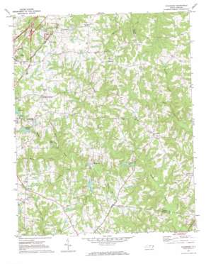
Vicksboro Topo Map North Carolina
To zoom in, hover over the map of Vicksboro
USGS Topo Quad 36078c3 - 1:24,000 scale
| Topo Map Name: | Vicksboro |
| USGS Topo Quad ID: | 36078c3 |
| Print Size: | ca. 21 1/4" wide x 27" high |
| Southeast Coordinates: | 36.25° N latitude / 78.25° W longitude |
| Map Center Coordinates: | 36.3125° N latitude / 78.3125° W longitude |
| U.S. State: | NC |
| Filename: | o36078c3.jpg |
| Download Map JPG Image: | Vicksboro topo map 1:24,000 scale |
| Map Type: | Topographic |
| Topo Series: | 7.5´ |
| Map Scale: | 1:24,000 |
| Source of Map Images: | United States Geological Survey (USGS) |
| Alternate Map Versions: |
Vicksboro NC 1970, updated 1973 Download PDF Buy paper map Vicksboro NC 2010 Download PDF Buy paper map Vicksboro NC 2013 Download PDF Buy paper map Vicksboro NC 2016 Download PDF Buy paper map |
1:24,000 Topo Quads surrounding Vicksboro
> Back to 36078a1 at 1:100,000 scale
> Back to 36078a1 at 1:250,000 scale
> Back to U.S. Topo Maps home
Vicksboro topo map: Gazetteer
Vicksboro: Bridges
High Tower Bridge elevation 82m 269′Vicksboro: Dams
Ayscues Pond Dam elevation 105m 344′Ellis Pond Dam elevation 118m 387′
Harringtons Pond Dam elevation 109m 357′
Henderson City Lake Dam elevation 128m 419′
Rowland Pond Dam elevation 129m 423′
Southerlands Pond Dam elevation 93m 305′
Weldons Pond Dam elevation 98m 321′
Vicksboro: Lakes
Club Pond elevation 111m 364′Roland Pond elevation 121m 396′
Southerlands Pond elevation 93m 305′
Vicksboro: Mines
Greystone Quarry elevation 151m 495′Vicksboro: Populated Places
Adcock Crossroads elevation 154m 505′Axtell elevation 139m 456′
Brookston elevation 151m 495′
Cokesbury elevation 149m 488′
Faulkner Crossroads elevation 142m 465′
Gillburg elevation 146m 479′
Greystone elevation 155m 508′
Vicksboro elevation 133m 436′
Weldons Mill elevation 98m 321′
Vicksboro: Post Offices
Shatter Post Office (historical) elevation 139m 456′Vicksboro: Reservoirs
Ayscues Pond elevation 105m 344′Ellis Pond elevation 118m 387′
Fox Reservoir elevation 127m 416′
Harringtons Pond elevation 109m 357′
Henderson City Lake elevation 128m 419′
Rowlands Pond elevation 129m 423′
Weldons Pond elevation 98m 321′
Vicksboro: Streams
Buzzard Branch elevation 93m 305′Cattail Creek elevation 98m 321′
Dickies Creek elevation 95m 311′
Martin Creek elevation 103m 337′
Pounder Branch elevation 109m 357′
Vaughn Branch elevation 93m 305′
Weaver Creek elevation 92m 301′
Vicksboro digital topo map on disk
Buy this Vicksboro topo map showing relief, roads, GPS coordinates and other geographical features, as a high-resolution digital map file on DVD:
Western Virginia & Southern West Virginia
Buy digital topo maps: Western Virginia & Southern West Virginia


