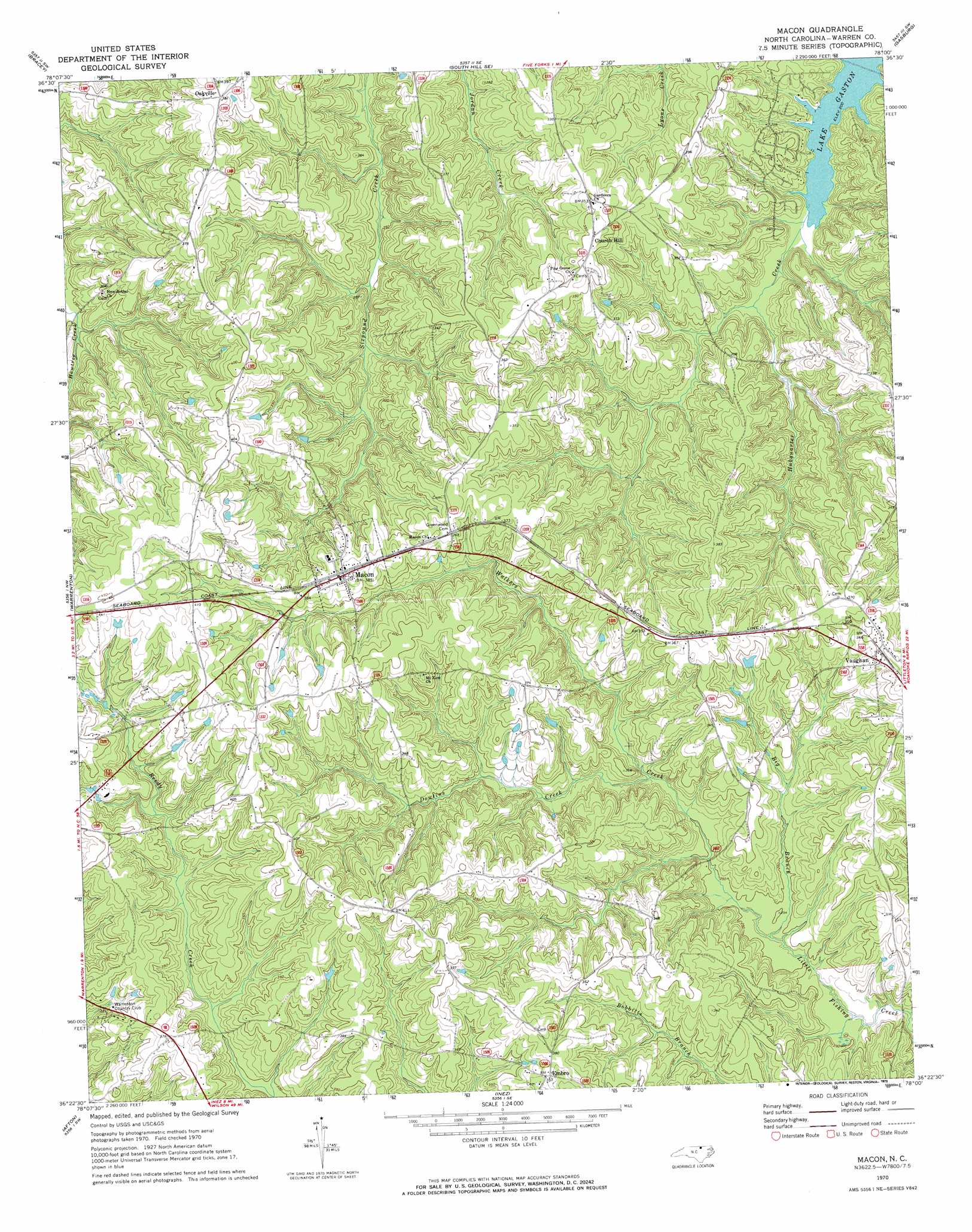
Macon Topo Map North Carolina
To zoom in, hover over the map of Macon
USGS Topo Quad 36078d1 - 1:24,000 scale
| Topo Map Name: | Macon |
| USGS Topo Quad ID: | 36078d1 |
| Print Size: | ca. 21 1/4" wide x 27" high |
| Southeast Coordinates: | 36.375° N latitude / 78° W longitude |
| Map Center Coordinates: | 36.4375° N latitude / 78.0625° W longitude |
| U.S. State: | NC |
| Filename: | o36078d1.jpg |
| Download Map JPG Image: | Macon topo map 1:24,000 scale |
| Map Type: | Topographic |
| Topo Series: | 7.5´ |
| Map Scale: | 1:24,000 |
| Source of Map Images: | United States Geological Survey (USGS) |
| Alternate Map Versions: |
Macon NC 1970, updated 1973 Download PDF Buy paper map Macon NC 1970, updated 1973 Download PDF Buy paper map Macon NC 1977, updated 1979 Download PDF Buy paper map Macon NC 2010 Download PDF Buy paper map Macon NC 2013 Download PDF Buy paper map Macon NC 2016 Download PDF Buy paper map |
1:24,000 Topo Quads surrounding Macon
Baskerville |
South Hill |
La Crosse |
White Plains |
Powellton |
John H Kerr Dam |
Bracey |
South Hill Se |
Gasburg |
Valentines |
Middleburg |
Warrenton |
Macon |
Littleton |
Thelma |
Vicksboro |
Afton |
Inez |
Hollister |
Aurelian Springs |
Ingleside |
Gold Sand |
Centerville |
Essex |
Ringwood |
> Back to 36078a1 at 1:100,000 scale
> Back to 36078a1 at 1:250,000 scale
> Back to U.S. Topo Maps home
Macon topo map: Gazetteer
Macon: Populated Places
Church Hill elevation 106m 347′Embro elevation 118m 387′
Macon elevation 116m 380′
Oakville elevation 116m 380′
Vaughan elevation 105m 344′
Macon: Streams
Big Branch elevation 72m 236′Dowtins Creek elevation 79m 259′
Walkers Creek elevation 72m 236′
Macon digital topo map on disk
Buy this Macon topo map showing relief, roads, GPS coordinates and other geographical features, as a high-resolution digital map file on DVD:
Western Virginia & Southern West Virginia
Buy digital topo maps: Western Virginia & Southern West Virginia