Warrenton Topo Map North Carolina
To zoom in, hover over the map of Warrenton
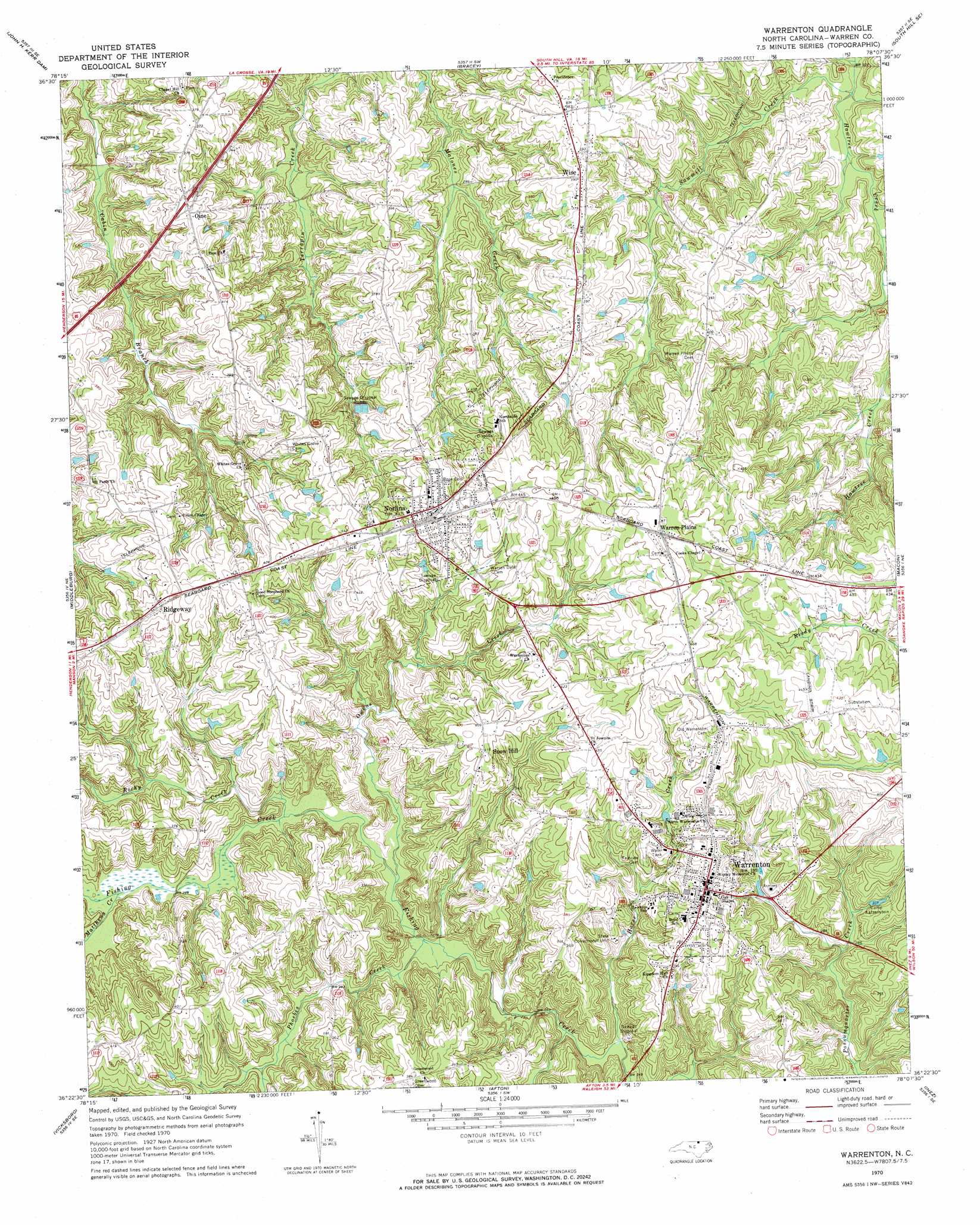
USGS Topo Quad 36078d2 - 1:24,000 scale
| Topo Map Name: | Warrenton |
| USGS Topo Quad ID: | 36078d2 |
| Print Size: | ca. 21 1/4" wide x 27" high |
| Southeast Coordinates: | 36.375° N latitude / 78.125° W longitude |
| Map Center Coordinates: | 36.4375° N latitude / 78.1875° W longitude |
| U.S. State: | NC |
| Filename: | o36078d2.jpg |
| Download Map JPG Image: | Warrenton topo map 1:24,000 scale |
| Map Type: | Topographic |
| Topo Series: | 7.5´ |
| Map Scale: | 1:24,000 |
| Source of Map Images: | United States Geological Survey (USGS) |
| Alternate Map Versions: |
Warrenton NC 1970, updated 1973 Download PDF Buy paper map Warrenton NC 1977, updated 1979 Download PDF Buy paper map Warrenton NC 2010 Download PDF Buy paper map Warrenton NC 2013 Download PDF Buy paper map Warrenton NC 2016 Download PDF Buy paper map |
1:24,000 Topo Quads surrounding Warrenton
Boydton |
Baskerville |
South Hill |
La Crosse |
White Plains |
Tungsten |
John H Kerr Dam |
Bracey |
South Hill Se |
Gasburg |
Townsville |
Middleburg |
Warrenton |
Macon |
Littleton |
Henderson |
Vicksboro |
Afton |
Inez |
Hollister |
Kittrell |
Ingleside |
Gold Sand |
Centerville |
Essex |
> Back to 36078a1 at 1:100,000 scale
> Back to 36078a1 at 1:250,000 scale
> Back to U.S. Topo Maps home
Warrenton topo map: Gazetteer
Warrenton: Airports
Warren County Airport elevation 134m 439′Warrenton: Dams
Coffmans Lake Dam elevation 96m 314′Warrenton: Populated Places
Norlina elevation 129m 423′Oine elevation 114m 374′
Ridgeway elevation 128m 419′
Snow Hill elevation 125m 410′
Warren Plains elevation 139m 456′
Warrenton elevation 118m 387′
Wise elevation 118m 387′
Warrenton: Reservoirs
Coffmans Lake elevation 96m 314′Hicks Pond elevation 85m 278′
Warrenton: Streams
Horse Creek elevation 74m 242′Matthews Creek elevation 87m 285′
Owens Creek elevation 79m 259′
Phoebes Creek elevation 78m 255′
Rocky Creek elevation 83m 272′
Sawmill Creek elevation 67m 219′
Warrenton digital topo map on disk
Buy this Warrenton topo map showing relief, roads, GPS coordinates and other geographical features, as a high-resolution digital map file on DVD:
Western Virginia & Southern West Virginia
Buy digital topo maps: Western Virginia & Southern West Virginia