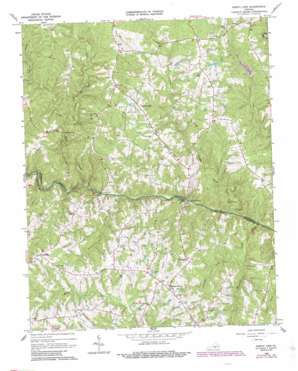
North View Topo Map Virginia
To zoom in, hover over the map of North View
USGS Topo Quad 36078g2 - 1:24,000 scale
| Topo Map Name: | North View |
| USGS Topo Quad ID: | 36078g2 |
| Print Size: | ca. 21 1/4" wide x 27" high |
| Southeast Coordinates: | 36.75° N latitude / 78.125° W longitude |
| Map Center Coordinates: | 36.8125° N latitude / 78.1875° W longitude |
| U.S. State: | VA |
| Filename: | o36078g2.jpg |
| Download Map JPG Image: | North View topo map 1:24,000 scale |
| Map Type: | Topographic |
| Topo Series: | 7.5´ |
| Map Scale: | 1:24,000 |
| Source of Map Images: | United States Geological Survey (USGS) |
| Alternate Map Versions: |
North View VA 1966, updated 1967 Download PDF Buy paper map North View VA 1966, updated 1990 Download PDF Buy paper map North View VA 1966, updated 1991 Download PDF Buy paper map North View VA 1966, updated 1992 Download PDF Buy paper map North View VA 2010 Download PDF Buy paper map North View VA 2013 Download PDF Buy paper map North View VA 2016 Download PDF Buy paper map |
1:24,000 Topo Quads surrounding North View
> Back to 36078e1 at 1:100,000 scale
> Back to 36078a1 at 1:250,000 scale
> Back to U.S. Topo Maps home
North View topo map: Gazetteer
North View: Bridges
Saffolds Bridge elevation 67m 219′North View: Cliffs
Chalk Level elevation 119m 390′North View: Dams
Whittles Dam elevation 97m 318′North View: Populated Places
Bagleys Mills elevation 116m 380′Gary elevation 137m 449′
North View elevation 149m 488′
Ogburn elevation 128m 419′
Opie elevation 125m 410′
Pleasant Grove elevation 118m 387′
Russell Corner elevation 156m 511′
Whittles Mill elevation 75m 246′
North View: Reservoirs
Whittles Millpond elevation 97m 318′North View: Streams
Bears Element Creek elevation 87m 285′Crooked Creek elevation 61m 200′
Crooked Creek elevation 70m 229′
Mason Creek elevation 66m 216′
Mountain Creek elevation 65m 213′
Piney Creek elevation 70m 229′
North View digital topo map on disk
Buy this North View topo map showing relief, roads, GPS coordinates and other geographical features, as a high-resolution digital map file on DVD:
Western Virginia & Southern West Virginia
Buy digital topo maps: Western Virginia & Southern West Virginia


