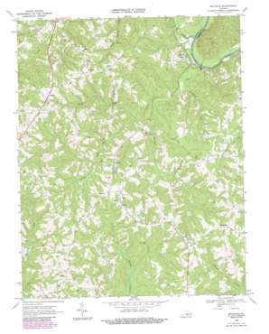
Nathalie Topo Map Virginia
To zoom in, hover over the map of Nathalie
USGS Topo Quad 36078h8 - 1:24,000 scale
| Topo Map Name: | Nathalie |
| USGS Topo Quad ID: | 36078h8 |
| Print Size: | ca. 21 1/4" wide x 27" high |
| Southeast Coordinates: | 36.875° N latitude / 78.875° W longitude |
| Map Center Coordinates: | 36.9375° N latitude / 78.9375° W longitude |
| U.S. State: | VA |
| Filename: | o36078h8.jpg |
| Download Map JPG Image: | Nathalie topo map 1:24,000 scale |
| Map Type: | Topographic |
| Topo Series: | 7.5´ |
| Map Scale: | 1:24,000 |
| Source of Map Images: | United States Geological Survey (USGS) |
| Alternate Map Versions: |
Nathalie VA 1968, updated 1971 Download PDF Buy paper map Nathalie VA 1968, updated 1984 Download PDF Buy paper map Nathalie VA 1968, updated 1990 Download PDF Buy paper map Nathalie VA 2010 Download PDF Buy paper map Nathalie VA 2013 Download PDF Buy paper map Nathalie VA 2016 Download PDF Buy paper map |
1:24,000 Topo Quads surrounding Nathalie
> Back to 36078e1 at 1:100,000 scale
> Back to 36078a1 at 1:250,000 scale
> Back to U.S. Topo Maps home
Nathalie topo map: Gazetteer
Nathalie: Dams
Hughes Dam elevation 186m 610′Nathalie: Populated Places
Acorn elevation 195m 639′Catawba elevation 177m 580′
Clarkton elevation 121m 396′
Lennig elevation 175m 574′
Liberty elevation 186m 610′
Loftis elevation 193m 633′
Morefield Mill elevation 177m 580′
Nathalie elevation 162m 531′
Rabat elevation 184m 603′
Whitesville elevation 185m 606′
Nathalie: Streams
Armistead Branch elevation 113m 370′Bentley Creek elevation 130m 426′
Birch Creek elevation 118m 387′
Blackwater Creek elevation 110m 360′
Catawba Creek elevation 105m 344′
Childrey Creek elevation 105m 344′
Nathalie digital topo map on disk
Buy this Nathalie topo map showing relief, roads, GPS coordinates and other geographical features, as a high-resolution digital map file on DVD:
Western Virginia & Southern West Virginia
Buy digital topo maps: Western Virginia & Southern West Virginia


