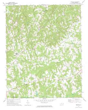
Bethany Topo Map North Carolina
To zoom in, hover over the map of Bethany
USGS Topo Quad 36079c7 - 1:24,000 scale
| Topo Map Name: | Bethany |
| USGS Topo Quad ID: | 36079c7 |
| Print Size: | ca. 21 1/4" wide x 27" high |
| Southeast Coordinates: | 36.25° N latitude / 79.75° W longitude |
| Map Center Coordinates: | 36.3125° N latitude / 79.8125° W longitude |
| U.S. State: | NC |
| Filename: | o36079c7.jpg |
| Download Map JPG Image: | Bethany topo map 1:24,000 scale |
| Map Type: | Topographic |
| Topo Series: | 7.5´ |
| Map Scale: | 1:24,000 |
| Source of Map Images: | United States Geological Survey (USGS) |
| Alternate Map Versions: |
Bethany NC 1971, updated 1974 Download PDF Buy paper map Bethany NC 1997, updated 2000 Download PDF Buy paper map Bethany NC 2010 Download PDF Buy paper map Bethany NC 2013 Download PDF Buy paper map Bethany NC 2016 Download PDF Buy paper map |
1:24,000 Topo Quads surrounding Bethany
> Back to 36079a1 at 1:100,000 scale
> Back to 36078a1 at 1:250,000 scale
> Back to U.S. Topo Maps home
Bethany topo map: Gazetteer
Bethany: Dams
Mebens Lake Dam elevation 243m 797′Simpsons Lake Dam elevation 246m 807′
Walker Dam elevation 247m 810′
Bethany: Parks
Haw River State Park elevation 234m 767′Bethany: Populated Places
Bakers Crossroads elevation 255m 836′Bethany elevation 272m 892′
Canaan Park elevation 256m 839′
Midway elevation 257m 843′
Wittys Crossroads elevation 258m 846′
Bethany: Reservoirs
Mebens Lake elevation 243m 797′Simpsons Lake elevation 246m 807′
Walker Lake elevation 247m 810′
Bethany: Streams
Huffines Mill Creek elevation 173m 567′Little Jacobs Creek elevation 169m 554′
Bethany digital topo map on disk
Buy this Bethany topo map showing relief, roads, GPS coordinates and other geographical features, as a high-resolution digital map file on DVD:
Western Virginia & Southern West Virginia
Buy digital topo maps: Western Virginia & Southern West Virginia


