Leasburg Topo Map North Carolina
To zoom in, hover over the map of Leasburg
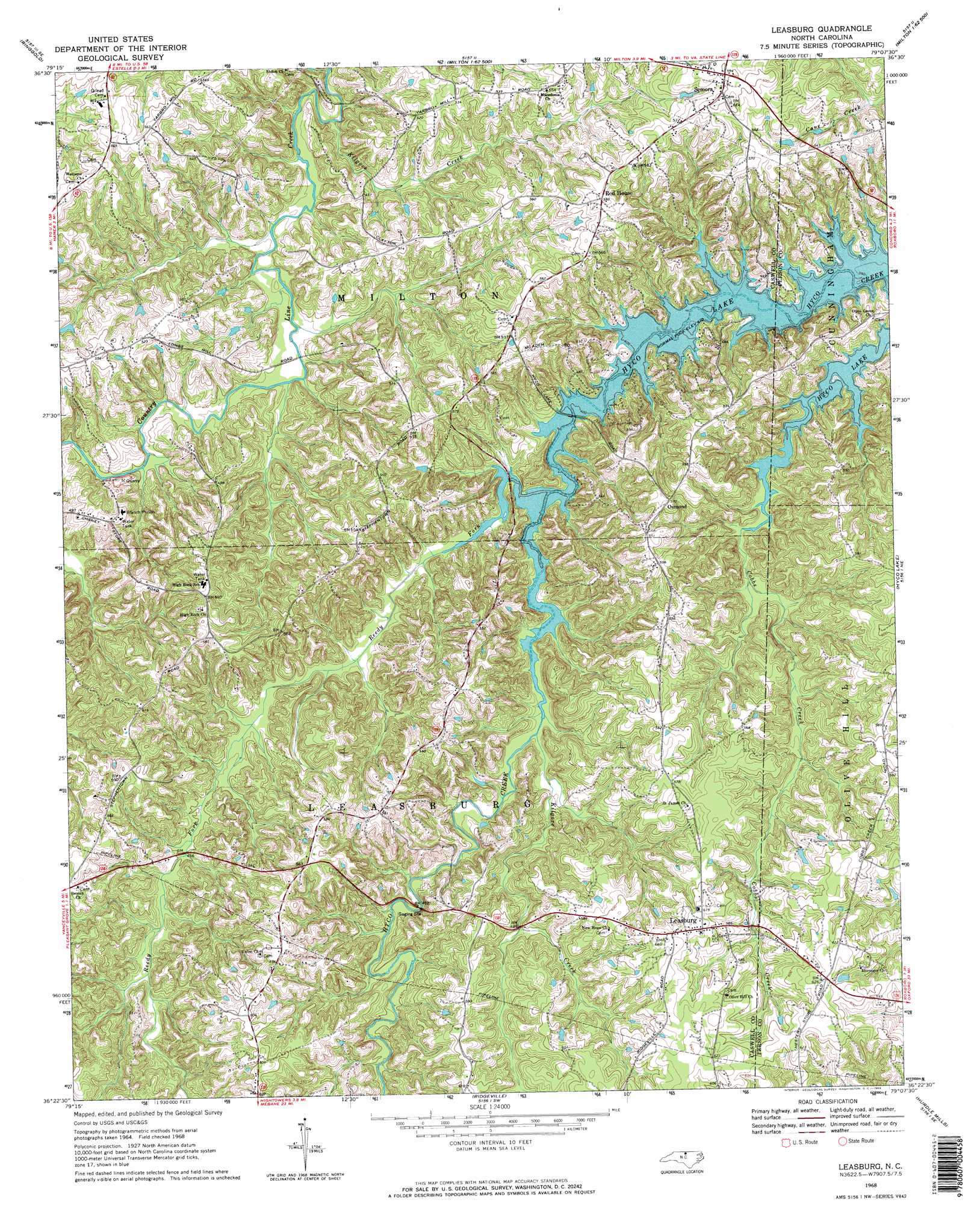
USGS Topo Quad 36079d2 - 1:24,000 scale
| Topo Map Name: | Leasburg |
| USGS Topo Quad ID: | 36079d2 |
| Print Size: | ca. 21 1/4" wide x 27" high |
| Southeast Coordinates: | 36.375° N latitude / 79.125° W longitude |
| Map Center Coordinates: | 36.4375° N latitude / 79.1875° W longitude |
| U.S. State: | NC |
| Filename: | o36079d2.jpg |
| Download Map JPG Image: | Leasburg topo map 1:24,000 scale |
| Map Type: | Topographic |
| Topo Series: | 7.5´ |
| Map Scale: | 1:24,000 |
| Source of Map Images: | United States Geological Survey (USGS) |
| Alternate Map Versions: |
Leasburg NC 1968, updated 1969 Download PDF Buy paper map Leasburg NC 1968, updated 1969 Download PDF Buy paper map Leasburg NC 1968, updated 1970 Download PDF Buy paper map Leasburg NC 1997, updated 2000 Download PDF Buy paper map Leasburg NC 2010 Download PDF Buy paper map Leasburg NC 2013 Download PDF Buy paper map Leasburg NC 2016 Download PDF Buy paper map |
1:24,000 Topo Quads surrounding Leasburg
Mount Hermon |
Blairs |
Ingram |
Oak Level |
South Boston |
Danville |
Ringgold |
Milton |
Alton |
Cluster Springs |
Park Spring |
Yanceyville |
Leasburg |
Olive Hill |
Roxboro |
Cherry Grove |
Anderson |
Ridgeville |
Hurdle Mills |
Timberlake |
Lake Burlington |
Burlington Ne |
Cedar Grove |
Caldwell |
Rougemont |
> Back to 36079a1 at 1:100,000 scale
> Back to 36078a1 at 1:250,000 scale
> Back to U.S. Topo Maps home
Leasburg topo map: Gazetteer
Leasburg: Airports
Winstead '76' Airport elevation 175m 574′Leasburg: Dams
Caswell Wildlife Mgmt Pond Dam Number Two elevation 138m 452′Leasburg: Populated Places
Leasburg elevation 185m 606′Osmond elevation 174m 570′
Semora elevation 181m 593′
Leasburg: Reservoirs
Caswell Wildlife Mgmt Area Pond T elevation 138m 452′Leasburg: Streams
Kilgore Creek elevation 114m 374′Kilgore Creek elevation 128m 419′
Reedy Fork elevation 124m 406′
Leasburg digital topo map on disk
Buy this Leasburg topo map showing relief, roads, GPS coordinates and other geographical features, as a high-resolution digital map file on DVD:
Western Virginia & Southern West Virginia
Buy digital topo maps: Western Virginia & Southern West Virginia