Yanceyville Topo Map North Carolina
To zoom in, hover over the map of Yanceyville
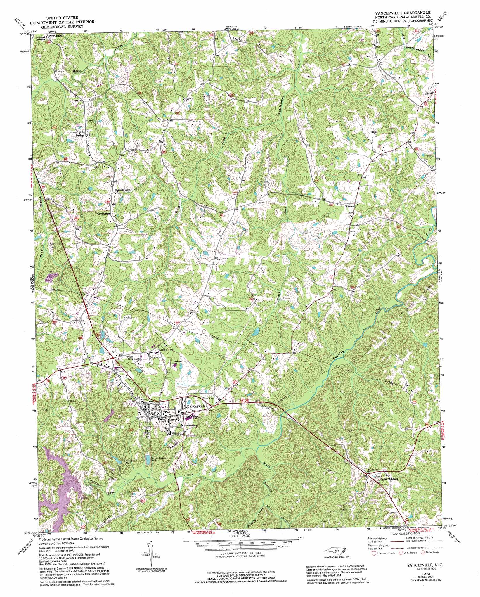
USGS Topo Quad 36079d3 - 1:24,000 scale
| Topo Map Name: | Yanceyville |
| USGS Topo Quad ID: | 36079d3 |
| Print Size: | ca. 21 1/4" wide x 27" high |
| Southeast Coordinates: | 36.375° N latitude / 79.25° W longitude |
| Map Center Coordinates: | 36.4375° N latitude / 79.3125° W longitude |
| U.S. State: | NC |
| Filename: | o36079d3.jpg |
| Download Map JPG Image: | Yanceyville topo map 1:24,000 scale |
| Map Type: | Topographic |
| Topo Series: | 7.5´ |
| Map Scale: | 1:24,000 |
| Source of Map Images: | United States Geological Survey (USGS) |
| Alternate Map Versions: |
Yanceyville NC 1972, updated 1974 Download PDF Buy paper map Yanceyville NC 1972, updated 1994 Download PDF Buy paper map Yanceyville NC 2002, updated 2002 Download PDF Buy paper map Yanceyville NC 2010 Download PDF Buy paper map Yanceyville NC 2013 Download PDF Buy paper map Yanceyville NC 2016 Download PDF Buy paper map |
1:24,000 Topo Quads surrounding Yanceyville
Whitmell |
Mount Hermon |
Blairs |
Ingram |
Oak Level |
Brosville |
Danville |
Ringgold |
Milton |
Alton |
Ruffin |
Park Spring |
Yanceyville |
Leasburg |
Olive Hill |
Williamsburg |
Cherry Grove |
Anderson |
Ridgeville |
Hurdle Mills |
Ossipee |
Lake Burlington |
Burlington Ne |
Cedar Grove |
Caldwell |
> Back to 36079a1 at 1:100,000 scale
> Back to 36078a1 at 1:250,000 scale
> Back to U.S. Topo Maps home
Yanceyville topo map: Gazetteer
Yanceyville: Parks
Caswell Game Land elevation 160m 524′Yanceyville: Populated Places
Covington elevation 187m 613′Hamer elevation 172m 564′
Pleasant Grove elevation 196m 643′
Purley elevation 172m 564′
Yanceyville elevation 185m 606′
Yanceyville: Streams
Benaja Creek elevation 128m 419′North Fork Rattlesnake Creek elevation 117m 383′
South Country Line Creek elevation 128m 419′
South Fork Rattlesnake Creek elevation 117m 383′
Yanceyville digital topo map on disk
Buy this Yanceyville topo map showing relief, roads, GPS coordinates and other geographical features, as a high-resolution digital map file on DVD:
Western Virginia & Southern West Virginia
Buy digital topo maps: Western Virginia & Southern West Virginia