Milton Topo Map Virginia
To zoom in, hover over the map of Milton
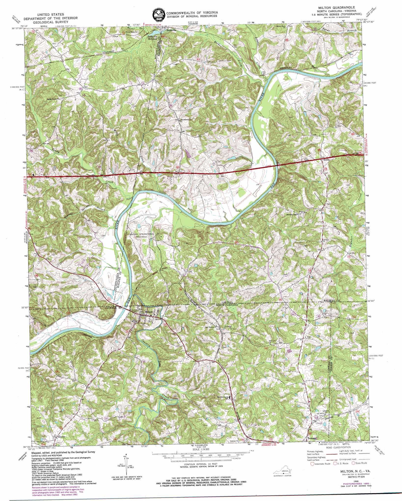
USGS Topo Quad 36079e2 - 1:24,000 scale
| Topo Map Name: | Milton |
| USGS Topo Quad ID: | 36079e2 |
| Print Size: | ca. 21 1/4" wide x 27" high |
| Southeast Coordinates: | 36.5° N latitude / 79.125° W longitude |
| Map Center Coordinates: | 36.5625° N latitude / 79.1875° W longitude |
| U.S. States: | VA, NC |
| Filename: | o36079e2.jpg |
| Download Map JPG Image: | Milton topo map 1:24,000 scale |
| Map Type: | Topographic |
| Topo Series: | 7.5´ |
| Map Scale: | 1:24,000 |
| Source of Map Images: | United States Geological Survey (USGS) |
| Alternate Map Versions: |
Milton NC 1968, updated 1972 Download PDF Buy paper map Milton NC 1968, updated 1984 Download PDF Buy paper map Milton NC 1968, updated 1984 Download PDF Buy paper map Milton NC 1997, updated 2000 Download PDF Buy paper map Milton NC 2011 Download PDF Buy paper map Milton NC 2013 Download PDF Buy paper map Milton NC 2016 Download PDF Buy paper map |
1:24,000 Topo Quads surrounding Milton
Chatham |
Spring Garden |
Java |
Vernon Hill |
Halifax |
Mount Hermon |
Blairs |
Ingram |
Oak Level |
South Boston |
Danville |
Ringgold |
Milton |
Alton |
Cluster Springs |
Park Spring |
Yanceyville |
Leasburg |
Olive Hill |
Roxboro |
Cherry Grove |
Anderson |
Ridgeville |
Hurdle Mills |
Timberlake |
> Back to 36079e1 at 1:100,000 scale
> Back to 36078a1 at 1:250,000 scale
> Back to U.S. Topo Maps home
Milton topo map: Gazetteer
Milton: Dams
Anderson Dam elevation 152m 498′Norfleet Dam elevation 121m 396′
Prevette Dam elevation 137m 449′
Milton: Populated Places
Barksdale elevation 137m 449′Delila elevation 157m 515′
Estelle elevation 172m 564′
Milton elevation 147m 482′
Sutherlin elevation 121m 396′
Milton: Reservoirs
Sutherlin Millpond elevation 123m 403′Milton: Streams
Barker Creek elevation 108m 354′Cocquade Creek elevation 119m 390′
Country Line Creek elevation 116m 380′
Country Line Creek elevation 116m 380′
Double Creek elevation 108m 354′
Mineral Springs Branch elevation 116m 380′
Sandy Creek elevation 115m 377′
Wolfe Creek elevation 113m 370′
Milton digital topo map on disk
Buy this Milton topo map showing relief, roads, GPS coordinates and other geographical features, as a high-resolution digital map file on DVD:
Western Virginia & Southern West Virginia
Buy digital topo maps: Western Virginia & Southern West Virginia